Sold2023c. 1755 Map Of the World Framedc. 1755 Map Of the World on Mercators Projection Framed. Gentleman's Magazine London 8 x 12.See Sold Price
Sold2017Framed Colored Engraved 17th C. World Map"Nova Totius Terrarum Sive Novi Orbis Tabula" Framed Colored Engraved 17th C. World Map by Willem Janszoon Blaeu - This interesting piece is an early world map created by Willem Janszoon Blaeu. The maSee Sold Price
Sold202118TH C. (1755) MAP OF N.Y. , PENSYLVANIA & NEW ENGLANDFRAMED 18TH C. (DATED 1755) 2 PART MAP "A MAP OF THE PROVINCE OF NEW YORK, WITH PART OF PENSILVANIA AND NEW ENGLAND / FROM AN ACTUAL SURVEY BY CAPTAIN MONTRESOR, ENGINEER 1755" - FRAME 59 1/4" X 39",See Sold Price
Sold2022C. S. Hammond & Co. NY Framed World MapC. S. Hammond & Co. NY Framed World Map. 24 1/2" X 20 1/2"See Sold Price
Sold2015Lg Framed early 19th c. Map of the WorldLg Framed early 19th c. Map of the World, "Mappe Monde", Indication des trois voyages du Capitaine Cook, French 1816 in floral gilt 32" x 46" frame Condition; was folded, some wear along fold lines frSee Sold Price
Sold2016Beautifully Colored Jan Van Loon World MapOrbis Terrarum Nova... Jan Van Loon (c. 1611-1686). Engraved map with original hand color in full. London: Moses Pitt, 1680. 17 3/4 x 21 inches visible, 28 1/4 x 31 3/4 inches framed. A fine example oSee Sold Price
Sold2024Nicolaes Van Geelkercken, 1632 world mapNicolaes Van Geelkercken, 1632 world map, Orbis Terrarum Descriptio Duobis Planis Hemisphaeriis Comprehesa, hand-colored engraving, 20th c. restrike, matted and framed under glass, 17"h x 23"w (sight)See Sold Price
Sold2022Vintage Air France Airline Travel Routes World MapVintage Air France Airline Travel Routes World Map, by Lucien Boucher (French, 1889-1971) color offset, C.1948. Framed. Size: 19.5'' x 33.75'', 50 x 86 cm (sight); 24.5'' x 39'', 62 x 99 cm (frame).See Sold Price
Sold2022Set of Framed 19th C. Relief Maps (3)Printed in Chicago, 1893, set includes a framed relief map of the United States, a relief map of Europe, and a relief map of the world, 27" x 37 1/2" sight, 34" x 47 1/2" framed.See Sold Price
Sold2015Two 18th C. Framed Asian MapsFrom "A Geography of the World," London 1768. One depicting a map of China, the other depicting a map of Asia. Framed behind glass, 14.5" H x 15.5" W.See Sold Price
Sold202319th C Hand Colored Map of State of Maine FRAMEDPublished by S.Augustus Mitchell, Jr. having a published date year of 1860. This hand colored map contains maps of the various countries of the world and plans of cities. Inset at lower right featuresSee Sold Price
Sold201918th C Map Ancient World JerusalemEngraved plate showing maps of ancient world including inset of Judea and Samaria and one of Jerusalem. Early 18th century.Very Good, trimmed to plate lines, measures 7 x 5.5". Reserve: $20.00 ShippinSee Sold Price
Sold2020Giovanni Battista Piranesi(Italian, 1720-1778) , "Libert et Familiae L'Arrunti", Tom. II, Plate VII, engraving, c. 1755. Nicely framed and in good overall condition with minor foxing consistent with age. H21 1/2" W31" Sold froSee Sold Price
2022Blaeu, Johannes (Netherlands, 1596-1673) "The New World Map" Double Hemisphere World Map C. 1664Nova et Accuratissima Totius Terrarum Orbis Tabula Translated "The New World Map", Hand Colored w/ Elaborately Decorated Spandrels.   Sight View 16" x 21-1/2", Overall View 21" x 25-1/2"See Sold Price
Sold2017FRAMED WORLD MAP BY HERMAN MOLL, 1719'A New & Correct Map of the Whole World, by Herman Moll, Geographer, 1719.' Hand tinted and framed. Frame size: 73 x 124 cm (28 3/4 x 48 3/4 in.)See Sold Price
2022Seutter, Matthaus (Germany, 1678-1757) Double Hemisphere World Map C. 1730Sight View  19-1/2" x 23", Overall View 22" x 25", Hand Colored "Quibus Addita, Pro Mutatione Horizontis Differentes Sphara Po Sitiones Earumque Convenientia Et RelaSee Sold Price
Sold20223 PC. FRAMED WORLD MAPS3 PC. FRAMED WORLD MAPS: Comprising; 1- A reduced scale world map based on Mercator's map of 1569. 1- 18th-century hand-colored, A New Map of the Whole World with the Tradewinds According To The LatesSee Sold Price
Sold2016Large Framed World Map w/ Latin InscriptionsLarge Framed World Map w/ Latin Inscriptions. Hand colored. Professionally framed and matted. Titled Mappe Monde. Measures 28 by 33 inches.See Sold Price
Sold2024EARLY 18TH C. MAP OF ITALY, FRAMED"Italia iam Tota Principes in suas Partes accuratius distincta hisee, praeter caeteras adjunximus Majerum ejus Insularum Siciliam . . .", by Peter Schenk, Amsterdam, ca 1700, handcolored copperplate eSee Sold Price
Sold2017Hand Colored World Map, FramedHand Colored World Map, Framed. Overall Dimensions: 30 x 33 in. This item is framed behind glass. Late 20th Century.See Sold Price
Sold2018Large 19th C. Framed Map of FloridaLarge 19th C. Framed Map of Florida. Image size: 26.5 inches.See Sold Price
Sold202219TH C FRAMED MAP OF RHINEBECK, NEW YORK, NICELY MATTED19TH C FRAMED MAP OF RHINEBECK, NEW YORK, NICELY MATTED AND FRAMED. FROM RHINEBECK, N.Y. FINE HOME, MAP MEASURES 17" X 13", FRAME SIZE IS 24.5" X 21".See Sold Price
Sold2023Antique Carte Pour L' Intelligence Du Livre Institute L' Esprit De S Loix Old World Framed MapAntique French framed old world map with gold tone frame. Professionally framed. Measures 15 1/2" x 24" total with 9" x 18" matte.See Sold Price
Sold2022The World Map (c. 1840) - On Tin - Folk ArtThe World Map (c. 1840) - On Tin - Folk Art. Vermont origin. Excellent Piece.Measurements: 21.25" x 17.25"Shipping: Available for in-house shipping. Please email us at ProvenanceAuctions@gmail.com ifSee Sold Price
BonhamsCHURCHILL (WINSTON S.) Photograph of Winston Churchill (as Secretary of State of War) seated wit...£1,800
4 days LeftWorthington Galleries19th c. Hemisphere World Map, Hohen und Tiefen der Erde in Lambert’s Zenithal-Projection von$10
4 days LeftWorthington Galleries18th c. Map OBSERVATIONS SUR LES POINTS CARDINAUX. LIGNES, ET CIRCLES DE LA SPHÈ$10
5 days LeftThe North Georgia Auction Company LLCClint Alderman Edgefield Area Potteries Map$200(1 bid)
3 days LeftEarly American History Auctionsc 1730 Hand-Colored Colonial Era Map of the Americas, California shown as an Island, Matted + Framed$500(1 bid)
6 days LeftWinter Associates Three historical engraved maps of the Caribbean, ranging from 1616-1814, each hand colored, framed$100(1 bid)
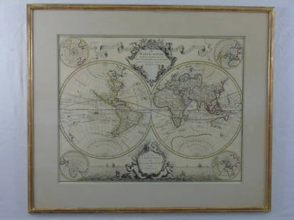
2 days LeftHolabird Western Americana CollectionsMap of The World in Hemispheres, c1850's [180166]$100
Jul 11Dan Morphy AuctionsRARE INDEPENDENT GASOLINE & MOTOR OIL FRAMED GRAPHIC HIGHWAY MAP OF ILLINOIS.$125


![Map of The World in Hemispheres, c1850's [180166] (1 of 1)](https://p1.liveauctioneers.com/2699/331495/178785785_1_x.jpg?height=282&quality=70&version=1717094933)


