Sold2024John Brewster - Dr. Amos Gale & Wife Sarah B. GaleJohn Brewster (American 1766-1854). Pair of Portraits of Dr. Amos Gale, Jr. and His Wife, Sarah Bartlett Gale of Kingston, New Hampshire, 1822. Each oil on canvas, signed in pencil on Amos Gale's streSee Sold Price
Sold2022Tallis, John (Pub) 1854 Map. New South Wales, AustraliaSteel Engraved Map Published 1854-55 by John Tallis, London for "The British Colonies; Their History, Extent, Condition and Resources" by Robert Montgomery Martin. Drawn & Engraved by John Rapkin. CenSee Sold Price
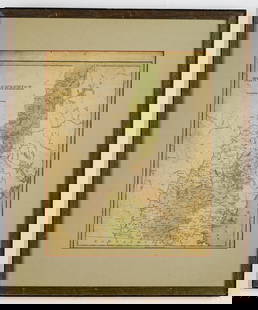
Sold2017Bradford: Antique Map of New Hampshire, 1838Title/Content of Map: New Hampshire by Bradford Date Printed: 1838/1841 Cartographer: Thomas G. Bradford Material/Medium: Paper Size: 13" x 16 1/2" Hand colored. A General Atlas of the World with a SeSee Sold Price
Sold2020New Hampshire & Vermont, 1845Title/Content of Map: New Hampshire & Vermont, 1845 Date Printed: 1845, Hildburghausen Cartographer: Joseph Meyer/Bibliographisches Instituts. Size: 11 3/4" x 14 3/4" The beautifully detailed and coloSee Sold Price
Sold2020New Hampshire 1886Title/Content of Map: New Hampshire 1886 Date Printed: 1886 Material/Medium: paper Size: 13.5x21 inches Additional Info: he People's Unrivaled Family Atlas of the World. People's Publishing Co, ChicagSee Sold Price
Sold2020New Hampshire & Vermont, 1849Title/Content of Map: New Hampshire & Vermont, 1849 Date Printed: 1849/1857, Hildburghausen Cartographer: Meyer/Bibliographisches Instituts. Size: 11 3/4" x 14 3/4" The beautifully detailed and coloreSee Sold Price
Sold2018Colton: Antique Map of New Hampshire, 1859Title/Content of Map: New Hampshire by Colton Date Printed: 1859 Cartographer: H.J. Colton Material/Medium: Paper Size: 17 1/2" x 15" Hand colored,engraved. Published in New York in 'Colton's GeneralSee Sold Price
Sold2018New Hampshire by ColtonTitle/Content of Map: New Hampshire by Colton Date Printed: 1861 Cartographer: J.H. Colton Material/Medium: Paper Size: 14" x 17" Provenance: New York From Colton's 'General Atlas.' Published in New YSee Sold Price
Sold2017Bradford: Antique Map of New Hampshire & Vermont, 1835Title/Content of Map: New Hampshire & Vermont Date Printed: 1835 Cartographer: T. G. Bradford Material/Medium: Paper Size: 9 1/2" x 13" A Comprehensive Atlas Geographical, Historical & Commercial. PubSee Sold Price
Sold2017James Carter MAP OF NEW HAMPSHIRE Portsmouth March 1831Details: CARTER, James G. (1795-1849). A Map of New Hampshire. Portsmouth: Nathaniel March, [1831]. Engraved folding pocket map, full period hand colouring. Statistical table at right side. Folds intSee Sold Price
Sold2016Map of New Hampshire, Carey & Lea 1829Title: Geographical, Historical and Statistical Map of New Hampshire Subject: New Hampshire Maker: Carey & Lea Date: 1827, Carey & Lea: Philadelphia Size: 11.8 x 8.8 inches Very detailed map showing cSee Sold Price
Sold2019Early map of New HampshireOne of the few maps specifically of New Hampshire published in the mid- 19th century. Shows superb detail regarding the cities, transportation system, geographical features and counties. Detailed mapSee Sold Price
Sold20181861 Johnson Map of New Hampshire and Vermont --Title/Content of Map: 1861 Johnson Map of New Hampshire and Vermont -- Johnson's New Hampshire and Vermont Date: 1861, New York Cartographer: Johnson & Ward Size: 24 x 17 in. This is a fantastic, verySee Sold Price
Sold20211938 R Taylor White Pictorial Map of New Hampshire --Title: 1938 R Taylor White Pictorial Map of New Hampshire -- New Hampshire Cartographer: Ruth Taylor White Year / Place: 1938, Boston Map Dimension (in.): 11.6 x 8.5 in. This is Ruth Taylor White's chSee Sold Price
Sold20211835 map of New Hampshire & Vermont, T. G. BradfordTitle: 1835 map of New Hampshire & Vermont, T. G. Bradford Description: Nice map that isolates New Hampshire and Vermont by completely filling up the frame. Signature light blue frame with red and greSee Sold Price
Sold20221862 Johnson Map of New Hampshire and Vermont --Title: 1862 Johnson Map of New Hampshire and Vermont -- Johnson's New Hampshire and Vermont Cartographer: Johnson & Browning Year/Place: 1862, New York Dimensions: 24 x 17 in. Description: This is a fSee Sold Price
Sold20221890 c. Cram Map of New Hampshire [verso] Adirondacks and White Mountain -- New Hampshire [verso]Title: 1890 c. Cram Map of New Hampshire [verso] Adirondacks and White Mountain -- New Hampshire [verso] Adirondack Mts. and White Mountains Cartographer: G Cram Year / Place: 1890 c., Chicago Map DimSee Sold Price
Sold2021Belknap Map of NHAntique map of New Hampshire Jeremy Belknap. 1791. Framed. Dimensions 18" x 14"See Sold Price
Sold2022RR map of N. Hampshire & Vermont, Cowperthwait 1850Lovely map of New Hampshire and Vermont, with counties marked, plus travel information (distances, railroads, steamboat routes in states served by them, population, canals, capitals, county towns, etcSee Sold Price
Sold20191876 Mitchell Map of Vermont and New Hampshire --Title/Content of Map: 1876 Mitchell Map of Vermont and New Hampshire -- County and Township Map of New Hampshire and Vermont Date: 1876 Philadelphia Cartographer: S MitchellSize: 14.5 X 20.6 in. ThisSee Sold Price
Sold202019th Century Colored Map of NH & VT19TH CENTURY ATLAS BOOK PLATE MAP OF NEW HAMPSHIRE AND VERMONT- JOHNSON'S NH AND VT BY JOHNSON AND WARD- 26 1/2" X 17 3/4"- TONING, FOXING, CREASES, SMALL LOSSES TO EDGES AND IMPERFECTIONSSee Sold Price
Sold2020Mitchell: New Hampshire & Vermont, 1870Title/Content of Map: Mitchell: New Hampshire & Vermont, 1870 Date Printed: 1870, Philadelphia Cartographer: S. A. Mitchell Size: 11 3/8" x 13 3/4" The beautifully detailed and colored county map of NSee Sold Price
Jun 13Swann Auction Galleries(CONNECTICUT.) William Lester, Jr. Map of New London and Windham Counties in Conn.$600
Jun 13Swann Auction Galleries(MAINE.) J.H. Colton; and C.C. Hall. Railroad & Township Map of the State of Maine with Portions$375
Jun 13Swann Auction Galleries(PICTORIAL MAPS.) John Held, Jr. Motor Routes to "Real New England Inns".$600
5 days LeftHolabird Western Americana CollectionsRocky Bar Mining Co. Stock Certificate, 1854 [142895]$600
1 day LeftJasper521854-5 Parke Profile Maps of California, Arizona and New Mexico -- Profiles from San Francisco Bay$55
Jun 13Swann Auction Galleries(NEW ENGLAND.) George Eldridge. A New Chart of the Coast of New England$600
3 days LeftHolabird Western Americana CollectionsBartlett's Explorations ... Texas, NM, Calif., Sonora... 1854, 2 vols [181677]$200
5 days LeftSimpson Galleries, LLC.TWO AMERICAN MAPS, "Texas," AND "Mexico," J.H. COLTON, NEW YORK, CIRCA 1854-1856$150
20 hrs LeftJasper52Saint John, New Brunswick (Canada) - William Howland (American, 1822–1875)$70


![James Carter MAP OF NEW HAMPSHIRE Portsmouth March 1831: Details: CARTER, James G. (1795-1849). A Map of New Hampshire. Portsmouth: Nathaniel March, [1831]. Engraved folding pocket map, full period hand colouring. Statistical table at right side. Folds int](https://p1.liveauctioneers.com/5671/105076/53811303_1_x.jpg?height=310&quality=70&version=1496954235)


![1890 c. Cram Map of New Hampshire [verso] Adirondacks and White Mountain -- New Hampshire [verso]: Title: 1890 c. Cram Map of New Hampshire [verso] Adirondacks and White Mountain -- New Hampshire [verso] Adirondack Mts. and White Mountains Cartographer: G Cram Year / Place: 1890 c., Chicago Map Dim](https://p1.liveauctioneers.com/5584/270923/141842413_1_x.jpg?height=310&quality=70&version=1670433092)


![Rocky Bar Mining Co. Stock Certificate, 1854 [142895] (1 of 1)](https://p1.liveauctioneers.com/2699/331499/178846124_1_x.jpg?height=282&quality=70&version=1717095214)


![Bartlett's Explorations ... Texas, NM, Calif., Sonora... 1854, 2 vols [181677] (1 of 12)](https://p1.liveauctioneers.com/2699/331494/178785464_1_x.jpg?height=282&quality=70&version=1717189774)

