Sold2018JACQUES NICOLAS BELLIN (FRENCH, 1703-1772) MAP OFJACQUES NICOLAS BELLIN (FRENCH, 1703-1772) MAP OF VIRGINIA AND MARYLAND, hand-colored, on laid paper, title to cartouche in lower right corner "CARTE / DE LA / VIRGINIE / MARI-LAND", with scale, upperSee Sold Price
Sold2017JACQUES NICOLAS BELLIN (FRENCH, 1703-1772) MAP OFJACQUES NICOLAS BELLIN (FRENCH, 1703-1772) MAP OF LOUISIANA AND THE GULF OF MEXICO engraving on laid paper, "Carte De La Louisiane et Pays Voisins Pour servir a l'Historie Generale des Voyages", publiSee Sold Price
Sold2017J.-N. Bellin, "Plan de la Nouvelle Orleans""Plan de la Nouvelle Orleans", by Jacques Nicolas Bellin (French, 1703-1772), hand-colored copper engraved map on laid paper, from Abbe Antoine Francois Prevost'sL'Histoire Generale des Voyages..., voSee Sold Price
Sold2022MAP: "Carte du Katay Ou Empire de Kin", c. 1760, by J.MAP: "Carte du Katay Ou Empire de Kin", c. 1760, by J. N. Bellin (French, 1703 -1772), prolific cartographer to Louis XVI, hand-colored copper engraving, depicts northeast China and Korea, including tSee Sold Price
Sold20231781 ATLAS Vaugondy 17 MAPS FAMOUS Voyages Geography Asia Africa Europe French1781 ATLAS Vaugondy 17 MAPS FAMOUS Voyages Geography Asia Africa Europe French Collectors, of both maps and atlases, agree that Vaugondy maps are among the best and most accurate maps! This collectionSee Sold Price
Sold2017Bellin: Map of Fort Royal in Grenada, 1763Map Title: Map of Fort Royal in Grenada Maker: Jacques Bellin Printed in Paris Publishing Date: 1763 Dimensions: 9 x 11.5 inches Jacques-Nicolas Bellin(1703-1772) was a French cartographer, hydrographSee Sold Price
2017Bellin: Plan De La Ville De Port Royal, 1763Map Title: Plan De La Ville De Port Royal Maker: Jacques Bellin Printed in Paris Publishing Date: Circa 1763 Dimensions: 9 x 11.5 inches Jacques-Nicolas Bellin(1703-1772) was a French cartographer, hySee Sold Price
Sold2023French map of North America published by Bonne 1781 sea of the westRigobert Bonne (6 October 1727 – 2 September 1794) work represents an important step in the evolution of the cartographic ideology away from the decorative work of the 17th and early 18th centurSee Sold Price
Sold20211825 Plan of Yorktown in Virginia & Adj Country1825 Map, Plan of Yorktown in Virginia and Adjacent Country, Exhibiting the operations of the American French & English armies, during the Siege of that place in Oct. 1781. Sheet is irregularly trimmeSee Sold Price
Sold2024Hermes Silk Scarf Yorktown CentennialFramed Hermes silk scarf, 1781-1981 Yorktown centennial, Hugo Grygkar designer. A map of the United States with U.S. state coats of arms, presented by French President Francois Mitterrand. Framed andSee Sold Price
Sold2016Attributed to Francois Boucher (French 1703- 1770)DESCRIPTION:Attributed to Francois Boucher oil on canvas painting illustrating a rococo courting garden scene with a young man placing flowers on the lap of a beautiful young woman whilst resting amidSee Sold Price
Sold201718th C. French Map w/ Oiled Paper, ex-Sotheby'sEurope, France, map from 1709 CE, oiled paper overlays from 1756 to 1763 CE, owned by Louis-Alexandre Berthier (1753 to 1815 CE), Marshal, Vice-Constable of France, and Chief of Staff (Major general)See Sold Price
Sold2021Antique French Map of MississippiAntique French Map of Mississippi , "Carte Geographique, Statistique et Historique du Mississipi", Paris, Buchon, 1825, sight 21 in. x 27 1/2 in., framed Provenance: Estate of Julia Evans ReedSee Sold Price
Sold2021Antique French Map of United States- Etats-Unis De L'Amerique Septentrionale Avec Les Isles Royale, De Terre Neuve, De St. Jean, L'Acadie &c.; Hand-colored; Ches Boudet Imprimeur du Roi; Paris; undated (circa 1785). One of the early maSee Sold Price
Sold2022c. 1703 Map AMERICA by Peter Heylyn Calif. IslandHistoric Maps Rare Circa 1703 Hand-Colored Engraved Map titled: "AMERICA" with California as an Island by Peter Heylyn c. 1703 Hand-Colored Engraved Map titled "AMERICA" by Peter Heylyn, showing CalifSee Sold Price
Sold2022Mannevillette French Map of the Indian Ocean, 1753D'APRES DE MANNEVILLETTE, Jean-Baptiste-Nicolas-Denis (1707-1780). [Indian Ocean] Carte Reduite de l'Ocean Oriental depuis le Cap de Bonne Esperance... Engraved map with original hand color in part. PSee Sold Price
Sold20241812 large French map of Paris plan routier de la Ville et faubourgLarge engraving of Paris and its surrounding area dated 1812 , cooper engraving in the manner of the Turgot map ,Jean Pierre printer , a Paris, chez Jean, Rue St Jean de Beauvais, N° 10, It is thSee Sold Price
Sold20221738 Antique French Map of North America1738 Antique French Map of North America, 1783 - Antique Map of North America, with documentation, This map is 221 years old - it is not a modern reproduction or copy, This map comes from: ATLAS DE TOSee Sold Price
Sold201718th Century French Map of North AmericaL’Amerique Septentrionale. Daniel de la Feuille (1640-1709). Engraved map with hand color in full. Amsterdam, 1702 or 1706. 6 x 8 inches visible, 13 x 14 1/2 inches framed. Nicely colored early 18thSee Sold Price
Sold2022c. 1788 French Map of the Eastern United StatesHistoric Maps c. 1788 Map, "Les Etats Unis de L'Amerique Septentrionale, Partie Orientale" (Eastern Part of the Northern United States of America) by M. (Rigobert) Bonne c. 1788 Map titled, "Les EtatsSee Sold Price
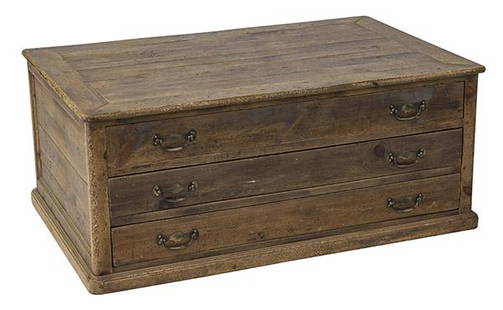
Sold2020Country French Map CabinetThree drawer case in pine with original brass hardware. Drawers pull out from both sides. 49w x 31 1/2d x 20 1/2hSee Sold Price
Sold2023(2) LOUIS XVI STYLE ORMOLU-MOUNTED CABINETS(pair) Louis XVI style marble-top parquetry cabinets, transfer decorated scene, after the original painting, Vulcan Presenting Venus with Arms for Aeneas, by Francois Boucher (French 1703-1770), withSee Sold Price
Sold2021After Francois Boucher, Elegant figures, 4After Francois Boucher (French, 1703-1770)Elegant figures in landscapes (4)oil on canvasoval format49 x 33in (124.5 x 84cm) Provenance:Sold Property of a Southern Gentleman, BonhamSee Sold Price
Sold2023Francois Boucher (French, 1703-1770)Francois Boucher (French, 1703-1770) Playful Putti (two works) pen and brown ink with red chalk on paper 7 5/8 x 9 1/4 inches (sight).† This lot is located in Chicago. Provenance: Didier Aaron LSee Sold Price
May 12Schilb Antiquarian Rare Books1844 Siege of Gibraltar American Revolution SPAIN France Drinkwater MAP History$1(1 bid)
May 16Potter & Potter AuctionsAUDIBERTI, J. Choain. Afrique Equatoriale Francaise. Paris:...$100(1 bid)
May 09Hunt and Peck Estate Services, Inc.Jacques Nicolas Bellin Map Of Western Part Of New France Or Canada$200(1 bid)
May 14Fleischer's Auctions1755 Map Partie de l'Amerique Septentrionale, qui comprend Le Cours de L'Ohio...$200(3 bids)
May 09Hunt and Peck Estate Services, Inc.1794 Laurie & Whittle after Thomas Jefferys Map Of The United States Of America$340(1 bid)
2 days LeftTrillium Antique Prints & Rare BooksBonne - Map of the Eastern Coast of North America$85(3 bids)


![Mannevillette French Map of the Indian Ocean, 1753: D'APRES DE MANNEVILLETTE, Jean-Baptiste-Nicolas-Denis (1707-1780). [Indian Ocean] Carte Reduite de l'Ocean Oriental depuis le Cap de Bonne Esperance... Engraved map with original hand color in part. P](https://p1.liveauctioneers.com/1968/250616/130196497_1_x.jpg?height=310&quality=70&version=1654190895)