Sold2022FRAMED HANDCOLORED MERCATOR MAP OF THE WORLD BY JOHNSON & WARD, 1863From Johson's "Family Atlas" of 1863, Western & Eastern Hemisphere, joined sheets, as issued, in gilt molded panel frame, black mat with gilt liner, under glass, OS: 23 1/4" x 34 1/4", SS: 16" x 27",See Sold Price
Sold2020TEXAS MAP ENGRAVING PANHANDLE COUNTIES INSETFramed Texas map, hand-colored engraving on paper, a page from an atlas, plate 68, published by William Bradley, c.1880, an inset with Panhandle counties, within a geometric border, sight: approx 17.5See Sold Price
Sold2019Two Maps by Johnson & Ward, consisting of "Prussia,Two Maps by Johnson & Ward, consisting of "Prussia, Norway, Sweden, and Denmark," 19th c., hand colored, H.- 26 1/2 in., W.- 18 1/4 in.; together with Johnson & Ward, "West Indies," 1863-1866, hand coSee Sold Price
Sold2015Lot of 7 Hand-Colored Copper Engraved Maps including(Lot of 7) Maps including; "Johnson's Australia," by Johnson and Ward, published in New York c. 1864, hand-colored copper engraved map, North Riding, Yorkshire, published by Henry Teesdale & Co. c. 18See Sold Price
Sold2023Johnson's Family Atlas of the World 1865Johnson's New Illustrated (Steel Plate) Family Atlas published in 1865 by Johnson and Ward hand colored maps of the United States and the world ( DOUBLE PAGE, AND FULL PAGE MAPS OF NORTH AMERICA, SOUTSee Sold Price
Sold2024Nicolaes Van Geelkercken, 1632 world mapNicolaes Van Geelkercken, 1632 world map, Orbis Terrarum Descriptio Duobis Planis Hemisphaeriis Comprehesa, hand-colored engraving, 20th c. restrike, matted and framed under glass, 17"h x 23"w (sight)See Sold Price
Sold2016Rare 1866 Johnson's Map of New York and Brooklyn FrameVery rare 1866 map of Manhattan and Brooklyn in 1866. Johnson & Ward, makers. Hand-colored. Professionally matted and framed. Approx 35" x 27". In excellent condition.See Sold Price
Sold202319th C Hand Colored Map of State of Maine FRAMEDPublished by S.Augustus Mitchell, Jr. having a published date year of 1860. This hand colored map contains maps of the various countries of the world and plans of cities. Inset at lower right featuresSee Sold Price
Sold2021Hand Drawn Map of "Edgefield Area Potteries"Framed hand drawn and colored map "Edgefield Area Potteries: 1810-1880", signed and dated "C. Alderman, Penman / 2007"; map identifies the 19th century pottery sites in the Edgefield District of SouthSee Sold Price
Sold2017JOHNSON'S MAP OF FLORIDA CIRCA 1863 PUBLISHED BYJOHNSON'S MAP OF FLORIDA CIRCA 1863 PUBLISHED BY JOHNSON AND WARD, HAND COLORED, VERY GOOD CONDITION, FRAMED SIZE 22"W X 18"H, SKU896.10See Sold Price
Sold2023FRAMED 19TH C. JOHNSON'S FLORIDA MAP1863 Civil War Era Colored Map of Florida, by Alvin Jewett Johnson (1827-1884), published by Johnson & Ward, New York, in a gilded and green painted wooden frame with mat, glazed, OS: 19 1/2" x 23 1/2See Sold Price
Sold2016Beautifully Colored Jan Van Loon World MapOrbis Terrarum Nova... Jan Van Loon (c. 1611-1686). Engraved map with original hand color in full. London: Moses Pitt, 1680. 17 3/4 x 21 inches visible, 28 1/4 x 31 3/4 inches framed. A fine example oSee Sold Price
Sold2017Hand Colored World Map, FramedHand Colored World Map, Framed. Overall Dimensions: 30 x 33 in. This item is framed behind glass. Late 20th Century.See Sold Price
Sold2018Johannes Blaeau (1650-1712, Dutch), "Nicaea ad VarumJohannes Blaeau (1650-1712, Dutch), "Nicaea ad Varum Cum Novo Orbis," 17th c., hand colored map, framed, H.- 23 1/2 in., W.- 28 1/2 in.See Sold Price
Sold2016c. 1760s, Hand-Colored World Map, “Mappa Mondo”Historic Maps 1760 Hand-Colored World Map, Siena Presso Pazzini Carli c. 1760s, Hand-Colored World Map, “Mappa Mondo,” Printed & Colored by Siena Presso Pazzini Carli, Choice Very Fine. A fine GobSee Sold Price
Sold2016Large Framed World Map w/ Latin InscriptionsLarge Framed World Map w/ Latin Inscriptions. Hand colored. Professionally framed and matted. Titled Mappe Monde. Measures 28 by 33 inches.See Sold Price
Sold2015THOMSON'S NEW GENERAL ATLAS MAPSTHOMSON'S NEW GENERAL ATLAS MAPS (23), 18'' X 24 1/4'', NOT FRAMED:Engraved and hand colored maps, c. 1827. Maps vary from two images on one page to larger images covering two pages. The map depictionSee Sold Price
Sold2019Two Copies of Johnson & Ward, "New Military Map of theTwo Copies of Johnson & Ward, "New Military Map of the United States," 1861, hand colored, H.- 17 7/8 in., W.- 26 3/4 in. (2 Pcs.)See Sold Price
Sold201818th C. Milan Ducatus Mediterranean Map18th C. framed copper engraved map, hand colored of Milan, Genoa, Lake Como and Mantua Cartouche. By Matthai Serteri, S.C.M. GEOGR Augustani. Visible paper measures approximately 20.25" H X 24" W, witSee Sold Price
Sold2019Johnson & Ward, "Hindostan or British India," 19th c.,Johnson & Ward, "Hindostan or British India," 19th c., hand colored, H.- 12 1/2 in., W.- 16 1/2 in.See Sold Price
2022Blaeu, Johannes (Netherlands, 1596-1673) "The New World Map" Double Hemisphere World Map C. 1664Nova et Accuratissima Totius Terrarum Orbis Tabula Translated "The New World Map", Hand Colored w/ Elaborately Decorated Spandrels.   Sight View 16" x 21-1/2", Overall View 21" x 25-1/2"See Sold Price
Sold20223 PC. FRAMED WORLD MAPS3 PC. FRAMED WORLD MAPS: Comprising; 1- A reduced scale world map based on Mercator's map of 1569. 1- 18th-century hand-colored, A New Map of the Whole World with the Tradewinds According To The LatesSee Sold Price
Sold2020Framed Hand Colored Map of The World 19th CenturyFramed Hand Colored Map of The World 19th Century. Original Map of World Hemispheres with supposed population and religious division. Certificate of Authenticity on back.Condition: Very Good, slight wSee Sold Price
Sold2024ANTIQUE MAP - REPRESENTATION OF THE TURKISH EMPIRE IN THE 16TH C.16TH C. FRAMED HAND COLORED ANTIQUE MAP - ABRAHAM ORTELIUS (BELGIAN, 1527-1598) REPRESENTATION OF THE TURKISH EMPIRE IN THE 16TH C. - TITLED "TURCICI IMPERII DESCRIPTO" - FRAME MEASURES APPROX. 23 1/2See Sold Price
BonhamsWORLD MAP. LOON, JAN VAN. C 1611-1686. Orbis Terrarum Nova et Accuratissima tabula. [Oxford: Mo...$2,400
6 days LeftGeorge Cole AuctionsLot 2 Framed Hand Colored Engr 18th C Map Of India + Environs 6" X 8 1/4" + Poughkeepsie 3 3/4" X 7$30
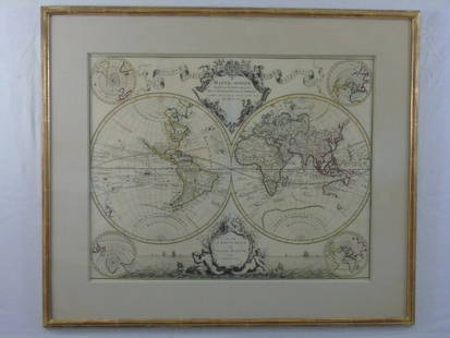
BonhamsWORLD MAP. JAILLOT, ALEXIS HUBERT. C.1632-1712. Mappe-Monde Geo-Hydrographique, ou Description ...$1,600
2 days LeftDOYLE Auctioneers & AppraisersOrtelius' historical map of antique "Magna Graecia," present-day Southern Italy$150
BonhamsCURRIER & IVES (New York, New York, 1857-1907), Two Framed Hand-colored Lithographs of Winter Sc...$260(1 bid)
2 days LeftDOYLE Auctioneers & AppraisersAn attractive eighteenth-century Dutch map of the Americas$150
2 days LeftDOYLE Auctioneers & AppraisersAn eighteenth-century map of Nîmes in Southern France, with views of its Roman monuments$100(1 bid)
2 days LeftJasper52World showing Dutch East India Co Possessions, c1720, CA as a island. By J.Malherbe$550
1 day LeftBonhamsREISCH, GREGOR. 1470-1525. Margarita Philosophica. Basel: Michael Furter and Johann Schott, 1508.$10,000
Jul 07Worthington GalleriesFirst Edition Hand-colored Map THE NORTH RIDING OF YORKSHIRE by Robert Morden$20
3 days LeftA.H. Wilkens Auctions & AppraisalsJEFFERYS. AN EXACT CHART OF THE RIVER ST. LAURENCECA$200(1 bid)