Sold2021"PARTICULAR MAP OF THE ISLAND OF CORCEGA, from the"PARTICULAR MAP OF THE ISLAND OF CORCEGA, from the "Atlas Universel, dressé sur les meilleures cartes modernes", second half of the 18th century.Illuminated engraving (colour demarcations).EditionSee Sold Price
Sold2024Laurie & Whittle - Map of the Island and Kingdom of SicilyThis exceptional map is from the very handsome atlas entitled A New and Elegant Imperial Sheet Atlas; Comprehending general and particular maps of every part of the world... The work was published bySee Sold Price
Sold2022WORLD MAP & MONTREAL MAPGibson, John. A PARTICULAR MAP, TO ILLUSTRATE GEN. AMBERST'S EXPEDTIION, TO MONTREAL; WITH A PLAN OF THE TOW & DRAUGHT OF YE ISLAND (London: The Gentleman's Magazine, ca. 1760). Copper engraving. HandSee Sold Price
Sold20201750 Bowen Map of Islands off the Coast of Africa --Title/Content of Map: 1750 Bowen Map of Islands off the Coast of Africa -- Particular Draughts Of Some Of The Chief African Islands In The Mediterranean, As Also In The Atlantic And Ethiopic Oceans CaSee Sold Price
Sold2018Bowen: Antique Map of Atlantic & Mediterranean IslandsMap: Particular Draughts of some of the chief African Islands in the Mediterranean, as also in the Atlantic and Ethiopic Oceans Cartographer: Bowen Place & Date: London / 1752 Size: 16 3/4" x 13 3/4"See Sold Price
Sold2022[MAP]. BOWEN, Emanuel (1694–1767). Particular Draughts of S...[MAP]. BOWEN, Emanuel (1694–1767). Particular Draughts of Some of the Chief African Islands in the Mediterranean. London: William Innys and Joseph Richardson, 1752. Original hand–colored eSee Sold Price
Sold2019Anon 1816 Hand Col Map. Island of St. Helena, Africa"The Island & Forts of St. Helena" Copper Engraved Map Published 1816 by Nuthall, Fisher & Co., Liverpool. Unknown Cartographer/Engraver. Paper Size: 10.5 x 8.5 inch (27 x 22cm) Chip to bottom marginSee Sold Price
Sold2017Neele: Antique Map Islands of the Pacific Ocean, 1817Map: Map of the Islands in the Pacific Ocean Publication Date: 1817 Cartographer: NEELE, sc. Publisher: THOMSON'S NEW GENERAL ATLAS Size: Folio – 19.50 H x 23.75 W Inches From a famous Scottish atlaSee Sold Price
Sold2023Frame Map "Islands of Minorca" 28" x 36"Frame Map "Islands of Minorca" 28" x 36"See Sold Price
Sold2021Tallis, John (Pub) 1852 Map Islands in the Indian OceanSteel Engraved Map with Original Outline Hand Color Published 1852-56 by John Tallis, London for "The Universal Pronouncing Dictionary" by Thomas Wright. Drawn & Engraved by John Rapkin. Centre fold aSee Sold Price
Sold2021Tallis, John (Pub) 1852 Map. Islands in the AtlanticShowing Canary Islands, Madeira and Bermuda. Steel Engraved Map with Original Outline Hand Color Published 1852-56 by John Tallis, London for "The Universal Pronouncing Dictionary" by Thomas Wright. DSee Sold Price
Sold2024Antique Maps - Americas - Emanuel Bowen - North America - South AmericaMap "A new general map of America. Drawn from several accurate particular maps and charts, and regulated by astronomical observations. By Eman. Bowen". An impressive publication by Emanuel Bowen, "A NSee Sold Price
Sold2020Island Juan Fernandez 1748 J. N. BellinTitle/Content of Map: Island Juan Fernandez 1748 J. N. Bellin Cartographer:J. Nicolas. Bellin Date Printed: 1748 Material/Medium: Paper Size: Sheet Size 34 x 24 cm. Image 28 x 19 cm. Reserve: $95.00 SSee Sold Price
Sold2022Three Antique Hawaiian Maps, US Government3 1920s Hawaiian Maps. Island Of Oahu Map Approximately 47.1875 x 36.5 in. Hawaiian Islands Approximately 45.875 x 35.125 in. Hawaii To Oahu Approximately 46.4375 x 35.5625 in.See Sold Price
Sold2018Bellin: Antique Map of Haiti & Dominican Republic, 1740Title/Content of Map: Island of Hispaniola, Haiti & Dominican Republic by Bellin Date Printed: 1740-70's Cartographer: J.N. Bellin & J.F. La Harpe Material/Medium: Paper Size: 14" x 10" Copperplate enSee Sold Price
Sold2017Bellin: Antique Map of Island of Juan Fernandez, 1740Title/Content of Map: Island of Juan Fernandez rare and early view of Chile's island Date Printed: c 1740-70's Cartographer: J.N. Bellin & J.F. La Harpe Material/Medium: Paper Size: 13" x 9 1/2" CoppeSee Sold Price
Sold20181788 Folding Map Westerly Coast of AfricaLarge folding map being "Particular Map of the Westerly Coast of Africa from Cape Blanco to Cape de Verga and of the course of the Rivers Senega and Gambia", fom D’Anvilles Atlas. Engraved for HarriSee Sold Price
Sold2017Bellin: Antique Map of New Zembla Island, 1750Title/Content of Map: Island of New Zembla Northern Russia Arctic Ocean Date Printed: 1750's -60's Cartographer: Jacques Nicolas Bellin Material/Medium: Paper Size: 9 1/2" x 7" Copperplate engraving.See Sold Price
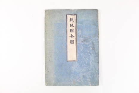
Sold2021Japanese Fold Out Handmade Ink Drawn Map,Islands,RoutesJapanese Fold Out Handmade Ink Drawn Map,Islands,Routes. This is a beautiful, handmade map of what appear to be islands and possibly routes. It is written in Japanese. The two hard covers are attachedSee Sold Price
Sold2019INDIAN OCEAN Madagascar Seychelles Maldives MauritiusReserve Reduced! TITLE/CONTENT OF MAP: 'ISLANDS IN THE INDIAN OCEAN. Madagascar, Amirantes, Seychelle Archipelago, Socotra, Lakadive Islands, Maldive Islands, Andaman Isles, Nicobar Isles, Chagos GrouSee Sold Price
Sold2019ATLANTIC ISLANDS. Bermuda Madeira Canaries.TenerifeTITLE/CONTENT OF MAP: 'Islands in the Atlantic' The map shows the islands of Madeira, the Azores, the "Bermudas or Summers Islands", the Canary Islands and teh Cape de Verde Islands. Vignettes: Fayal,See Sold Price
Sold2017Tallis: Map of Islands in the Indian Ocean, 1851Map: Islands in the Indian Ocean Cartographer: Tallis Place & Date: London/New York / 1851 Size: 13 1/4" x 10 1/2" The superb Indian Ocean islands map from Tallis' Illustrated Atlas extending from theSee Sold Price
Sold2016Caribbean Island Map, by Mount & Page, 1720 (rare &Spectacular sea chart of the Spanish Main to Puerto Rico, from Mount & Page's English Pilot, Fourth Book. Known as the most important English Atlas of Sea Chart covering the Mediterranean and North AmSee Sold Price
Sold2023Vintage 14K Gold Nantucket Island Map Pendant NecklaceVintage 14K Gold Nantucket Island Map Pendant Necklace, the reverse marked "14K", the chain marked "Italy 14K Aurea". Chain length 14 in. Width of pendant .9 in. Weight 3.7 dwt.See Sold Price
6 days LeftJasper521760 MAP CARTE PARTICULIERE DE L'ISLE DE JUAN FERNANDES antique Robinson Crusoe$55
3 days LeftBlackstone Valley Auctions & Estates LLCAntique Treasure Island Reverse Glass Banjo Clock.$150
4 days LeftBidhausHermes HERMES Calvi Verso Card Case Nata Vaux Swift Chevre Misor U Engraving Cream White Bicolor Sea$1
Featured3 hrs LeftJasper52Hyperboreorum/Septentrionalum regionum. Bertius/Langenes. Europe Arctic 1603 map$420
Crawford Family Auctions LLCVintage 1944 US DOC Survey Map Hecate Strait to Etolin Island incl. Behm & Portland Canals$10
Featured6 days LeftJasper521764 Bellin Map of Lesser Antilles Northern Portion -- Petites Antilles ou Isles du Vent 3e. Partie.$130
May 30Forum AuctionsSt. Helena.- Beatson (Maj.-Gen. Alexander) Tracts Relative to the Island of St. Helena, 1816£400
3 days LeftBlackstone Valley Auctions & Estates LLCRevolutionary Era War Map of the Attack on Ft. Moultrie.$275(3 bids)
18 hrs LeftPotter & Potter AuctionsMap to Acquaint You with the Great Mission Bay Project. 194...$125(1 bid)
19 hrs LeftZikorn Arts & History ObjectsWest Indies, Western Cuba 1879 British Admiralty Nautical Map$100
May 31Freeman's | Hindman[CIVIL WAR]. Archive of items related to Elisha Hunt RHODES (1842-1917), 2nd Rhode Island Volunteer$750


![[MAP]. BOWEN, Emanuel (1694–1767). Particular Draughts of S...: [MAP]. BOWEN, Emanuel (1694–1767). Particular Draughts of Some of the Chief African Islands in the Mediterranean. London: William Innys and Joseph Richardson, 1752. Original hand–colored e](https://p1.liveauctioneers.com/928/252933/131521910_1_x.jpg?height=310&quality=70&version=1656110480)


![[CIVIL WAR]. Archive of items related to Elisha Hunt RHODES (1842-1917), 2nd Rhode Island Volunteer (1 of 6)](https://p1.liveauctioneers.com/197/329785/177758366_1_x.jpg?height=282&quality=70&version=1715625218)