Sold20222 Framed 18th C. Faden Maps - Greece & Denmark**Originally Listed At $200** Cartographer: William Faden (British, 1749-1836). Engraver: William Palmer (British, 1735-1812). "Graecie Antiquae et Aegaei Maris Tabula" Published by William Faden JanuSee Sold Price
Sold2023Map Of America & West Indies Principal Harbors Eman BowenDraughts and Plans of Principal Towns and Harbours belonging to the English, French and Spaniards by Eman Bowen 15 3/4 x 18 1/2 (sheet) 18th century framed map.See Sold Price
Sold2021Map of City and Harbour of MacauA Plan of the City and Harbour of Macao" engraved by B. Baker, Islington 27" x 20 1/2" (sight) hand-colored engraved map 18th century framed- 32 1/2" x 40See Sold Price
Sold201718th Century French Map of North AmericaL’Amerique Septentrionale. Daniel de la Feuille (1640-1709). Engraved map with hand color in full. Amsterdam, 1702 or 1706. 6 x 8 inches visible, 13 x 14 1/2 inches framed. Nicely colored early 18thSee Sold Price
Sold202118TH C. (1755) MAP OF N.Y. , PENSYLVANIA & NEW ENGLANDFRAMED 18TH C. (DATED 1755) 2 PART MAP "A MAP OF THE PROVINCE OF NEW YORK, WITH PART OF PENSILVANIA AND NEW ENGLAND / FROM AN ACTUAL SURVEY BY CAPTAIN MONTRESOR, ENGINEER 1755" - FRAME 59 1/4" X 39",See Sold Price
Sold2023"Regni Daniae" Antique 18thC Hand Colored Map of Denmark by Johann Baptiste Homann"Regni Daniae" Antique 18thC Hand Colored Map of Denmark by Johann Baptiste Homann. Frame Size: 21 3/4" H x 25 1/4" W x .75" D. Sight Size: 20" H x 23 1/2" W.See Sold Price
Sold2023Antique Map of HispaniolaAntique Map of Hispaniola, "Hispaniolae, Cubae...", Ortelius, late 17th/early 18th c., hand-colored engraved map, sight 15 in. x 21 1/2 in., framedSee Sold Price
Sold2024Two (2) Antique 18th C. Copper Engraved Framed Maps - America & EuropeTwo (2) antique 18th C. copper engraved framed maps. One of Amerique and other titled Carte d'Europe. Both framed under glass. Frame Size: 13.5H x 14.5W (each)See Sold Price
Sold2020LOT OF THREE ANTIQUE c.1819 FRAMED MAPSLOT OF THREE ANTIQUE c.1819 FRAMED MAPS - EAST INDIES, DENMARK, SWEDEN, & NORWAY Height: 16 1/2 & 8 in. by Width: 18 1/2 & 10 in.See Sold Price
Sold202218th C. MAPS OF NORTH AMERICA & CARIBBEAN (2 MAPS)Includes: Brian de la Tour, Louis. L'AMERIQUE DRESSEE POUR L'ETUDE DE LA GEOGRAPHIE (Paris, 1764).Copperplate engraved map of North and South America. Hand colored. Matted and framed. H. 11", W. 12" BSee Sold Price
Sold202218th & 19th C. MAPS OF ASIA (3 MAPS)Includes: 2 maps by John Tallis & Co. London / New York, ca. 1850, both matted and framed, including: (1) MAP OF ASIA. Hand colored engraved map. 5 hand colored vignettes. H. 10.25", W. 12.75"; (2) MASee Sold Price
Sold2017English 18th C. Petit Point Map of England & WalesDated May 8th 1787 or 1788. Framed and under glass. Sight: 21 x 18. Frame: 25 1/4 x 22 1/2 inches. Shipping weight: 5 lbs.See Sold Price
Sold20222 E. Bowen Maps of Italy & GreeceEmanuel Bowen, Welsh, 1694-1767. Two 18th century hand-colored engraved maps. Includes one titled "Middle or Proper Italy" and another titled "A Map of Great Greece and the Islands of Sardinia and CorSee Sold Price
Sold2017Two 18th century engraved maps with hand coloringHind, Hindoostan, or India. Louis de la Rochette. Engraved map with hand color in part. London: W. Faden, c. 1790-1811. 31 x 23 inches framed. AND Africae in Tabula Geographica Delineatio. Adam FriedrSee Sold Price
Sold2023Benjamin Cole, Map of Wards of LondonBenjamin Cole (English, 1695-1766), 18th century hand-colored engraving depicting the Baynards Castle Ward and Farringdon Ward, 14 1/2" x 18 1/2" sight size, 23 3/4" x 27 3/4" framed.See Sold Price
Sold2022A framed 18th Century map of the road from London to Poole by John Ogleby 36 x 45 cm.A framed 18th Century map of the road from London to Poole by John Ogleby 36 x 45 cm.See Sold Price
Sold2022A framed 18th Century map of the road from London to Poole by John Ogleby 36 x 45 cm.A framed 18th Century map of the road from London to Poole by John Ogleby 36 x 45 cm.See Sold Price
Sold2019(2) 18TH C. MAPSNetherlands. Dimensions: (Frame) H 32.25" x W 36", (Sight) H 22.5" x W 27" Condition: Wear consistent with age and handling. Toning, marks, and creases.See Sold Price
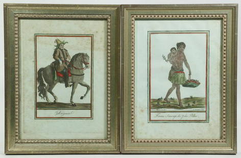
Sold2022(2) FRAMED 18TH C. FRENCH ENGRAVINGSLot of (2) Early French Hand Colored engravings, from "Costumes de Differents Pays" engraved by Jacques Grasset de Saint Sauveur (France, 1757-1810), L. Labrousse and J. Laroque, circa 1797, in matchiSee Sold Price
Sold2022A framed early 18th Century map on parchment of Northumberland by Robert Morden 41 x 35cmA framed early 18th Century map on parchment of Northumberland by Robert Morden 41 x 35cmSee Sold Price
Sold2022A framed early 18th Century map on parchment of Northumberland by Robert Morden 41 x 35cmA framed early 18th Century map on parchment of Northumberland by Robert Morden 41 x 35cmSee Sold Price
Sold20242 18th C. Road Maps: London to Carlisle (14 1/2" x 17 1/2") & Bristol to Exeter, 6 1/2"2 18th C. Road Maps: London to Carlisle (14 1/2" x 17 1/2") & Bristol to Exeter, 6 1/2"See Sold Price
May 09Hunt and Peck Estate Services, Inc.ANTONIO ZATTA (ITALIAN, 18TH CENTURY) MAP OF VIRGINIA$80(2 bids)
May 09Hunt and Peck Estate Services, Inc.ANTONIO ZATTA (ITALIAN, 18TH CENTURY) MAP OF VIRGINIA$70(1 bid)
11 hrs LeftJasper52GIOVANNI PIRANESI ETCHING VEDUTA DELL ARCO DI TITO ORIGINAL antique 18th century$380
11 hrs LeftJasper521792 ANCIENT HISTORY of INDIA antique ILLUSTRATED w/ MAPS 18th CENTURY in FRENCH$170
1 day LeftRapid Estate Liquidators and Auction GalleryFramed Coconut Tree Natural History Of History Print$5
5 days LeftTremont AuctionsPair of 17th/18th century old master oval portraits on oak panels. 1) Man wearing armor. 2) Young$600
5 days LeftTremont Auctions18th century Japanese 12 months 6-panel floor screen depicting landscapes and court scenes with$300
Jul 07A-1 Auction18th Century Miniature Oil on Canvas Portrait H.W. Portman Born 1738 - England$100(3 bids)
Featured9 hrs LeftJasper52Fairlee House, the Seat of John White (Newport - Isle of Wight). Antique engraving by Godfrey, 18th$150