Sold2020(3) SMITH'S ATLAS MAPS, EGYPT, ASIA & PERSIA(lot of 3) Unframed maps from Smith's Atlas, 19th c., published by Charles Smith, London, including: (1) "Persia, Arabia, and Cabul," engraved by W.R. Gardner, sheet: approx 12.5"h, 15.75"w, (1) "EgypSee Sold Price
Sold2017LOT (5) ENGRAVED MAPS INCLUDING MARTINIQUE, FROM PETITLOT (5) ENGRAVED MAPS INCLUDING MARTINIQUE, FROM PETIT ATLAS NATIONAL, 19TH CENTURY, 10 X 8"; WINDWARD ISLANDS (ST. LUCIA, ST. VINCENT AND BARBADOS), T. KITCHIN, 18TH CENTURY, 10 1/4 X 8"; ANTILLES ORSee Sold Price
Sold2022Nat. Encyclo. C1875 Lot of 5 Maps - AsiaIncl China, Turkey in Asia, Asia Continent, North and South India. Lithograph Map Published C1868-81 by William Mackenzie, London for "The National Encyclopedia: A dictionary of Universal Knowledge" CSee Sold Price
Sold202218th & 19th C. MAPS OF ASIA (3 MAPS)Includes: 2 maps by John Tallis & Co. London / New York, ca. 1850, both matted and framed, including: (1) MAP OF ASIA. Hand colored engraved map. 5 hand colored vignettes. H. 10.25", W. 12.75"; (2) MASee Sold Price
Sold2019Egypt & Arabia 19th Cent. Lot of 5 MapsLot of 4 19th Cent Lithographed and Engraved Maps. Examples by SDUK, Weller/Weekly Dispatch, William Collins, and Johnston. Together with a large 20th Cent. Admiralty Chart of the Red Sea, published 1See Sold Price
Sold2020Rapkin, John 1860 Lot of 5 British & European MapsIncl Scotland, Germany, England/Wales, Denmark and Northern Italy. Steel Engraved Maps Published 1860 by The London Printing & Published Company, London for "The Royal Dictionary-Cyclopedia for UniverSee Sold Price
Sold2022Dugdale & Archer C1840 Lot of 5 British County MapsSteel Engraved Maps with outline hand color Published C1835-60 London for "Curiosities of Great Britain. England & Wales Delineated..." by Thomas Dugdale. Drawn and Engraved by John Archer. Paper SizeSee Sold Price
Sold2021Bartholomew, John 1889 Lot of 5 Continents MapsCommercial Continent Maps of Asia, Africa, Europe, North & South America. Lithograph Maps Published 1889, Cambridge for "Atlas of Commercial Geography" by John George Bartholomew. Paper Size: 12 x 10See Sold Price
Sold2021Eadie, John 1864 Lot of 5 Holy Land MapsIncl Journeys of Apostle Paul/Asia Minor Apocalyptic Churches, Plan of Jerusalem, Journeys of the Children of Israel/Old & New Canaan, Judah & Israel/Land of Canaan, and The World as peopled by the deSee Sold Price
Sold2018Isle De Crete | Die Insel Creta.Title/Content of Map: Isle De Crete | Die Insel Creta. Date: 1719 Cartographer: MALLET, ALAIN MANESSON Size: 5.5X3.8 Detailed engraved map. Fig. LXXVII Please note that this lot has a confidential resSee Sold Price
Sold2018Is. De Corse | Die Insel Corsica.Title: Is. De Corse | Die Insel Corsica. Publication Date: 1719 Cartographer: MALLET, ALAIN MANESSON Size: 5.5X4 Detailed engraved birdseye map. Fig. CIV Please note that this lot has a confidential rSee Sold Price
Sold2020Maps 19th Century. Mixed Lot of 8Lot of 8 Lithographed and Engraved Maps. Incl Europe Continent, Italy (Part Map) South Africa, Worcester/Gloucester, Huntingdonshire, Asia and UK. Examples by Stieler, Weekly Dispatch, Goldsmith, JohnSee Sold Price
Sold20211871 Map of AsiaTitle: 1871 Map of Asia Medium: Ink on Paper Dimensions: 11.5"X9" Map of Asia engraved by James Monteith dated 1871. Published by A J Barnes and co.in New York and Chicago. Part of Monteith Physical GSee Sold Price
Sold2019TURKEY. Asia Minor provinces. Karamania Adana ItchiTITLE/CONTENT OF MAP: 'TURKEY, CONTAINING THE PROVINCES IN ASIA MINOR' DATE PRINTED: 1846 IMAGE SIZE: Approx 32.5 x 42.0cm, 12.75 x 16.5 inches (Large) TYPE: Antique steel engraved map with original oSee Sold Price
Sold2019ASIA shows Sultanate of Sulu in North Borneo, MindanaoTITLE/CONTENT OF MAP: 'ASIA' DATE PRINTED: 1874 IMAGE SIZE: Approx 33.5 x 42.0cm, 13.25 x 16.5 inches (Large) TYPE: Antique steel engraved map with original outline hand colouring CONDITION: Good; suiSee Sold Price
Sold2018TURKEY. Asia Minor provinces. Karamania Adana CyprusTITLE/CONTENT OF MAP: 'TURKEY, CONTAINING THE PROVINCES IN ASIA MINOR' DATE PRINTED: 1846 IMAGE SIZE: Approx 32.5 x 42.0cm, 12.75 x 16.5 inches (Large) TYPE: Antique steel engraved map with original oSee Sold Price
Sold2021Nolan, Edward C1880 Lot of 3 Maps. China, Japan, AsiaSteel Engraved Map Published C1880, London for "The Illustrated History of the British Empire in India and the East" by Edward H. Nolan. Centre fold as issued. Paper Size: 12 x 10 inch (30 x 25cm) GooSee Sold Price
Sold2021(4) SEUTTER HAND-COLORED ENGRAVED MAPSAsia, Middle East, The Baltic, and South America. Dimensions: (Frame) H 18" x W 15.5" x D 1.75" (Sight) H 8" x W 10.25" Condition: Not examined out of frame. Colors bright; showing light wear consisteSee Sold Price
Sold2020[CEYLON] A lot of 6 mapsMAPS OF CEYLON. A lot of 6 maps Including: Sanson, N. CEYLON EN DE MALDIVE SCH EILANDEN. Engraved map, centre fold, minor imperfections,good condition, 8.5 x 24.5. [1705] ** Samuel Purchas. NECIUS VOYSee Sold Price
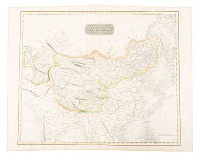
Sold2019Map of Tartary comprising most of AsiaHeading: (Maps) Author: Thomson, John Title: Tartary Place Published: Edinburgh Publisher: Date Published: 1814 Description: Engraved map, hand-colored in outline. 49.8x59.5See Sold Price
Sold2024Moule, Thomas C1835 Lot of 12 British County MapsSteel Engraved Map Published C1835, London for "A Complete and Universal English Dictionary" by the Rev. James Barclay et al. Maps by Thomas Moule. Paper Size: 10.5 x 8 inch (27 x 21cm) Faults presentSee Sold Price
Sold2018Levasseur, Victor 1859 Lot of 6 Large French MapsIncl Drome, Lozere, Cher, Loire, Charente, Manche. Steel Engraved Maps Published 1859, Paris for "Atlas National Illustre" by Victor Levasseur. Outline hand colour. Paper Size: 20 x 14.5 inch (51 x 37See Sold Price
Sold2018Levasseur, Victor 1859 Lot of 6 Large French MapsIncl Ardennes, D'Ille et Vilaine, L'Indre, L'Aveyron, Calvados. Steel Engraved Maps Published 1859, Paris for "Atlas National Illustre" by Victor Levasseur. Outline hand colour. Paper Size: 20 x 14.5See Sold Price
Sold2018Levasseur, Victor 1859 Lot of 6 Large French MapsIncl L'Isere, Garonne, Loiret, Lot, L'Aude, L'Aube. Steel Engraved Maps Published 1859, Paris for "Atlas National Illustre" by Victor Levasseur. Outline hand colour. Paper Size: 20 x 14.5 inch (51 x 3See Sold Price
Jun 27NY Elizabeth ANTIQUE MAP-ILLUSTRATED FLORAL ILLUSTRATION 1761 NEW DICTIONARY OF TRADE AND COMMERCE R. ROTH$100
7 days LeftJasper521696 SYRIA Asia Minor & Syrian-Arabic region HISTORY antique ILLUSTRATED vellum$340
7 days LeftJasper521877 RIDE TO KHIVA TRAVELS ADVENTURES in CENTRAL ASIA antique ILLUSTRATED w/MAPS$100
BonhamsBOWYER (ROBERT) An Illustrated Record of Important Events in the Annals of Europe, During the La...£800


![[ASIA]. A lot of 5 engraved maps First Image](https://p1.liveauctioneers.com/1124/187577/94368843_1_x.jpg?height=300&quality=1&version=1607095126&width=300)
![[ASIA]. A lot of 5 engraved maps First Image](https://p1.liveauctioneers.com/1124/187577/94368843_1_x.jpg?height=300&quality=95&version=1607095126&width=300)


![[CEYLON] A lot of 6 maps: MAPS OF CEYLON. A lot of 6 maps Including: Sanson, N. CEYLON EN DE MALDIVE SCH EILANDEN. Engraved map, centre fold, minor imperfections,good condition, 8.5 x 24.5. [1705] ** Samuel Purchas. NECIUS VOY](https://p1.liveauctioneers.com/1124/187577/94368857_1_x.jpg?height=310&quality=70&version=1607095126)