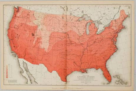
Sold2017Map Showing The Distribution Of The Genus JuglansMap Showing The Distribution Of The Genus Juglans [the Walnuts] In North America Exclusive Of Mexico. Dept. Of The Interior. 10th Census, Gannett, Henry/harry King, 1883, Folio – 17.40 H X 27.40 W ISee Sold Price
Sold2024Map Showing Distribution of Pinus Palustris (Longleaf Pine) & Pinus Cubensis (Cuban Pine) | PinusPublication Date: 1891 Title: Map Showing Distribution of Pinus Palustris (Longleaf Pine) & Pinus Cubensis (Cuban Pine) | Pinus Echinata (Shortleaf Pine) | Pinus Taeda (Loblolly Pine) Cartographer: SCSee Sold Price
Sold2021Map Showing the Distribution of the Tribes of AlaskaPublication Date: 1875 Title: Map Showing the Distribution of the Tribes of Alaska and Adjoining Territory Cartographer: DALL, W.H. | C.W. RAYMOND | DAVIDSON Publisher: U.S. COAST & GEODETIC SURVEY OFSee Sold Price
Sold2018Map Showing the Distribution of the Indian Tribes, 1876Title/Content of Map: ... Map Showing the Distribution of the Indian Tribes of Washington Territory Date Printed: 1876 Cartographer: DALL, W. H. Size: 19.75X15.5 Elegant topographical and ethnologic mSee Sold Price
Sold2022Map Showing the Distribution of Wealth.Publication Date:1874 Title:Map Showing the Distribution of Wealth. Cartographer:WALKER, FRANCIS A. Publisher:BUREAU OF THE CENSUS Height:19.75 Width:14.75 Compiled from the tables of true valuation,See Sold Price
Sold20191850 Petermann Map of the Distribution of Birds andTitle/Content of Map: 1850 Petermann Map of the Distribution of Birds and Reptiles Globally -- Zoological Map Showing the Distribution of Birds and Reptiles (Aves et Reptilia) over the Globe Date: 185See Sold Price
Sold20191850 Petermann Map of the Distribution of MammalsTitle/Content of Map: 1850 Petermann Map of the Distribution of Mammals Globally -- Zoological Map Showing the Distribution of the Principal Mammiferous Animals (Class Mammalia) over the Globe Date: 1See Sold Price
Sold2019Bryce, James 1881 Lot 3 Maps World. Temperature, BirdsIncl 2 Temperature Maps and one showing the distribution of Birds and Fish. Lithograph Maps Published 1881, London for ""The International Atlas and Geography..." by James Bryce. Maps by Edward WellerSee Sold Price
Sold20181850 Petermann Map of the Distribution of ActiveTitle/Content of Map: 1850 Petermann Map of the Distribution of Active Volcanoes and Eartquake Prone Regions Globally -- Map of the World Showing the Distribution of Active Volcanoes and Regions VisitSee Sold Price
Sold2019Rare 1st ed. German world distribution, 1846World map in partial color showing the distribution of Germans throughout the world. Inset maps showing the specific spread of Germans in North America and South America. Inset shows Germans in NorthSee Sold Price
Sold20181850 Petermann World Map of the Human RaceTitle/Content of Map: 1850 Petermann World Map of the Human Race -- Ethnographical Map of the World Showing the Distribution of the Human Race in the Middle of the 19th Century Date Printed: 1850, LonSee Sold Price
Sold2022Map of the Cordilleran Region Showing the Distribution of Woods and ForestsPublication Date: 1898 Title: Map of the Cordilleran Region Showing the Distribution of Woods and Forests Cartographer: GANNETT, HENRY Publisher: U.S. GEOLOGICAL SURVEY Height: 36.25 Width: 29.5 NinetSee Sold Price
Sold2020Reconnoissance Map of the United States Showing theTitle: Reconnoissance Map of the United States Showing the Distribution of The Geologic System Cartographer: MC GEE, W. J. Date: 1893 Publisher: U.S. GEOLOGICAL SURVEY Size: 17.5Height - 28.25Width AdSee Sold Price
Sold20211880 Gannett Climate Map of the US with IsothermalTitle: 1880 Gannett Climate Map of the US with Isothermal Minimum Temperature Lines -- Map of the United states Showing the Distribution of Lines of Minimum Temperature… Cartographer: H Gannett / DeSee Sold Price
Sold20231880 US Census Map of Corn Production per Capita -- Map of the United States Showing theTitle: 1880 US Census Map of Corn Production per Capita -- Map of the United States Showing the Distribution of Production of Indian Corn in Bushels per Capita… Cartographer: US Census Bureau YeSee Sold Price
Sold20231880 US Census Map of Wheat Production per Capita -- Map of the United States Showing theTitle: 1880 US Census Map of Wheat Production per Capita -- Map of the United States Showing the Distribution of Production of Wheat in Bushels per Capita… Cartographer: US Census Bureau Year /See Sold Price
Sold20231880 US Census Map of Oats Production per Capita -- Map of the United States Showing theTitle: 1880 US Census Map of Oats Production per Capita -- Map of the United States Showing the Distribution of Production of Oats in Bushels per Capita… Cartographer: US Census Bureau Year / PlSee Sold Price
Sold2019Rare 1st ed. 1847 ethno map of Europe/AsiaA large full color map of Europe and Asia showing the ethnographic distribution of people. Includes an accompanying chart. From the first comprehensive physical atlas of the world. This map comes fromSee Sold Price
Sold2020Map of Indian TerritoryTitle/Content of Map: Map of Indian Territory Date: 1899 Cartographer: U.S. GEOLOGICAL SURVEY Publisher: U.S.G.S. Size: 32.5Height - 29.5Width showing distribution of woodland. Compiled under the direSee Sold Price
Sold2024Goode, George Brown 1884 Lot of 4 Natural History & Meteorology MapsIncl River Basins of the Atlantic Slope, World showing distribution on the Hair Seal Family, Ditto the Walruses/Seals/Sea Lions and Sea Elephants, and influence of Hydro-Thermals of the Migration of SSee Sold Price
Sold2018Lloyds 1890's Lot of 8 Natural History MapsShowing the distribution of Moths and Butterflies. Chromolithograph Maps Published 1894-97, London for "Lloyds's Natural History. A Hand-Book to the Marsupialia and Monotremata" Edited by R. Bowdler SSee Sold Price
Sold2022Water distribution in San Francisco 1894Heading: -1894 Author: Spring Valley Water Company Title: Map of San Francisco showing the Water Service of Spring Valley Water Works... Place Published: San Francisco Publisher:Britton & Rey DatSee Sold Price
Sold2019Map of Predominating Sex Showing the Local Excess ofTitle: Map of Predominating Sex Showing the Local Excess of Males Or Of Females in the Distribution Of Population Over The Territory Of The United States East Of The 100th Meridian. Publication Date:See Sold Price
Sold20221879 Powell US Rain Chart Map -- Rain Chart of the United States Showing by Isothermal Lines theTitle: 1879 Powell US Rain Chart Map -- Rain Chart of the United States Showing by Isothermal Lines the Distribution of the Mean Annual Precipitation in Rain and Melted Snow Cartographer: J W Powell /See Sold Price
Jun 12Dan Morphy AuctionsPLATE CXIII. MAP OF INDIAN TERRITORY SHOWING DISTRIBUTION OF WOODLAND” FROM THE TWENTY-FIRST$100
May 29Cedarburg Auction & Appraisals LLCSet of Four Maps Showing All of Spain and Portugal$125(2 bids)
5 days LeftJasper52Quarry Map Showing the Situation and Size of the More Important Slate Quarries in The "Unfading$20
368 Lots AwayPotter & Potter AuctionsLISTER, James Wren (1897 – 1952). Avalon Town / Santa Catal...$125(2 bids)
384 Lots AwayPotter & Potter AuctionsMcCARTY, Lea (1905 – 1960). Sonoma County / Its Highlights ...$100(1 bid)
402 Lots AwayPotter & Potter AuctionsPan American Airways World System Map. 1956. Art by John Br...$200
Jun 08Connoisseur AuctionsEarly 1900's Railway Service Map, Illinois, Ohio, Indiana, Kentucky, Tennessee$20
Featured6 days LeftJasper52Les voyages de Rubruquis, Marco Polo, Jenkinson'. BELLIN/SCHLEY 1749 old map$75
5 days LeftJasper521866 McNally Map of Huge Idaho, Dakota, Colorado, Nebraska, etc -- Nebraska, Kansas, Dakota,$70
5 days LeftJasper521892 Cowles Civil War Map of Battles in Gettysburg, Virginia, W Virginia and Maryland -- Sketch of$55
5 days LeftJasper52Sketch Showing the Progress of the Survey On The Atlantic, Gulf of Mexico and Pacific Coasts Of The$25
5 days LeftJasper521788 Bowen Map of Ottoman Empire and Mediterranean Region -- A Correct Map of the Ottoman Empire,$140
6 days LeftCurated AuctionsTHE BOEHM MAYFLOWER CLOCK: AN ANNULAR SILVER MOUNTED TIMEPIECE, NO. 243£450
7 days LeftSloans & KenyonTOTAL ECLIPSE OF THE SUN : SEE NIGHT-TIME WHEN ITS DAY IN NEW ENGLAND WHILE YOU PLAY JOHN HELD JR$1,000
7 days LeftSloans & KenyonMAP OF CONNECTICUT SHOWING PRINCIPAL HIGHWAYS, WITH ILLUSTRATIONS BY JOHN HELD JR AND HISTORIC$350


![Map Showing The Distribution Of The Genus Juglans: Map Showing The Distribution Of The Genus Juglans [the Walnuts] In North America Exclusive Of Mexico. Dept. Of The Interior. 10th Census, Gannett, Henry/harry King, 1883, Folio – 17.40 H X 27.40 W I](https://p1.liveauctioneers.com/5584/101555/51863510_1_x.jpg?height=310&quality=70&version=1489788854)