Sold2021Map Showing the Distribution of the Tribes of AlaskaPublication Date: 1875 Title: Map Showing the Distribution of the Tribes of Alaska and Adjoining Territory Cartographer: DALL, W.H. | C.W. RAYMOND | DAVIDSON Publisher: U.S. COAST & GEODETIC SURVEY OFSee Sold Price
Sold2018Map Showing the Distribution of the Indian Tribes, 1876Title/Content of Map: ... Map Showing the Distribution of the Indian Tribes of Washington Territory Date Printed: 1876 Cartographer: DALL, W. H. Size: 19.75X15.5 Elegant topographical and ethnologic mSee Sold Price
Sold20211858 map of N. America showing Gold RegionsMap dated 1858 and found in an 1869 edition of Mitchell’s School Atlas. An early map showing Alaska as U. S. territory. Alaska labeled “Russia America; Ter’y of United States.”See Sold Price
Sold2017Map Showing The Distribution Of The Genus JuglansMap Showing The Distribution Of The Genus Juglans [the Walnuts] In North America Exclusive Of Mexico. Dept. Of The Interior. 10th Census, Gannett, Henry/harry King, 1883, Folio – 17.40 H X 27.40 W ISee Sold Price
Sold2022Map Showing the Distribution of Wealth.Publication Date:1874 Title:Map Showing the Distribution of Wealth. Cartographer:WALKER, FRANCIS A. Publisher:BUREAU OF THE CENSUS Height:19.75 Width:14.75 Compiled from the tables of true valuation,See Sold Price
Sold20191850 Petermann Map of the Distribution of Birds andTitle/Content of Map: 1850 Petermann Map of the Distribution of Birds and Reptiles Globally -- Zoological Map Showing the Distribution of Birds and Reptiles (Aves et Reptilia) over the Globe Date: 185See Sold Price
Sold20191850 Petermann Map of the Distribution of MammalsTitle/Content of Map: 1850 Petermann Map of the Distribution of Mammals Globally -- Zoological Map Showing the Distribution of the Principal Mammiferous Animals (Class Mammalia) over the Globe Date: 1See Sold Price
Sold2021Pictorial Map United States IndiansIndians of the U.S.A. Louise E. Jefferson. Friendship Press, New York: 1944. Novelty map showing native American tribes. Vintage color print. 22 1/2" x 34 1/2", overall 26" x 40".See Sold Price
Sold2019Bryce, James 1881 Lot 3 Maps World. Temperature, BirdsIncl 2 Temperature Maps and one showing the distribution of Birds and Fish. Lithograph Maps Published 1881, London for ""The International Atlas and Geography..." by James Bryce. Maps by Edward WellerSee Sold Price
Sold20221852 map of North America showing numerous IndianInteresting mid-century map showing locations of numerous Indian tribes (Apaches, Pawnee, Comanches, Crow, Black Feet, Riccarees, Shoshones, Utahs, Moquis). Shows forts, mountains, towns, rivers (locaSee Sold Price
Sold20181850 Petermann Map of the Distribution of ActiveTitle/Content of Map: 1850 Petermann Map of the Distribution of Active Volcanoes and Eartquake Prone Regions Globally -- Map of the World Showing the Distribution of Active Volcanoes and Regions VisitSee Sold Price
Sold2019Rare 1st ed. German world distribution, 1846World map in partial color showing the distribution of Germans throughout the world. Inset maps showing the specific spread of Germans in North America and South America. Inset shows Germans in NorthSee Sold Price
Sold20181850 Petermann World Map of the Human RaceTitle/Content of Map: 1850 Petermann World Map of the Human Race -- Ethnographical Map of the World Showing the Distribution of the Human Race in the Middle of the 19th Century Date Printed: 1850, LonSee Sold Price
Sold2022Map of the Cordilleran Region Showing the Distribution of Woods and ForestsPublication Date: 1898 Title: Map of the Cordilleran Region Showing the Distribution of Woods and Forests Cartographer: GANNETT, HENRY Publisher: U.S. GEOLOGICAL SURVEY Height: 36.25 Width: 29.5 NinetSee Sold Price
Sold2022Early Map of North AmericaEarly Map of North America Showing numerous Indian Tribes and California as a peninsula. Cartographer: Samuel Walker - Boston Dated: Circa 1830's - 40's<See Sold Price
Sold2020Early Map of North AmericaEarly Map of North America Showing numerous Indian Tribes Maker: Samuel Walker - Boston Dated: Circa 1830's - 40's Type: Engraving<See Sold Price
Sold2020Reconnoissance Map of the United States Showing theTitle: Reconnoissance Map of the United States Showing the Distribution of The Geologic System Cartographer: MC GEE, W. J. Date: 1893 Publisher: U.S. GEOLOGICAL SURVEY Size: 17.5Height - 28.25Width AdSee Sold Price
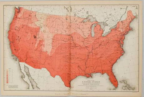
Sold20211880 Gannett Climate Map of the US with IsothermalTitle: 1880 Gannett Climate Map of the US with Isothermal Minimum Temperature Lines -- Map of the United states Showing the Distribution of Lines of Minimum Temperature… Cartographer: H Gannett / DeSee Sold Price
Sold20231880 US Census Map of Corn Production per Capita -- Map of the United States Showing theTitle: 1880 US Census Map of Corn Production per Capita -- Map of the United States Showing the Distribution of Production of Indian Corn in Bushels per Capita… Cartographer: US Census Bureau YeSee Sold Price
Sold20231880 US Census Map of Wheat Production per Capita -- Map of the United States Showing theTitle: 1880 US Census Map of Wheat Production per Capita -- Map of the United States Showing the Distribution of Production of Wheat in Bushels per Capita… Cartographer: US Census Bureau Year /See Sold Price
Sold20231880 US Census Map of Oats Production per Capita -- Map of the United States Showing theTitle: 1880 US Census Map of Oats Production per Capita -- Map of the United States Showing the Distribution of Production of Oats in Bushels per Capita… Cartographer: US Census Bureau Year / PlSee Sold Price
Sold20151897 Klondike Gold Rush MapScarce colored folded map 16 x 22 inches with full title ‘Map of Alaska & Surroundings, Showing the Klondike Gold Field, and Routes to the Mining Camp’. This map of all of Alaska, is undaSee Sold Price
Sold2022Geologic Reconnaissance Map of Prince William Sound, Alaska Showing the District from the CopperPublication Date: 1909 Title: Geologic Reconnaissance Map of Prince William Sound, Alaska Showing the District from the Copper River Delta to Resurrection Bay. Cartographer: HIGGINS, D. F./U. S. GRANTSee Sold Price
Sold2019Map of North America Showing All Routes to Alaska andTitle: Map of North America Showing All Routes to Alaska and Klondike Country Prublication Date: 1898 Cartographer: CONKEY, W.B. Publisher: W.B. CONKEY COMPANY Size: 13.5Height - 14.6Width AdditionalSee Sold Price
May 16Potter & Potter AuctionsLISTER, James Wren (1897 – 1952). Avalon Town / Santa Catal...$100(1 bid)
May 16Potter & Potter AuctionsMcCARTY, Lea (1905 – 1960). Sonoma County / Its Highlights ...$100(1 bid)
May 10Rail & Road AuctionsFour Early 1900s Steamship Timetables and Travel Brochures - Detroit & Cleveland, Dominion Atlantic$20
1 day LeftJasper521875 Warner & Beers United States Railroad Map -- Railroad Map of the United States$140
1 day LeftJasper521700 Schenk Map of Russian Empire -- La Russie Blanche ou Moscovie Divisee Suivant l'Estendue des$240
1 day LeftJasper521645 Jansson Map of Portugal and Parts of Spain -- Portugallia et Algarbia quae olim Lusitania$200
5 days LeftBid Again Auctions (American Space Museum)4 - Lunar Orbiter I Original Site Map Photographs$50


![Map Showing The Distribution Of The Genus Juglans: Map Showing The Distribution Of The Genus Juglans [the Walnuts] In North America Exclusive Of Mexico. Dept. Of The Interior. 10th Census, Gannett, Henry/harry King, 1883, Folio – 17.40 H X 27.40 W I](https://p1.liveauctioneers.com/5584/101555/51863510_1_x.jpg?height=310&quality=70&version=1489788854)