Sold2016Geroge Cram: Map of Western Part of Quebec, 1891Map: Western Part of Quebec Maker: George Cram Date: 1891 Size: 13.5 x 21.75 inches For "The Home Knowledge Atlas" George F. Cram (1842-1928) served in the U.S. Army during the American Civil War. AftSee Sold Price
Sold2020Mitchell Map of Western U.S.*** START PRICE IS THE RESERVE *** [America] MITCHELL, Samuel Augustus (1792-1868). A New Map of Texas, Oregon and California with the Regions Adjoining. Engraving with original hand color, with origiSee Sold Price
Sold20181854 Bartlett Map of Western US and Northern Mexico --Title/Content of Map: 1854 Bartlett Map of Western US and Northern Mexico -- Survey Map Showing the Countries Explored & Surveyed by the United States & Mexico Boundary Commission in the Years 1850, 5See Sold Price
Sold2023WWII US Army 1st Armored Division 1943 - 1945 Color War MapOriginal WWII US map as shown. See pictures for details. Good condition for its age, with signs of use and age. It has folds and creases throughout consistent with a map.See Sold Price
Sold20191945 US Army Escape Silk Map of Northern Sumatra/MalayTitle/Content of Map: 1945 US Army Escape Silk Map of Northern Sumatra/Malay Peninsula [verso] Central Sumatra -- [Escape Silk Map] C800 [verso] C920 Cloth Chart Date: 1945, Washington DC CartographerSee Sold Price
Sold2017US Air Force Silk Escape Map of Tokyo and Osaka, 1943Title/Content of Map: 1943 US Army Air Force Silk Escape Map of Tokyo and Osaka -- Tokyo [verso] Osaka Date Printed: 1943 Washington Cartographer: US Army Size: 18 x 23 in. This is a highly detailed tSee Sold Price
Sold20181943 US Air Force Silk Escape Map of Northern HonsuTitle/Content of Map: 1943 US Army Air Force Silk Escape Map of Northern Honsu (main island) and Hokkado Islands, Japan -- [Escape Silk Map] Hakodate [verso] Nemuro Date Printed: 1943, Washington DC CSee Sold Price
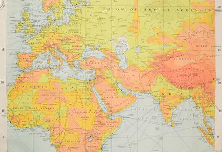
Sold20221861 Map of Western US -- Reduced Section of NorthTitle: 1861 Map of Western US -- Reduced Section of North America Including all the Recent Geographical Discoveries Cartographer: US Government - Senate Date/Place: 1861, Washington Dimensions: 7.1 XSee Sold Price
Sold20201869 Mitchell Map of Western US [verso] Mexico andTitle: 1869 Mitchell Map of Western US [verso] Mexico and Central America -- XIX California, Oregon, Idaho, Utah, Nevada, Arizona and Washington [verso] XX Mexico and Central America Cartographer: S MSee Sold Price
Sold2021WWII Aircraft Protractor Map Machine - U.S. Army AirWWII Aircraft Protractor Map Machine - U.S. Army Air Corps Order No.42 Bruning-WallaceSee Sold Price
Sold20201869 McNally Map of Western US -- Washington, Oregon,Title: 1869 McNally Map of Western US -- Washington, Oregon, Idaho, Nevada, Utah, and Arizona Date: 1869, New York Cartographer: F McNally Size: 10.8 X 8.5 in. Additional Information: This is a charmiSee Sold Price
Sold20231891 Mitchell Map of Western US -- Map of Oregon, Kansas, California and the Territories.Title: 1891 Mitchell Map of Western US -- Map of Oregon, Kansas, California and the Territories. Cartographer: S Mitchell Year / Place: 1891, Philadelphia Map Dimension (in.): 8.2 X 10.6 in. This is aSee Sold Price
Sold20181944 Western Pacific Railroad Pictorial Map of WesternTitle/Content of Map: 1944 Western Pacific Railroad Pictorial Map of Western US with Illustrations -- From San Francisco along the line of Western Pacific Railroad to Salt Lake City Date: 1944, DenverSee Sold Price
Sold2017(2) ASSORTED ROTARY TELEPHONES(2) ASSORTED ROTARY TELEPHONES - Includes Western Electric US Army Signal Corps phone and Western Electric Bell System G3 phone ; Condition - General age appropriate with age and use; dust stitches; aSee Sold Price
Sold2022US DEPARTMENT OF DEFENSE. KOREAN WAR MAPS (1950-1953)US DEPARTMENT OF DEFENSE. KOREAN WAR MAPS (1950-1953) INCLUDING SANGYONG, MAJON-NI, AND YANGHOP-TONG. Washington DC: US Army Map Service. Seven maps from the country, of Sangyong (17), Majon-Ni (8), YSee Sold Price
Sold2022US DEPARTMENT OF DEFENSEUS DEPARTMENT OF DEFENSE. KOREAN WAR MAPS (1950-1953) YONCH'ON, CH'ORWON AND OTHERS. Washington DC: US Army Map Service. Seven maps from the country, of Yonch'on (7), Ch'orwon (7), Tuksom (9), UijongbSee Sold Price
Sold20221842 US Army Map of Lake St. Clair by Detroit -- Map of the Delta of the St. Clair…Title: 1842 US Army Map of Lake St. Clair by Detroit -- Map of the Delta of the St. Clair… Cartographer: US Army Year/Place: 1842 Dimensions: 27.8 X 47 in. Description: This superb and quite uncSee Sold Price
Sold20191869 Richardson Map of the Western US -- Map 1869 ofTitle/Content of Map: 1869 Richardson Map of the Western US -- Map 1869 of the Region Between the Mississippi and the Pacific, to Accompany Richardson's "Beyond the Mississippi". Date: 1869, HartfordCSee Sold Price
Sold2020WW2 US Army western pacific ground forces tunicIncludes division patch and moreSee Sold Price
Sold2022US DEPARTMENT OF DEFENSE. WORLD WAR 2, SUMATRA, INDONESIA AND DUTCH EAST INDIES MAPS (1944-1946)US DEPARTMENT OF DEFENSE. WORLD WAR 2, SUMATRA, INDONESIA AND DUTCH EAST INDIES MAPS (1944-1946). US Army Map Service. Eight maps from Dutch Sumatra and Timor: Gle Jeueng (paper) and Lho'Nga (paper) eSee Sold Price
Sold2022US DEPARTMENT OF DEFENSE. WORLD WAR 2, SUMATRA, INDONESIA AND DUTCH EAST INDIES MAPS (1943-1946)US DEPARTMENT OF DEFENSE. WORLD WAR 2, SUMATRA, INDONESIA AND DUTCH EAST INDIES MAPS (1943-1946). US Army Map Service. Eight maps, from Dutch East Indies: Dutch Timor, Isle of Roti; Portuguese Timor;See Sold Price
Sold202440+ Asst 1940s-Newer Maps- Army, Declassified, More - Army Corps Engineers, US Army Maps - Maps from40+ Asst 1940s-Newer Maps- Army, Declassified, More - Army Corps Engineers, US Army Maps - Maps from around the World - 1:50,000 + 1:1,000,000 ScaleSee Sold Price
Sold2022WW2 Army MapsA collection of (8) WW2 U.S. Army Map Service maps of the world. Large, in vivid color.See Sold Price
Sold20241805 John Cary New Map Of Western Territory Of U.S.John Cary was an English cartographerSee Sold Price
2 days LeftJasper52Océanique. Partie des Iles Salomon #32. Solomon Islands. VANDERMAELEN 1827 map$75
May 10Rail & Road AuctionsEleven Army Corps of Engineers Port Series No. 1 Through No. 8 Books with Fold Out Maps$35(2 bids)
May 10Rail & Road AuctionsEleven Port Series Books with Fold Out Maps - No. 9 Through No. 23 - Army Corps of Engineers$20(1 bid)
May 09Hunt and Peck Estate Services, Inc.1849 Alex Mackay 1st US Ed. 2 Vol. "The Western World or Travels in the United States in 1846-1847"$50
May 19Rich Penn AuctionsMilitaria License Plates (4), pair U.S. Recruiting, pressed steel & pair U.S. Army, litho on steel,$50(1 bid)
2 days LeftJasper52PACIFIC OCEAN showing British French Dutch US territory. US Philippines 1947 map$20
1 day LeftBlock Auction HouseHillerich and Bradsby Ted Williams US Army Model Wooden Baseball Bat$40(3 bids)
6 days LeftM.J. Stasak Jr. Auction and Appraisal ServiceFile Boxes US Army Coca Cola Pouch & Misc$9(3 bids)
Old Steel Historical Firearms LLCWWII US Army Jacket and Trouser - 86th Infantry Division Patch$10(1 bid)


![Mitchell Map of Western U.S.: *** START PRICE IS THE RESERVE *** [America] MITCHELL, Samuel Augustus (1792-1868). A New Map of Texas, Oregon and California with the Regions Adjoining. Engraving with original hand color, with origi](https://p1.liveauctioneers.com/1968/163248/82424595_1_x.jpg?height=310&quality=70&version=1583340284)


![1945 US Army Escape Silk Map of Northern Sumatra/Malay: Title/Content of Map: 1945 US Army Escape Silk Map of Northern Sumatra/Malay Peninsula [verso] Central Sumatra -- [Escape Silk Map] C800 [verso] C920 Cloth Chart Date: 1945, Washington DC Cartographer](https://p1.liveauctioneers.com/5584/134050/68048822_1_x.jpg?height=310&quality=70&version=1546996032)
![US Air Force Silk Escape Map of Tokyo and Osaka, 1943: Title/Content of Map: 1943 US Army Air Force Silk Escape Map of Tokyo and Osaka -- Tokyo [verso] Osaka Date Printed: 1943 Washington Cartographer: US Army Size: 18 x 23 in. This is a highly detailed t](https://p1.liveauctioneers.com/5584/112417/57704460_1_x.jpg?height=310&quality=70&version=1511317189)
![1943 US Air Force Silk Escape Map of Northern Honsu: Title/Content of Map: 1943 US Army Air Force Silk Escape Map of Northern Honsu (main island) and Hokkado Islands, Japan -- [Escape Silk Map] Hakodate [verso] Nemuro Date Printed: 1943, Washington DC C](https://p1.liveauctioneers.com/5584/117342/60336934_1_x.jpg?height=310&quality=70&version=1520389291)

![1869 Mitchell Map of Western US [verso] Mexico and: Title: 1869 Mitchell Map of Western US [verso] Mexico and Central America -- XIX California, Oregon, Idaho, Utah, Nevada, Arizona and Washington [verso] XX Mexico and Central America Cartographer: S M](https://p1.liveauctioneers.com/5584/188299/94765046_1_x.jpg?height=310&quality=70&version=1608072723)


![Native American Warrior in US Army Uniform [Tintype] (1 of 1)](https://p1.liveauctioneers.com/7226/322253/173251534_1_x.jpg?height=282&quality=70&version=1710004847)


