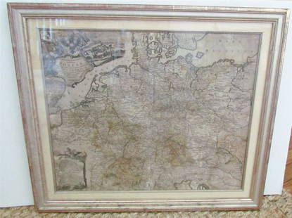
Sold2019Matthaus Seutter (1678-1757), "Ducatus Lotharingiae etMatthaus Seutter (1678-1757), "Ducatus Lotharingiae et Barr.. Episcopatluum," hand colored, H. - 21 in., W. - 24 in.See Sold Price
Sold2019Tobias Conrad Lotter (1717-1777, German), "MappaTobias Conrad Lotter (1717-1777, German), "Mappa Geographica Regionem Mexicanem et Floridam", 1740, hand colored, H. - 21 1/2 in., W. - 25 1/2 in.See Sold Price
Sold2019Matthias Seutter (1678-1781), " Mappa GeographicaMatthias Seutter (1678-1781), " Mappa Geographica Regionem Mexicanem et Floridam… Americae Unsulas Cursus," c. 1740, hand colored, H.-20 in., W.- 23 1/2 in.See Sold Price
Sold2019Tobias Conrad Lotter (1717-1777, German), "MappaTobias Conrad Lotter (1717-1777, German), "Mappa Geographica Regionem Mexicanem et Floridam," 1740, hand colored, H.- 21 1/2 in., W.- 25 1/2 in.See Sold Price
Sold2021A LATE BAROQUE MAP OF COLONIAL AMERICA, "MappaA LATE BAROQUE MAP OF COLONIAL AMERICA, "Mappa geographica Regionem Mexicanam et Floridam," AUGSBURG, CIRCA 1740, hand colored engraving on paper, "Terrasque adjacentes, ut et Anteriores Americæ insuSee Sold Price
Sold2018Lotter: Grand Sicily Map with Malta InsetMap: Mappa Geographica totius Insulae et Regni Siciliae Cartographer: Lotter Place/Date: Augsburg / 1760 Size: 22" x 19 1/2" Condition: "wash color, cartouches in b&w; overall age toningminor stainingSee Sold Price
Sold20211749 Homann Map of British Isles -- Regnorum MagnaeTitle: 1749 Homann Map of British Isles -- Regnorum Magnae Britanniae et Hiberniae Mappa Geographica... Cartographer: J. Homann Year / Place: 1749 Nurnberg Map Dimension (in.): 18.7 X 21.5 in. This isSee Sold Price
Sold2019TOBIAS CONRAD LOTTER (German 1717-1777) A MAP,TOBIAS CONRAD LOTTER (German 1717-1777) A MAP, "SPATIOSISSIMUM IMPERIUM RUSSIAE MAGNAE JUXTA RECENTIFSIMAS OBFERVATIONES MAPPA GEOGRAPHICA..." "...accuratifsime delineatum opera et fumtibus Tobiae ConSee Sold Price
Sold20201720 c. Homann Map of Central Germany's ThuringianTitle: 1720 c. Homann Map of Central Germany's Thuringian Forest Area -- Tabula Geographica in qua ... Principatus Gotha, Coburg et Altenburg Cartographer: J Homann Year/Place: 1720 c., Nurnberg DimenSee Sold Price
Sold20231730 MAP UKRAINE CRIMEA RUSSIA BLACK & AZOV SEA antique NOVA MAPPA GEOGRAPHICANOVA MAPPA GEOGRAPHICA MARIS ASSOVIENSIS vel de ZABACHE et PALUDIS MAEOTIDIS accuratè aeri incisa et in lucem edita per Matthaeum Seutter chalcograph. Augsburg; 1730 Overall size 21.5 by 25.5" ImSee Sold Price
Sold2018Seutter. Nova Mappa Geographica Maris...[Eastern Europe/Western Asia] Nova Mappa Geographica Maris Assoviensis Vil De Zabache Et Paludis Maetidis, accurate aeri incise et in luce edita per Matthaeum Seutter Chalcograph. Map of the Sea of AzSee Sold Price
Sold2016Rhine, the Meuse and the Moselle. Nicholas VisscherTabula Geographica qua pars Septentrionalis sive Inferior Rheni, Mosae et Mosellae Maker: Visscher, Nicholas. Origin: Amsterdam, 1706. Medium: Original copper engraving with early hand-coloring. SheetSee Sold Price
Sold20181720 Homann Map of Black Sea, Southern Russia andTitle/Content of Map: 1720 Homann Map of Black Sea, Southern Russia and Ukraine -- Tabula Geographica qua pars Russiae Magnae Pontus Euxinus seu Mare Nigrum et Tartaria Minor cum finitimis Bulgariae,See Sold Price
Sold20211757 Homann Map of Poland and the Baltic States --Title: 1757 Homann Map of Poland and the Baltic States -- Mappa Geographica Regni Poloniae ex Novissimis quot quot sunt Mappis Specialibus Composita et ad LL. Stereographica Projectionis Revocata a ToSee Sold Price
Sold20241720 Tabula Geographica Homann Map of Black Sea18th Century 1720 Tabula Geographica Homann Map of Black Sea - Tabula Geographica qua pars Russiae Magnae Pontus Euxinus seu Mare Nigrum et Tartaria Minor cum finitimis Bulgariae, et Romaniae et NatolSee Sold Price
Sold2017Plancius: Antique Map of Biblical Middle East, 1600Map: Tabula geographica, in qua Israelitarum, ab Aegypto ad Kenahanaeam usque profectiones omnes, et stationes describuntur Cartographer: Plancius/Cloppenburg Place & Date: Amsterdam / 1600 Size: 19 1See Sold Price
Sold20211760 Homann Map of Northwest France -- Carte dTitle: 1760 Homann Map of Northwest France -- Carte d' Artois et des Environs Vel Mappa Specialis Comitatus Artesiae in qua simul Terrae Iuris dictionales Dicast: Provincialis Artesiae Cartographer: JSee Sold Price
2023Henry Popple, Amerique Septentrionale. Nova Mappa Geographica Americae Septentrionalis insulasTitle: Amerique Septentrionale. Nova Mappa Geographica Americae Septentrionalis insulas praecipuas Partes divisa. Artist: Henry Popple Publisher: Published by J. M. Probst, Augsburg. Hand colored coSee Sold Price
Sold2019Johann Baptist Homann (1661-1774), "Mappa GeographicaJohann Baptist Homann (1661-1774), "Mappa Geographica Complectens lndiae Occidentalisi, lsthmum Panamensemii, Lchnographiam, Preaecipuorum Locorum Portum iii. Carte des Isles L'Amerique iv. Ver Cruzv.See Sold Price
Sold2022(CARIBBEAN.) Homann Heirs. Mappa Geographica Complectens I. Indiae Occidentalis Partem Mediam Circum(CARIBBEAN.) Homann Heirs. Mappa Geographica Complectens I. Indiae Occidentalis Partem Mediam Circum Isthmum Panamensem. Double-page engraved map of the Caribbean and Gulf of Mexico bordered by insetsSee Sold Price
Sold2021Ortelius, Abraham. Carinthiae Ducatus, Et GoritiaeOrtelius, Abraham. Carinthiae Ducatus, Et Goritiae Palatinatus, Wolf. Lazio auctorefrom Theatrum Orbis Terrarum, late 16th century, copperplate engraving with hand color, incorporating three regionalSee Sold Price
Sold2024Adam Friedrich Zurner (German 1679 - 1742) and Peter Schenk (German 1660 - 1711)Adam Friedrich Zurner (German 1679 - 1742) and Peter Schenk (German 1660 - 1711) "Americae tam Septentionalis quam Meridionalis in Mappa Geographica Delineato", circa 1709 Hand colored map engraving 2See Sold Price
Sold2020Homann Heirs Map of the West Indies and Mexico 17Homann Heirs, "Mappa Geographica complectens I. Indiae Occidentalis Partem Mediam Circum Isthmum Panamensem," Nuremberg, 1740. Hand colored map of the Gulf Coast, Florida, and the Caribbean, with inseSee Sold Price
Sold20231769 ANTIQUE MAP of EUROPE framed EUROPEAN POSTAL ROADS & STATIONS1769 ANTIQUE MAP: MAPPA GEOGRAPHICA EXHIBENS POSTAS omnes tam vehiculares quam verdarias Totius Germaniae cum earum accurata distantia Diligentissime propriis sumptibus excudit. Aug. Vindelicor. : TobSee Sold Price
18 hrs LeftTremont AuctionsImportant pair of Worcester Flight-Barr and Barr porcelain large oval plaques done in the French old$1,500(1 bid)
3 days LeftAkiba GalleriesSalvador Dali "Le Corregidor Don Eugenio De Zuniga Et Son Alguazil Garduna" Colored Lithograph$25(1 bid)
May 19Leonard Auction, a division of The Leonard CompanyPablo Picasso (Spanish, 1881-1973) 'Taureau et Picador' Earthenware Pitcher$1,500(1 bid)
May 16Freeman's | HindmanEdouard Léon Cortès (French, 1882-1969) Notre-Dame et les Bouquinistes, c. 1954$7,500
4 days LeftSanta Fe Art AuctionKermit Oliver for Hermès, Faune et Flore Du Texas Wildlife$300(1 bid)
May 14Adam's AuctioneersAN EARLY 20TH CENTURY 'TOI ET MOI' DIAMOND DRESS RING Composed of two old-cut diamonds weighing res€15(2 bids)
BonhamsVarious Photographers including Tina Modotti, et al.; Portafolio de las Mujeres (Portfolio of th...$1,000
May 16Potter & Potter AuctionsFavor / Cycles et Motos de Grand Luxe. Paris: Delatire, ca....$400(1 bid)
21 hrs LeftTaylor & HarrisPair Rookwood Pottery Vases by E.T. Hurley #6806, 1943. Hand Painted Tulips$500
May 16Zikorn Arts & History ObjectsSalvador Dali: Le Chene et le Roseau, 1974 Pochoir Ed.36/250$3,000


![Seutter. Nova Mappa Geographica Maris...: [Eastern Europe/Western Asia] Nova Mappa Geographica Maris Assoviensis Vil De Zabache Et Paludis Maetidis, accurate aeri incise et in luce edita per Matthaeum Seutter Chalcograph. Map of the Sea of Az](https://p1.liveauctioneers.com/179/117971/60557754_1_x.jpg?height=310&quality=70&version=1520636872)