Sold2019The Netherlands. French-ruled Belgium with 13Reserve Reduced! TITLE/CONTENT OF MAP: 'The Netherlands [Belgium]' Somewhat confusingly entitled "The Netherlands", the map shows the country today known as Belgium. The map is shown as it had been unSee Sold Price
Sold2022The Netherlands. 1st French Empire Belgium w/ 13 Départements. THOMSON 1830 mapTITLE/CONTENT OF MAP: 'Belgium or the Netherlands' Belgium shown under the First French Empire, with 13 Départements; although Napoleon's rule over the region had ended with his defeat at WaterloSee Sold Price
Sold2017Thomson: Map of The Netherlands, 1817Map: 'The Netherlands [Belgium]' Somewhat confusingly entitled "The Netherlands", the map shows the country today known as Belgium. The map is shown as it had been under French rule with 13 DépartemeSee Sold Price
Sold202118TH C. SET OF (4) ITALIAN PASTORAL GOUACHES, MATTED,Shepherds in Various Landscapes, all with fanciful architecture, in French ruled mats, OS: 16 3/4" x 13 1/4", SS: 11 1/2" x 8". Soiling to mats, paintings are good.See Sold Price
Sold2021Wooden box, coins various countries 1932-1986Large bundle. Official coins. 1932-1986. Netherlands, Great Britain, British Commonwealth, France, French Colonies, Belgium, Luxembourg, Greece, Austria, Spain, Russia, Scandinavia, Poland, Arab. StatSee Sold Price
Sold20201831 Teesdale Map of Netherlands, Belgium andTitle/Content of Map: 1831 Teesdale Map of Netherlands, Belgium and Luxembourg -- Netherlands Date: 1831, London Cartographer: H Teesdale Size: 16.1 X 13.2 in. This is a very nice and detailed map ofSee Sold Price
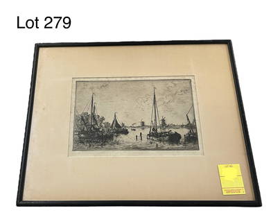
Sold2023Indistinguishable Signature - French ? Belgium ? LithographIndistinguishable signature - lithograph signed in pencil bottom right. French / Belgian tree lined lane by the river. Frame dimension 13 3/4 inches x 21 1/2 inches piece dimension 6 1/2 inches x 14 1See Sold Price
Sold2022BERNARD LANGLAIS (ME/NY, 1921-1977)Drawing of a Lion in ink and watercolor on textured paper, signed lower left, edge toned, framed and matted with French ruled line, SS: 8" x 10" mat size 13" x 15".See Sold Price
Sold2022Jacob van Dieghem (Netherlands/Belgium, 1843-1885), "Shepherdess and Her Flock of Sheep," 19th c.,Jacob van Dieghem (Netherlands/Belgium, 1843-1885), "Shepherdess and Her Flock of Sheep," 19th c., oil on canvas, signed lower right, presented in a gilt frame, H.- 8 1/2 in., W.- 13 1/4 in., Framed HSee Sold Price
Sold2022H. BOYLSTON DUMMER (MA,1878-1945)Fishing Shack, watercolor, signed lower right, dated '11 and marked 'Marblehead', in a mahogany cove frame with gilt liner, under French-ruled mat, glazed, OS: 22 3/4" x 28 3/4", SS: 13 1/2" x 19 1/2"See Sold Price
Sold2021Central and Eastern Europe by Bonne/ Raynal 1780Title: Central and Eastern Europe by Bonne/ Raynal 1780 Date/Period: 1780 Materials: Copperplate engraved Size: 13 1/2 x 9'' Map centers on Germany, but Netherlands, Belgium, Luxembourg, Austria, SwitSee Sold Price
Sold2023FRAMED RESTRIKE OF AN 18TH C. BIRDSEYE VIEW OF HANAU, GERMANYPrinted on oaktag from the original engraved block, in water gilt domed stick frames, French ruled mat, under glass, OS: 14 3/4" x 19 3/4", SS: 8 1/4" x 13", good condition.See Sold Price
Sold2020Netherlands and Belgium. With a unusual insert of aTitle: Netherlands and Belgium. With a unusual insert of a Roman fort built during the time of Caligula Date/Period: 1729-1736 Materials: Copperplate engraved. Dimensions: 13 1/2 x 9 “ By. H. MollSee Sold Price
Sold2017Colton: Antique Map of Netherlands and Belgium, 1861Title/Content of Map: Colton's Netherlands and Belgium Date Printed: 1861 Cartographer: J. H. Colton Material/Medium: Paper Size: 17 1/2" x 13 3/4" Hand colored. Steel engraved. From 'Colton's GeneralSee Sold Price
Sold2021Netherlands and Belgium. 1850 by ThomasTitle: Netherlands and Belgium. 1850 by Thomas Date/Period: c1850 Materials: Hand colored steel engraved Size: 16 1/2 x 13 1/2 inches. c1850 by Thomas, Cowperthwait & Co. From 'A New Universal Atlas'See Sold Price
Sold2023Antique Etching Titled Zaandam, Netherlands by Maxime Lalanne (1827-1886)An antique etching of a Dutch dock scene titled Zaandam, Netherlands by French artist Maxime Lalanne (1827-1886). Additional writing on back, measures 16" x 13", 9 1/2" x 6 1/4" site. *note - some spoSee Sold Price
Sold2020ANTIQUE CARVED ICON NECKLACE BELGIUMAntique finely carved high relief icon 2 1/4", portraying Albert VII, cardinal archduke of Austria who as governor and sovereign prince of the Low Countries (1559-1621) ruled the Spanish Netherlands jSee Sold Price
Sold2021Netherlands with parts of Belgium and Germany. ByTitle: Netherlands with parts of Belgium and Germany. By Bonne/ Raynal 1780 Date/Period: 1780 Materials: Copperplate engraved Size: 13 1/2 x 9'' 1780, cartographer Rigobert Bonne one of the most imporSee Sold Price
Sold2017Five Porcelain Table ArticlesIncluding a transfer decorated Etruscan pitcher and an Olympus pattern jug. Together with two tall vases, one Boch, Belgium, the other French and a Classical porcelain gilt metal mounted vase. 13"hSee Sold Price
Sold2018Assorted Western European Issuers, 1910s-1970s, GroupGroup of assorted Western European issues, includes notes from Austria (4); Belgium (12); Finland (2); France (13); Iceland (3); Italy (4); Luxembourg (6); Netherlands (2); Netherlands Indies (3); PorSee Sold Price
Sold2021Yves Bolez (20th C.) French, Oil on CanvasYves Bolez (20th C) French artist, oil on canvas. Bolez' works are exhibited in prestigious galleries in France, Belgium, Netherlands, Germany and Switzerland. Overall Size: 15 x 18 in.Sight Size: 10See Sold Price
Sold2023Baedeker, Karl 1928 Lot of 25 Maps of Belgium etcMostly Belgium, also a few of Luxembourg and Netherlands. Lithograph Maps Published 1928, Leipzig for "Belgique et Luxembourg" by Karl Baedeker. Folds as issued. Paper Size: Up to 13 x 10 inch (33 x 2See Sold Price
Sold20191720 Homann Map of Netherlands, Belgium and LuxemburgReserve Reduced! Map Title/Content: 1720 Homann Map of Netherlands, Belgium and Luxemburg -- Tabula Generalis Totius Belgii qua Provinciae XVII. Infer. Germaniae olim sub S.R.I. Circulo Burgundiae…See Sold Price
Sold2018Desnos/de la Tour: Antique Map of Netherlands & BelgiumTITLE/CONTENT OF MAP: 'Les Pays Bas François. Autrichiens, et Hollandois, divisés en Provinces Civiles et Ecclésiastiques. à Paris. Chez le Sr. Desnos. Ingenieur Géographe pour les Globes et Sph�See Sold Price
2 days LeftJasper521792 Elwe Map of Southern Netherlands to Belgium to Northern France -- Carte Nouvelle des Pais Bas$80
Jul 07Broward Auction GalleryATTR Hermanus Franciscus Anker (Dutch,French,1832-1883) oil painting antique$10(1 bid)
2 days LeftJasper521792 Elwe Map of the Netherlands and Belgium -- Les Dix-Sept Provinces des Pays-Bas$80
1 day LeftPiasaRoger Capron (1922-2006) Ashtray Glazed earthenware Stamped 'Capron Vallauris France' under the base€300
4 days LeftNew England Auctions - Fred Giampietro19th Century Carved Limestone Statue of Children$100
May 19Fontaine's Auction GalleryLimoges Art Nouveau Figural Porcelain Charger, W.G. & Co., France$225
Jun 02Nazmiyal AuctionsAntique D Art De Rambouillet Edition French Tapestry 13 ft 10 in x 9 ft 9 in ( x )$2,000


![The Netherlands. French-ruled Belgium with 13: Reserve Reduced! TITLE/CONTENT OF MAP: 'The Netherlands [Belgium]' Somewhat confusingly entitled "The Netherlands", the map shows the country today known as Belgium. The map is shown as it had been un](https://p1.liveauctioneers.com/5584/135277/68682148_1_x.jpg?height=310&quality=70&version=1548808491)


![Thomson: Map of The Netherlands, 1817: Map: 'The Netherlands [Belgium]' Somewhat confusingly entitled "The Netherlands", the map shows the country today known as Belgium. The map is shown as it had been under French rule with 13 Départeme](https://p1.liveauctioneers.com/5584/102391/52309299_1_x.jpg?height=310&quality=70&version=1491597186)