Sold2022Butler, Samuel 1842 Pair of Maps. England & ScotlandSteel Engraved Map Published 1842, London for "An Atlas of Modern Geography" by Samuel Butler. Drawn & Engraved by Sidney Hall. Centre fold as published. Original outline hand colour. Paper Size: 10.5See Sold Price
Sold2019Cornwell & Dower 1849 Lot of 7 Miniature MapsIncl America Continent, Solar System, Mexico/West Indies, Oceania, Ireland, Scotland, and England/Wales. Steel Engraved Maps Published 1849, London for "A School Atlas" by James Cornwell. Maps by JohnSee Sold Price
Sold20181850 McDowall Diamond Maps ATLAS Geography England1850 McDowall Diamond Maps ATLAS Geography England Scotland Ireland World Color A collection of 19th-century McDowall maps. These four maps are extremely desirable, hand-colored views. Maps include: �See Sold Price
Sold20181814 ATLAS Maps of England & Wales Scotland Color Nav1814 ATLAS Maps of England & Wales Scotland Color Navigation Travel John Cary An incredible atlas consisting of 42 color maps of Great Britain by John Cary. The atlas covers cities in England, Wales,See Sold Price
Sold20181675 John Ogilby Britannia Atlas England HUGE FOLIOS1675 John Ogilby Britannia Atlas England HUGE FOLIOS Roads Scotland Wales 2v In 1675, John Ogilby, a famed Scottish cartographer, began working on his famous road atlas known as ‘The Britannia.’ BSee Sold Price
Sold2022COLLINS (GREENVILLE) Great-Britain's Coasting Pilot: Being a New and Exact Survey of the Sea-Coa...COLLINS (GREENVILLE) Great-Britain's Coasting Pilot: Being a New and Exact Survey of the Sea-Coast of England and Scotland, engraved pictorial frontispiece, title printed in red and black, 49 engraveSee Sold Price
Sold2017The USA Map 1829, Engraving by W. Darton, London, UKThe United States of America, 1829 by W. Darton Junior, Holborn Hill. England. Hand colored engraved atlas map. Relief is shown pictorially. Map framed, matted and glazed. Publisher 1829, William DartSee Sold Price
Sold2020Lyttleton, George 1810 Map of England, Scotland, Wales"An Accurate Map of England, Scotland, and Wales" Copper Engraved Map Published 1810, London for "The History of England..." by George Courtney Lyttleton. Folds as issued. Paper Size: 18 x 14 inch (46See Sold Price
Sold2020Lyttleton, George 1810 Map of England, Scotland, Wales"An Accurate Map of England, Scotland, and Wales" Copper Engraved Map Published 1810, London for "The History of England..." by George Courtney Lyttleton. Folds as issued. Paper Size: 18 x 14 inch (46See Sold Price
Sold2019Lyttleton, George 1810 Map of England, Scotland, Wales"An Accurate Map of England, Scotland, and Wales" Copper Engraved Map Published 1810, London for "The History of England..." by George Courtney Lyttleton. Folds as issued. Paper Size: 18 x 14 inch (46See Sold Price
Sold2020Encyclopaedia Perthensis 1816 Pair of Maps of the UK"Scotland" and "England and Wales" Copper Engraved Maps Published 1816 by John Brown, Edinburgh for "Encyclopaedia Perthensis; Or Universal Dictionary of the Arts, Sciences, Literature, &c" by John BrSee Sold Price
Sold2021Smith, G. 1746 Map of Carlisle, England & Scotland"A Map of the countries Adjacent to Carlisle…" by G. Smith. Copper Engraved Map Published London 1731-1833, London for "The Gentleman's Magazine..." by Various Contributors. Folds as issued. Paper SSee Sold Price
Sold2019James II. Exemplification relating to Sir Ralph Sadler,James II (King of England, Scotland, and Ireland, 1633-1701) Inspeximus and exemplification relating to Sir Ralph Sadler, fine engraved portrait of James II, royal coat of arms and floral decoration aSee Sold Price
Sold2022Map of United Kingdom, Circa 1833Map of United Kingdom of England, Scotland and Ireland. Published June 1833, engraved by William Darton, London. As is, condition commensurate with age. Size: 11 x 13 in. Location U1 CREAM BOXSee Sold Price
Sold2022Swire, William 1825 Large Canal & River Map of the UK"Map of the Canals and Navigable Rivers in England, Wales and Scotland" Copper Engraved Map Published 1824-25, Liverpool for "History, Directory, and Gazetteer, of the County Palatine of Lancaster" bySee Sold Price
Sold2023Rapkin, John 1860 Lot of 3 British MapsIncl Channel Islands, England/Wales and Scotland. Steel Engraved Map Published 1860 by The London Printing & Published Company, London for "The Royal Dictionary-Cyclopedia for Universal Reference" bySee Sold Price
Sold2022Thomson, John The Atlas of ScotlandThomson, John The Atlas of Scotland Edinburgh: for John Thomson & Co., 1832. Large folio (54 x 41cm), contemporary half calf, [4] viii 18, engraved 'Index Map' hand-coloured in outline, 2 engraved plaSee Sold Price
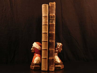
Sold2024Speed, John England, Wales & Scotland and Ireland Described and AbridgedEngland, Wales & Scotland and Ireland Described and Abridged With ye historic relation of thingsworthy from a farr larger volume. [date unclear.] Small oblong 8vo, engraved title-page, 43 maps only (oSee Sold Price
Sold2015TEESDALE, HENRY. New British AtlasTEESDALE, HENRY. New British Atlas Containing a *Complete Set of County Maps...Preceded by General Maos of England, Ireland, Scotland, North & South Wales, the Whole Carefully Revised and CorrecteSee Sold Price
Sold2017British Isles: C England Wales Scotland Ireland MapBritish Isles: Counties. England Wales Scotland Ireland. Tallis/rapkin 1851 Map. Vignettes: London; Edinburgh; Dublin. Approx 36.5 x 26.5cm, 14.5 x 10.25 inches (Large). Antique engraved map by J RapkSee Sold Price
Sold2021Neale, John C1830 Lot of 35 British Engraved ViewsSteel Engravings Published 1824-31, London for "Views of the Seats of the Noblemen and Gentlemen in England, Wales, Scotland and Ireland" by John Preston Neale, Thomas Moule and others. Paper Size: 8See Sold Price
Sold2018The Border Antiquities of England and Scotland.Scott, Sir Walter. The Border Antiquities of England and Scotland. London, 1889. Period quarter leather, gilt spines, marbled sides. Engraved plates under tissue. Folio. Wear to boards and page edges,See Sold Price
Sold2023Map: An 18thC engraved map titled Angliae Scotiae et Hiberniae Regna cum insulis adjacentibus,Map: An 18thC engraved map titled Angliae Scotiae et Hiberniae Regna cum insulis adjacentibus, depicting England, Ireland, Scotland and Wales. Approx. 5 3/4" x 7"See Sold Price
Sold2021Neale, John C1830 Lot of 50 British Engraved ViewsSteel Engravings Published 1824-31, London for "Views of the Seats of the Noblemen and Gentlemen in England, Wales, Scotland and Ireland" by John Preston Neale, Thomas Moule and others. Paper Size: 8See Sold Price
2 days LeftClaydon Auctioneers LtdMaps: A quantity of assorted engraved and hand coloured maps to include Northamptonshire,£30
13 hrs LeftTrillium Antique Prints & Rare BooksCarey, pub. 1814 - Map of Scotland with the Principal Roads$50
13 hrs LeftTrillium Antique Prints & Rare BooksBlaeu's Tooneel des Aerdrycx - Fifth Volume with 55 Engraved Maps$1,950(1 bid)
13 hrs LeftTrillium Antique Prints & Rare BooksPtolemy & Magini, pub. 1620 - Map of the British Isles (England, Scotland, Ireland) / Verso: Map of$50(1 bid)
2 days LeftClaydon Auctioneers LtdBook: A 1911 hand illuminated Royal Exchange Assurance Presentation Volume containing illuminated£200
2 days LeftClaydon Auctioneers LtdBooks: A quantity of silver and silver plate reference books comprising EPNS Electroplated Nickel£50
2 days LeftClark's Auction CompanyThe Border Antiquities Of England And Scotland, Walter Scott, 1814, Volumes I & II$120
Jun 08TimeLine Auctions Ltd.Commemorative Medals - Anne - Union of England and Scotland - Bronze Medallion by Croker£5
May 18RbfineartsWilliam Russell (Sir William) Flint 1880-1969 "The Farm Girl And The Nymphs" Watercolor$100
6 days LeftConestoga Auction Company Division of Hess Auction GroupTwo 19th C. American A. F. Bellows Engravings.$50


![Thomson, John The Atlas of Scotland: Thomson, John The Atlas of Scotland Edinburgh: for John Thomson & Co., 1832. Large folio (54 x 41cm), contemporary half calf, [4] viii 18, engraved 'Index Map' hand-coloured in outline, 2 engraved pla](https://p1.liveauctioneers.com/94/251108/130828922_1_x.jpg?height=310&quality=70&version=1655281539)
![Speed, John England, Wales & Scotland and Ireland Described and Abridged: England, Wales & Scotland and Ireland Described and Abridged With ye historic relation of thingsworthy from a farr larger volume. [date unclear.] Small oblong 8vo, engraved title-page, 43 maps only (o](https://p1.liveauctioneers.com/94/316498/169880617_1_x.jpg?height=310&quality=70&version=1705579068)


