Sold2022TWO EUROPEAN MAPS.Mid 17th century, hand colored engravings on laid paper. William Blaeu map of "Karstia, Carniola, Histria et Windorum Marchia". Text on back. Crease. 18.5"h. 22.75"w. And Nicolaum Visscher map of "BelSee Sold Price
Sold2020TWO EUROPEAN MAPS BY WILLIAM BLAEU.Amsterdam, 2nd quarter 17th century, hand colored engravings on rag paper. "Brabantia Ducatus" and "Ducatus Holsatiae". Matching late frames, 22.5"h. 27"w. overall.See Sold Price
Sold2023Two Folders of Vintage European MapsTwo folders of vintage European maps, including Spain, Portugal, Austrian Dominions, Prussia, Germany, etc. Provenance: Phyllis Lucas Gallery, NYC.See Sold Price
Sold2022Two early hand colored European views/maps.Two early hand colored European views/maps including:1)A historical view of the German town of Schleswig by Georg Braun and Frans Hogenberg (between 1572 and 1618) on laid paper - Crease down the middSee Sold Price
Sold2019Merian maps of Poland & HungaryHeading: Author: Merian, Matthaus Title: Two maps of Eastern European countries Place Published: Frankfurt Publisher: Date Published: c.1640 Description: Includes:See Sold Price
Sold2022THREE EUROPEAN ENGRAVED MAPS.Mid 17th century. Two hand colored maps of Corfu by Johann Baptiste Homann. Some toning, edge damage and one is stained. 21"h. 24.5"w. And uncolored French map of "Bois le Duc, Hertogenbosch", publishSee Sold Price
Sold2023ASSORTED EUROPEAN / AFRICAN PICTORIAL MAPS, LOT OF TWOASSORTED EUROPEAN / AFRICAN PICTORIAL MAPS, LOT OF TWO, engraving on paper, comprising a bird's-eye view of the siege of the town Oost Ende (Ostend), a Flemish town, during The Eighty Years' WSee Sold Price
Sold2024Antique French Limoges & German Porcelain Box 2pcAn estate lot of two (2) European porcelain hinged keepsake boxes with gild brass mountings. Includes: one (1) German porcelain box featuring a colorful bands of map of the New World over a black grouSee Sold Price
Sold2024TWO WORLD WAR II SILK ESCAPE MAPS. - Maps, 28 1/2 in. x 28 1/2 in. Pouch, 6 1/4 in. x 5 1/8 in.TWO WORLD WAR II SILK ESCAPE MAPS. Printed front and reverse with maps of European countries; includes maps "C/D" and "E/F" with original storage pouch.Issued to Special Operation Executive PersonnelSee Sold Price
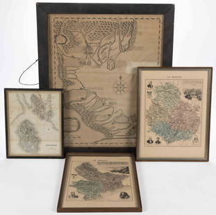
Sold2023ASSORTED EUROPEAN AND ASIAN MAPS, LOT OF FOURASSORTED EUROPEAN AND ASIAN MAPS, LOT OF FOUR, engraving on paper, three with hand-coloring, comprising a map of Buteshire in Scotland by William Home Lizars (Scottish, 1788-1859), two "LA FRANCESee Sold Price
Sold2021European School: La Suisse; Fromages et Vignobles; andEuropean School: La Suisse; Fromages et Vignobles; and Theatrum Historicum par Occidentalis Three engraved maps with hand-coloring. Two 13 3/4 x 18 in. (sight), 21 x 25 1/2 in. (frame), one 18 1/2 x 4See Sold Price
Sold2024Anna. Lunt of European Settlements in AmericaBy Burke, 1760, two volu in one with original leather binding, loose cover board With fold out mapSee Sold Price
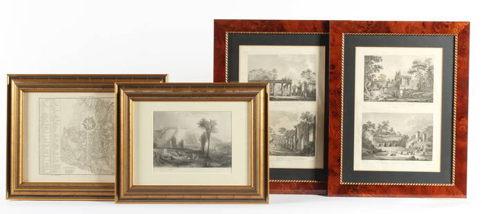
Sold2023Four Antique European EngravingsDescription: Each professionally framed, to include a 1796 map of Milan by J. J. De La Lande, a 19th century steel engraving after J.M.W. Turner of Ehrenbreitstein, and two plates depicting scenes ofSee Sold Price
Sold2022Two European bronze multiple spiral fibulae 2Two European bronze multiple spiral fibulae Bronze Age, circa 1200-800 B.C. Both fibulae formed from a length of wire, with pin and catch closing mechanism, the long pin wound into eleven tight coilSee Sold Price
Sold2024Two European bronze swords 2Two European bronze swords Late Bronze Age, circa 13th-10th Century B.C. 61.5cm and 58cm long (2) Footnotes: Provenance: Kuizenga collection, the Netherlands, acquired in Austria 17th February 1989 aSee Sold Price
SoldEASTERN EUROPEAN MAPS. Four framed maps.EASTERN EUROPEAN MAPS. Four framed maps. Comprising: Magni Ducatus Lithuaniae (18 1/4 x 22 1/2 in.); Emanuel Bowen's A New and Accurate Map of the Whole Russian Empire (15 x 20 in.); Polonia et SilesiSee Sold Price
Sold2019Two Maps by the Hydrographic Office U. S. Navy,Two Maps by the Hydrographic Office U. S. Navy, consisting of "China- East Coast- Hwangpoo River, Kaokiao Creek to Yangtzepoo Creek," 1931, H. - 42 in., W. - 30 in.; together with "China- East Coast-See Sold Price
Sold2019Two European Gold Pocket WatchesBoth 19th century, and key wind. One marked Bourquin, Geneva, the other is marked "Ancre" . Dimensions: The diameters are both about 1 5/8". Provenance: From a local estateSee Sold Price
Sold2024Two Maps of the United States by William Faden (London, 1785 and 1796)Two Maps of the United States by William Faden (London, 1785 and 1796) Two hand-colored maps engraved by William Faden (British, 1749-1836), London, 1785 and 1796. Titled "The United States of North ASee Sold Price
Sold2021Two European Mid Century Modern Lounge ChairsTwo European Mid Century Modern Lounge Chairs - 34 in tall x 36 x 34See Sold Price
Sold2019Two Maps by Matthaus Seutter (1678-1757), "AccurataTwo Maps by Matthaus Seutter (1678-1757), "Accurata Delineatio Celeberrimae Regionis Ludocianae vel Gallice Louisiane al Canadae et Floridae adpellatione in Septemtrionali America, Mississippi, St. LoSee Sold Price
Sold2016Two European Engines and One TenderIncludes Steam Engine 12" and Bing Engine 10", and 1 Tender. One gaugeSee Sold Price
Sold2019Two Maps by Willem Janszoon Blaeu (1571-1638),Two Maps by Willem Janszoon Blaeu (1571-1638), "Virginiae partis australis et Florida partis orientalis," 1640, hand colored, H. - 15 in., W. - 20 in.; together with India Quae Orientalis Diktur et InSee Sold Price
Sold2016Two European Engines and Tenders.Includes 12" and 13" Engines with Tenders. One gaugeSee Sold Price
3 hrs LeftJasper52India extrema. Asia & East Indies. Mermaid. SEBASTIAN MÜNSTER 1572 old map$1,500
3 days LeftFontaine's Auction GalleryLouis Comfort Tiffany (American, 1848-1933), Two European Street Scenes, Watercolor$900
Nov 12J. Greenstein & Co., Inc.TWO MAPS OF THE HOLY LAND. Exceptionally large. Probably used for classroom instruction.$50
Oct 18Rail & Road Auctions1878 Maps of the New and Popular St. Louis and Texas Short Line Railroad Color Lithograph$40(1 bid)
3 hrs LeftJasper52LONDON UNDERGROUND tube map plan diagram. Northern Heights SCHLEGER/ZERO #3 1939$260
3 hrs LeftJasper52LONDON UNDERGROUND tube map diagram plan. Northern Heights SCHLEGER/ZERO #2 1939$260
Oct 03HISTORY Collections.ARMOUR EUROPEAN MILITARY WARRIOR CHEST PLATES 2 SIDES LION FACE & QUIVER WARRIOR FIGS ON HORSE$1,050