Sold2015TEESDALE, HENRY. New British AtlasTEESDALE, HENRY. New British Atlas Containing a *Complete Set of County Maps...Preceded by General Maos of England, Ireland, Scotland, North & South Wales, the Whole Carefully Revised and CorrecteSee Sold Price
Sold2022Chart of the World on Mercator’s Projection, fromTitle/Content of Map: Chart of the World on Mercator’s Projection Date Printed: 1796 Cartographer: Thomas & Andrew Material/Medium: Engraving Size: 8 1/4 x 11" Description: Rare map by Isaiah ThomasSee Sold Price
Sold2023Russell & Barclay C1825 Antique Map. Chart of the World (On Mercator Proj.)Copper Engraved Map Published C1825., by Fisher & Son, "A Complete Atlas of the World" by John Russell et al. The companion Atlas to "A Complete and Universal English Dictionary" by James Barclay. PapSee Sold Price
Sold2017Chart of the World on Mercators ProjectionCirca 1796 Lot of 2 Antique World Maps; Titles: "Chart of the World on Mercators Projection" (Doolittle, sculp.) Approximate size: 11" x 8-3/8". "Map of the World from the best Authorities" (DoolittleSee Sold Price
Sold2019Chart of the World, On Mercators ProjectionTitle/Content of Map: Chart of the World, On Mercators Projection Date: 1815 ca. Cartographer: WYLD/HEWETT Size: 11.4Height - 17.4Width Publisher: JOHN THOMPSON & CO. Only named place in Mid-MississipSee Sold Price
Sold2017Chart of the World On Mercators Projection, 1796Map: Chart of the World On Mercators Projection Maker: Thomas & Andrews, Morse/Doolittle (Sculp) Publisher: Boston, 1796 Size: Quarto - 7.30 H x 10.00 W Inches Small map of the world. Shows LouisianaSee Sold Price
Sold2020World.- Purdy (John, hydrographer) A Chart of theWorld.- Purdy (John) A Chart of the World, on Mercator's Projection; with the Tracks of the more Distinguished Modern Navigators. Regulated throughout, according to the best Scientific Determinations,See Sold Price
Sold2018World chart with discoveries of James Cook 1787Heading: Author: Faden, William Title: A New General Chart of the World, Exhibiting the Whole of the Discoveries made by the late Captain James Cook, F.R.S. with the Tracks of the Ships under his ComSee Sold Price
Sold2022BENCSATHY, Henry (1909-1996). New York World’s Fair / Ameri...BENCSATHY, Henry (1909-1996). New York World’s Fair / American Airlines. 1961. Travel poster bears a modernized image of the Manhattan skyline and the fair’s trademark Unisphere sculpture.See Sold Price
Sold2017Thomson: Antique World Map, Mercator's Projection, 1814Map: Chart of the World on Mercator's Projection Cartographer: Thomson Place & Date: Edinburgh / 1814 Size: 20" x 17 3/4" Condition: b&w; overall age toning; browning along centerfold; two small, repaSee Sold Price
Sold2022(MANUSCRIPT MAP.) A. Rogers. A Chart of the World According to Mercator's Projections.(MANUSCRIPT MAP.) A. Rogers. A Chart of the World According to Mercator's Projections. Ink and watercolor on four joined sheets of "Potts & Reynolds" watermarked laid paper. 25x31½ inches overallSee Sold Price
Sold2023General Chart on Mercators Projection. World. Cook's route. PAYNE 1798 old mapTITLE/CONTENT OF MAP: 'General Chart on Mercators Projection' DATE PRINTED: 1798 IMAGE SIZE: Approx 18.0 x 25.0cm, 7 x 9.75 inches (Medium) TYPE: Antique copperplate engraved map with original hand coSee Sold Price
Sold2022Color view of San Francisco, 1856Heading: (California - San Francisco) Author: Title: San Francisco. 1856. Published for the History of the World by Henry Bill, New York Place Published: New York Publisher: Date Published:See Sold Price
Sold2022Lithographed view of San Francisco, 1854Heading: (California - San Francisco) Author: Title: San Francisco. 1854. Published for the History of the World by Henry Bill, New York Place Published: New York Publisher: Date Published:See Sold Price
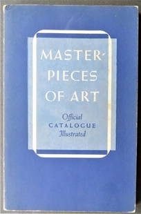
Sold2024New York World Fair 1939, Catalogue of European Paintings, illustrated"Catalogue of European Paintings and Sculpture from 1300-1800", compiled by George Henry McCall. Masterpieces of Art New York World's Fair - May to October 1939. Published by William Bradford Press, 1See Sold Price
Sold20191859 Beeton Chronological Chart with World Map -- AnTitle/Content of Map: 1859 Beeton Chronological Chart with World Map -- An Historical Chronological Chart with inset of The World in Mercators Projection Date: 1859 c., London Cartographer: S Beeton SSee Sold Price
Sold20191821 Chart of the World Map This is a mercator'sThis is a mercator's projection of North America by John Purdy, published Jan 1, 1821 by Richard Holmes Laurie, measures 40" wide by 26.5" tall.See Sold Price
Sold2020[GOREY, Edward]. ROSS, Clifford and Karen WILKIN.  [GOREY, Edward]. ROSS, Clifford and Karen WILKIN.  The  World of Edward Gorey. New York: Henry N. Abrams, 1996.   Oblong 4to. Illustrated. Original black cloth; original pictorial dustSee Sold Price
Sold20181872 Asher and Adams Map of the World -- Asher & Adams'Reserve Reduced! Title/Content of Map: 1872 Asher and Adams Map of the World -- Asher & Adams' World on Mercator's Projection Date: 1872 New York Cartographer: Asher & Adams Size: 15.8 x 22.8 in. A veSee Sold Price
Sold20211613 America sive India Nova ad magnae GerardiBy: Michael MercatorDate: 1613 / DuisbergDimensions: 16 x 19.5 inches (40.7 x 49.5 cm)This is an authentic antique map of the Western Hemisphere by Michael Mercator. The map is based on Rumold MercatoSee Sold Price
Sold20211584 Asia VI Tab.By: Mercator / PtolemyDate: 1584 (circa) Amsterdam.Dimensions: 19 x 13 inches (48.25 x 33 cm)This is an early and scarce map of present day Saudi Arabia, Qatar, United Arab Emirates, Yemen, and Oman.See Sold Price
Sold20211610 Abissinorum Sive Pretiosi Joannis Imperiu.By: Mercator/HondiusDate: 1610 (circa) AmsterdamDimensions: 13.4 x 19.25 inches (34 x 48.9 cm)A map depicting the realm of the legendary Christian emperor Prester John, in Abyssinia (present-day EthioSee Sold Price
Sold2022The World on Mercator’s Projection, from 'A New andTitle/Content of Map: The World on Mercator?s Projection Date Printed: 1817 Cartographer: Thomas Kelly & Alexander Findlay Material/Medium: Copper Plate Engraving Size: 10 1/4 x 16 3/4" Description: ESee Sold Price
Sold2015Lot of 7 Hand-Colored Copper Engraved Maps including(Lot of 7) Maps including; "Johnson's Australia," by Johnson and Ward, published in New York c. 1864, hand-colored copper engraved map, North Riding, Yorkshire, published by Henry Teesdale & Co. c. 18See Sold Price
May 09Hunt and Peck Estate Services, Inc.Chart Of The World According To Mercators Projection Showing Tracks & Discoveries Of Capt. Cook$140
5 days LeftJasper521699 Moll World Map with Cowley's Voyages -- Nouvelle Carte du Monde Suivant l'idee de Mercator ou$240
5 days LeftJasper521886 Adams Chronological Chart of Civilizations -- A Chronological Chart of Ancient, Modern and$550
3 days LeftDonny Malone AuctionsRobert Angeloch 1922-2011, Color Woodcut, Early Morning Second Fairway #24/50, Dated 1978$40(2 bids)
3 days LeftDonny Malone AuctionsRobert Angeloch 1922-2011, Color Woodcut, "Mountainside", Pencil Signed and Dated 1985, S-107$35(2 bids)
1 day LeftJeschke Jadi Auctions Berlin GmbHChart of the world on Mercators projection constructed by Hermann Berghaus and Fr. v. Stü€200
Liberty & 33rd Furniture Co.Michael Taylor for Baker Furniture Mid-Century Hollywood Regency Cherry Wood Sideboard Credenza$500
Liberty & 33rd Furniture Co.Michael Taylor for Baker Furniture Black Lacquered Nightstands or End Tables, Newly Refinished$400
3 days LeftCR Sails NJ Consignment & AuctionBabe Ruth Signed New York World Fair 1939 Host Invitation$600(3 bids)
May 18Rich Penn AuctionsWorld's Fair Souvenir Glasses, 1964-1965 New York World's Fair set of 8 in orig box, each shows an$60(2 bids)


![[GOREY, Edward]. ROSS, Clifford and Karen WILKIN.  : [GOREY, Edward]. ROSS, Clifford and Karen WILKIN.  The  World of Edward Gorey. New York: Henry N. Abrams, 1996.   Oblong 4to. Illustrated. Original black cloth; original pictorial dust](https://p1.liveauctioneers.com/197/182135/91624842_1_x.jpg?height=310&quality=70&version=1602627152)


