Sold2018Map of Jerusalem - Engraving - Cologne, 1575Hierosolyma, Urbs Sancta. Ludeae, Totiusque Orientis Longe Clarissima, Qua Amplitudine Ac Magnificentia Hoc Nostro Aevo Conspicua Est. Map of Jerusalem - engraving from Georg Braun and Frans HogenburgSee Sold Price
Sold20221590 Map of Jerusalem from "Civitates Orbis Terrarum" by Hogen & Bran1590 Map of Jerusalem from "Civitates Orbis Terrarum" by Hogen & Bran 1p, measuring 21" x 16", [Cologne, Germany], undated [Ca. 1590]. A beautiful color copper etching map of Jerusalem, printed inSee Sold Price
Sold2017Braun & Hogenberg: Antique View of Tunis Besieged, 1575Map: Tunes Urbs Cartographer: Braun & Hogenberg Place & Date: Cologne / 1575 Size: 16 14" x 12 5/8" Condition: b&w; some creasing in the margins and along centerfold, otherwise a strong dark impressioSee Sold Price
Sold2019MAP - Jerusalem, Holy Land. DanckertsJerusalem, Holy Land. Cornelius Danckerts, De Stadt Ierusalem, 1718 (published). Hand Color. Great bird's-eye plan of the ancient holy city flanked by engravings of religious icons. At the bottom areSee Sold Price
Sold2021Wright, Paul 1782 Holy Land Map. Jerusalem"A Correct Plan of the Antient City of Jerusalem" by Thomas Conder. Folio Copper Plate Published 1782, London for "The Complete British Family Bible…" by Paul Wright. Paper Size: 14.5 x 9.5 inch (37See Sold Price
Sold2023Wright, Paul 1782 Folio Holy Land Map. Jerusalem City"A Correct Map of the Antient City of Jersusalem and Parts Adjacent" Folio Copper Engraved Map Published 1782, London for "The Complete British Family Bible…" by Paul Wright. Drawn and Engraved by TSee Sold Price
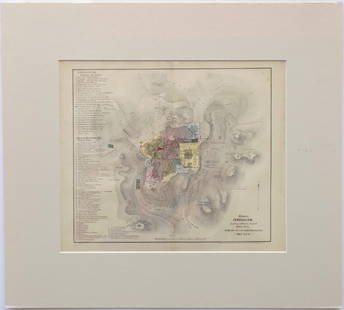
Sold20221850 Survey of Holy Land MAPS Jerusalem Bethlehem Canaan Bible Nativity Israel1850 Survey of Holy Land MAPS Jerusalem Bethlehem Canaan Bible Nativity Israel J.T. Bannisters “Survey of the Holy Land” is a rare, mid-19th-century history of Israel and Palestine. In thiSee Sold Price
Sold2017Ortelius: Map of Cyprus, 1575Map: 1575 Ortelius Map of Cyprus -- Cypri Insulae Nova De Script 1575 Cartographer: A. Ortelius Year / Place: 1575 Antwerp Map Dimensions: 14 x 20 in. This unique and very interesting map of Cyprus isSee Sold Price
Sold2018Braun & Hogenberg: Antique View of Alexandria, 1575Title/Content of Map: 1575 Braun & Hogenberg Bird's Eye View of Alexandria -- Alexandria, Vetustissimum Aegypti Emporium, Amplissima Civitas… Date Printed: 1575, Koln Cartographer: Braun & HogenbergSee Sold Price
Sold20181575 Braun and Hogenberg View of Prague and Cheb --Title/Content of Map: 1575 Braun and Hogenberg View of Prague and Cheb -- Praga, Bohemiae Metropolis Accuratissime Expressa [on sheet with] Egra Urbs a Fluvio, Cui Adiacet, Dicta, Olim Imperio Romano�See Sold Price
Sold2017Map of Jerusalem and Its Ruins, 1872Map: Jerusalem and Its Ruins Maker: Redding & Co Date: 1872 Size: Folio, 15.3 inches high x 19.75 inches wide Detailed plan of ancient biblical sites in the Holy City. Fine, Large Plan of Jerusalem PlSee Sold Price
Sold20181575 Braun and Hogenberg Birds Eye View of Velletri,Title/Content of Map: 1575 Braun and Hogenberg Birds Eye View of Velletri, Italy -- Velitrae vulgo Blitri Date: 1575, Koln Cartographer: Braun and Hogenberg Size: 13.4 X 15.7 in. This is an attractiveSee Sold Price
Sold2016Modern Jerusalem, 1858Map: Jerusalem before the Roman Destruction Publishing: Sarony & Major, 1858 Medium: Hand colored lithograph Size: 13.5 x 15 inches Napoleon Sarony (1821-1896) was an American lithographer and a highlSee Sold Price
Sold2017I.H. Coccejo / Weigel: Map of Jerusalem, 1720Map: Jerusalem, "Ierusalem aus den Schrifften Iosephi" Cartographer: I.H. Coccejo. / Weigel Place & Date: Nuremberg / 1720 Size: 16 5/8" x 13" Condition: original color; overall age toning and minor sSee Sold Price
Sold2021Jerusalem & Palestine 1889Title/Content of Map: Jerusalem & Palestine 1889 Date Printed: 1889 Material/Medium: Paper Size: approx 11x14 inches Mast, Crowell & Kirkpatrick, Peerless Atlas of the World Reserve: $30.00 Shipping:See Sold Price
Sold2020Jerusalem - BirdTitle/ Content of Map:Jerusalem - Bird's Eye View Date Printed: 1983 Cartographer: Aharon Bier Material/Medium: paper Dimensions: Approx. 16x20, olded size approx. 4"x10". Additional Information: ApprSee Sold Price
Sold20211758 History of Saladin Egypt Sultan Crusades MAPS1758 History of Saladin Egypt Sultan Crusades MAPS Jerusalem Ptolemais Israel Saladin was a 12th-century sultan, known for being the first sultan of Egypt and Syria. His reign was highlighted by his mSee Sold Price
Sold2017Florimi Map of Jerusalem and Christ Crucifiction, 1595Map: 1595 Florimi Map of Jerusalem and Christ Crucifiction -- L'Antichissima citta di Gierusalemme come era nel tempo di N. S. Gisu Christo con le sur cechiaratione Cartographer: M. Florimi Year / PlaSee Sold Price
Sold2022Panoramic Map of Jerusalem Book - 1845Panoramic Map of Jerusalem and the Adjacent Towns and Villages, from a drawing by the Librarian of the Armenian Convent. Drawn from the original and engraved by Nathaniel Whittock. Bound in a book thaSee Sold Price
Sold2022Braun & Hogenberg, Map of Jerusalem and temple, 1972Title: "Hierosolyma, Clarissima totius orientis Civitas Iudaee Metropolis". Copper engraving from Atlas of Cities of the World by Georg Braun and Franz Hogenberg which describes two periods of JerusalSee Sold Price
Sold2017Incunabulum. A Map of Jerusalem. Hartmann Schedel,An imaginary map of the walled city of Jerusalem. The Temple surrounded by a round city as it was traditionally depcited in the Middle Ages. By Hartmann Schedel. Nuremberg, 1493. Incunabulum. A beautiSee Sold Price
Sold20231862 CRUSADES History Michaud Holy Wars Jerusalem MAP 4v SET Knights Templar1862 CRUSADES History Michaud Holy Wars Jerusalem MAP 4v SET Knights Templar A rare, 19th-century printing of Joseph-François Michauds “History of the Crusades”. Michauds principal worSee Sold Price
Sold2022Early 18th cent Holy Land Map of JerusalemVisscher, after Nicolaum (Nicolaes) (Dutch, 1618-1679), Die Heylige und Weitberuhmte Stadt Jerusalem Erstlich Genant Salem, antique map, c. 1710s, published in a German bible by Johann Detleffsen, a sSee Sold Price
Featured3 days LeftJasper521575 Braun and Hogenberg View of Northen France's Hesdin -- Hesdinum Oppidum et Castrum?$80
6 days LeftTrillium Antique Prints & Rare BooksBraun & Hogenberg, pub. 1575 - View of Bologna, Italy$100(1 bid)
6 days LeftTrillium Antique Prints & Rare BooksBraun & Hogenberg, pub. 1575 - View of Basel, Switzerland$100
6 days LeftTrillium Antique Prints & Rare BooksBraun & Hogenberg, pub. 1575 - View of Marseille, France$100
6 days LeftTrillium Antique Prints & Rare BooksBraun & Hogenberg, pub. 1575 - View of Limbourg, Belgium$100
6 days LeftTrillium Antique Prints & Rare BooksBraun & Hogenberg, pub. 1575 - Coats of arms of Hannonia, Hennegau in Belgium$100
3 days LeftJasper521575 Braun and Hogenberg View of the Dutch City of Nijmegen -- Noviomagium sive Noviomagu Vulgo$140
3 days LeftJasper521575 Braun and Hogenberg Views of Southern Spanish Towns -- Le Brixa [on Sheet with] Settenil$140
6 days LeftTrillium Antique Prints & Rare BooksBraun & Hogenberg, pub. 1575 - View of Haarlem, Netherlands$100
May 14Fleischer's Auctions1755 Map Partie de l'Amerique Septentrionale, qui comprend Le Cours de L'Ohio...$200(3 bids)
3 hrs LeftTremont Auctions17th century original map 1676 "Virginia and Maryland" by John Speed. 2 sided framing. Overall:$650(3 bids)
3 hrs LeftTremont AuctionsJohn Speed and Francis Lamb "Map of New England and New York", ca. 1676. Hand colored engraved map$1,400(3 bids)
6 days LeftCrescent City Auction GalleryWilliam H. Williams (1817-1886), New Orleans "Map of the Sixth District and Carrollton," 1871, H.-$650


![1590 Map of Jerusalem from "Civitates Orbis Terrarum" by Hogen & Bran: 1590 Map of Jerusalem from "Civitates Orbis Terrarum" by Hogen & Bran 1p, measuring 21" x 16", [Cologne, Germany], undated [Ca. 1590]. A beautiful color copper etching map of Jerusalem, printed in](https://p1.liveauctioneers.com/6306/250544/130128283_1_x.jpg?height=310&quality=70&version=1654115529)


![1575 Braun and Hogenberg View of Prague and Cheb --: Title/Content of Map: 1575 Braun and Hogenberg View of Prague and Cheb -- Praga, Bohemiae Metropolis Accuratissime Expressa [on sheet with] Egra Urbs a Fluvio, Cui Adiacet, Dicta, Olim Imperio Romano�](https://p1.liveauctioneers.com/5584/126061/64118420_1_x.jpg?height=310&quality=70&version=1534288960)


![1575 Braun and Hogenberg Views of Southern Spanish Towns -- Le Brixa [on Sheet with] Settenil (1 of 1)](https://p1.liveauctioneers.com/5584/327462/176400785_1_x.jpg?height=282&quality=70&version=1714507756)


