Sold2022Map Showing the Illiteracy of the Adult White Male Population.Publication Date:1874 Title:Map Showing the Illiteracy of the Adult White Male Population. Cartographer:WALKER, FRANCIS A. Publisher:BUREAU OF THE CENSUS Height:19.75 Width:14.8 Compiled from the retuSee Sold Price
Sold2017Map of the United States showing Density of PopulationRand, McNally & Co. 1898 New Standard Atlas of the World. Also contains census information on population 1870, 1880, and 1890 Size: 21 x 15 inches No Reserve: This lot starts at $1 and has no reserveSee Sold Price
Sold2019Map Showing the Proportion of the Colored to TheTitle: Map Showing the Proportion of the Colored to The Aggregate Population. Publication Date: 1874 Cartographer: WALKER, FRANCIS A. Publisher: DEPARTMENT OF THE INTERIOR, CENSUS OFFICE Dimensions: 1See Sold Price
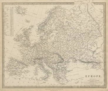
Sold2019EUROPE. General map. Inset table of population &TITLE/CONTENT OF MAP: 'EUROPE; inset table of population by country' The top image on the right hand side shows the entire map. To view a close up of the map showing the level of printed detail, pleasSee Sold Price
Sold2019AN ANTIQUE MAP, "Map of Oklahoma and Indian Territory,"AN ANTIQUE MAP, "Map of Oklahoma and Indian Territory," 1890-1892, color engraving on paper, copyrighted by Mast, Crowell & Kirkpatrick, with view of Beaver. 10.375" x 13" Note: Showing populations oSee Sold Price
Sold2021KY TN OH IN IL, State Populations 1831 Goodrich MapEarly 19th c. Hand-colored Map, Kentucky Tennessee Ohio Indiana Illinois, State Populations | Published: Boston: S.G. Goodrich, 1831 | Very nice hand colored engraved map showing each state with populSee Sold Price
Sold2018Rand McNally: Antique US Population Trend Map, 1892Title/Content of Map: 1892 Rand McNally US Population Trend Map -- Rand McNally & Co.'s Map of the United States Showing the Increase and Decrease of Population 1880 to 1890 Date Printed: 1892, ChicagSee Sold Price
Sold2019Map of Predominating Sex Showing the Local Excess ofTitle: Map of Predominating Sex Showing the Local Excess of Males Or Of Females in the Distribution Of Population Over The Territory Of The United States East Of The 100th Meridian. Publication Date:See Sold Price
Sold20211898 Rand McNally US Population Density Map -- RandTitle: 1898 Rand McNally US Population Density Map -- Rand McNally & Co.'s Map of the United states Showing in Six Degrees the Density of Population, 1890 Cartographer: Rand McNally Year / Place: 1898See Sold Price
Sold2018DESCRIPTIVE REVIEW SHOWING DEVELOPMENT OF THE STATE OFDESCRIPTIVE REVIEW SHOWING DEVELOPMENT OF THE STATE OF PENNSYLVANIA c1914 Oversized Folio Color Maps George F Cram Keystone State Index Populations Historical Industrial Commercial Agricultural ReviewSee Sold Price
Sold2022[MANUSCRIPT MAP-FLORIDA & MISSISSIPPI RIVER] Map Showing Raiford's Proposed Artificial River and[MANUSCRIPT MAP-FLORIDA & MISSISSIPPI RIVER] Map Showing Raiford's Proposed Artificial River and Plan to Continue the Western and Southern Inland System of Navigation to Harbors in the Atlantic. [FernSee Sold Price
Sold2022(PICTORIAL MAPS -- INTOXICATION INFATUATION.) H.J. (Heinie) Lawrence. Map Showing Isle of Pleasure,(PICTORIAL MAPS -- INTOXICATION INFATUATION.) H.J. (Heinie) Lawrence. Map Showing Isle of Pleasure, Scale Two Fingers to the Drink. Offset color-printed map of an alcohol-obsessed land loaded with allSee Sold Price
Sold2022Colton Maps showing the Danville, Urbana, Bloomington & Pekin RailroadCOLTON, George Woolworth (1827-1901) and Charles B. COLTON (1832-1916). Maps showing the Danville, Urbana, Bloomington & Pekin Railroad and its connections. Lithographed map. New York, 1869. 27 3/4" xSee Sold Price
Sold2022Rare 1818 Map Showing the Battle of Bunker Hill Sketched by Witness Henry de BerniereRare 1818 Map Showing the Battle of Bunker Hill Sketched by Witness Henry de Berniere Engraved map, Ca. 1818, Charlestown, MA. Entitled "Sketch of the Action on the Heights of Charlestown 17 June 1775See Sold Price
Sold2017Two Emanuel Bowen Maps Showing the East Coastfrom A Complete System of Geography (London, 1747), copperplate engravings with outline color as follows: A New and Accurate Map of New Jersey, Pennsylvania, New York and New England and A New & AccurSee Sold Price
Sold2021Rare c1780s U. S. map showing FrankliniaRare and unusual map of the United States showing early borders of various states. The seller has not been able to locate another copy of this map. The map appears to either be a source for, or copy oSee Sold Price
Sold2020Initials Unknown. A MAP SHOWING THE NETWORK OFINITIALS UNKNOWN A MAP SHOWING THE NETWORK OF EUROPEAN RAILROADS. 1949. 22x32 inches, 57x81 cm. Z.J. Kantin Company, New York. Condition B+: time-staining through left margin and image; small loss inSee Sold Price
Sold2023Map Showing the Roman Empire-John Speed-Late 17th CenturyMap titled "A New Mappe of the Romane Empire" by John Speed and published by Bassett and Chiswell, circa 1676. Sheet shows map at center surrounded by vignettes of various cities and views of variousSee Sold Price
Sold2019FLORIDA state map showing forts & railways. Miami isTITLE/CONTENT OF MAP: 'NORTH AMERICA, XlV., Florida' The city of Miami is marked on the map, which was published 22 years before Miami was incorporated in 1896. Miami was reported to have had 100 resiSee Sold Price
Sold2019Map showing California as an Island dated 1717 byMap showing California as an Island dated 1717 by Nicolas Defer, approx 10" x 14".See Sold Price
Sold2021Map Showing the Distribution of the Tribes of AlaskaPublication Date: 1875 Title: Map Showing the Distribution of the Tribes of Alaska and Adjoining Territory Cartographer: DALL, W.H. | C.W. RAYMOND | DAVIDSON Publisher: U.S. COAST & GEODETIC SURVEY OFSee Sold Price
Sold20221865 Colton's Map of Oil Regions of West Virginia -- J.H. Colton's Map Showing the Oil Region ofTitle: 1865 Colton's Map of Oil Regions of West Virginia -- J.H. Colton's Map Showing the Oil Region of West Virginia : and the location therein of the lands belonging to the Little Kanawha & Elk RiveSee Sold Price
Sold20181807 Marshall Map Showing New York City in 1776 -- IleTitle/Content of Map: 1807 Marshall Map Showing New York City in 1776 -- Ile de New-York. Partie de Long-Island ou de l'Ile Longue, et Positions des Armees Americaine et Britannique, apres le Combat LSee Sold Price
Sold2021Map showing Marco Polo's travelsHeading: Author: Bowen, Emanuel Title: A Map of Marco Polo's Voyages & Travels in the 13th Century Through a Great Part of Asia, All Tartary, the East India Islands & Part of Africa Place Published:See Sold Price
Jul 11Dan Morphy AuctionsRARE INDEPENDENT GASOLINE & MOTOR OIL FRAMED GRAPHIC HIGHWAY MAP OF ILLINOIS.$125
6 days LeftUniversity Archives(2) Apollo XI Orbital Photo Charts Likely Used in Training, 58" in Length!$200
BonhamsWORLD MAP. JAILLOT, ALEXIS HUBERT. C.1632-1712. Mappe-Monde Geo-Hydrographique, ou Description ...$1,600
Featured6 days LeftJasper521645 Jansson Map of Portugal and Parts of Spain -- Portugallia et Algarbia quae olim Lusitania$200
6 days LeftJasper521700 Schenk Map of Russian Empire -- La Russie Blanche ou Moscovie Divisee Suivant l'Estendue des$240
6 days LeftJasper521653 Blaeau Map of the Dnieper River -- Lectori S. Hunc Borysthenis Tractum ut ad Nostrum$850
Freeman's | Hindman[MAPS-THE AMERICAS]. 11 maps, incl. [Herrera y Tordesillas]. Descripcion de las Yndias Ocidentales. $250
3 days LeftEast Coast Fine Arts LLC1777 US Revolutionary War Map French Brion de la Tour Theatre de Guerre$1,000
6 days LeftJasper521771 ASTRONOMY by Joseph M. de La Lande 2 VOLUMES ILLUSTRATED antique in FRENCH$480
6 days LeftJasper521890 c. Clemens Wooden Puzzle Map of the US -- Clemens' Silent Teacher Dissected Map of the United$240
Jul 06Rafael Osona AuctionsVintage John H. Martin Hand Colored Map of Nantucket "Geological Base"$300


![[MANUSCRIPT MAP-FLORIDA & MISSISSIPPI RIVER] Map Showing Raiford's Proposed Artificial River and: [MANUSCRIPT MAP-FLORIDA & MISSISSIPPI RIVER] Map Showing Raiford's Proposed Artificial River and Plan to Continue the Western and Southern Inland System of Navigation to Harbors in the Atlantic. [Fern](https://p1.liveauctioneers.com/292/250642/130213644_1_x.jpg?height=310&quality=70&version=1654271664)


![[MAPS-THE AMERICAS]. 11 maps, incl. [Herrera y Tordesillas]. Descripcion de las Yndias Ocidentales. (1 of 0)](https://p1.liveauctioneers.com/dist/images/placeholder.jpg?height=282&quality=70)


