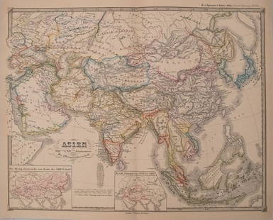
Sold20181855 Spruner Map of Asia -- Asien vom Viten bis in die1855 Spruner Map of Asia -- Asien vom Viten bis in die erste Halfte des Ixten Jahrhundrert's… 1855, Gotha K v Spruner 12.6 x 16 in. A very attractive and unusual map of Asia showing this continent iSee Sold Price
Sold2017Spruner: Antique Map of Asia, 1855Map: 1855 Spruner Map of Asia -- Asien im Xvten und XVIten Jahrhundrert… Cartographer: K v Spruner Year / Place: 1855 Dimensions: 12.8 x 16.5 in. Condition: Very Good to Excellent. On thick paper, sSee Sold Price
Sold2017Perthes: Antique Map of Asia in 15th Century, 1855Map: 1855 Perthes Map of Asia in 15th Century -- Asien gegen die Mitte des Funften Jahrhunderts... Date Printed: 1855, Gotha Cartographer: J Perthes Size: 12.9 x 16.5 in. Condition: Very good-excellenSee Sold Price
Sold2017Perthes: Antique Map of Asia in 13-14th Centuries, 1855Map: 1855 Perthes Map of Asia in the 13th and 14th Centuries -- Asien im XIII-ten & XIV-ten Jahrhundert… Date/Place: 1855, Gotha Cartographer: J Perthes Size: 12.7 x 16 in. Condition: Very good-exceSee Sold Price
Sold2022Spruner, Karl C1854 Antique Map of the British Isles"Die Britischen Inseln nach ihrer kirchlichen Eintheilung bis zur Reformation" Large Steel Engraved Map with outline hand color Published C1854, Gotha, Germany for "Historisch-geographischer Hand-AtlaSee Sold Price
Sold2018Bleau Map of AsiaBLAEU, Willem Janszoon (1571-1638). Asia Noviter Delineata…Engraved map with original hand color. Amsterdam, c. 1618-1650. 20 x 24 inches sheet, 25 1/8 x 21 3/8 inches framed This is one of the mostSee Sold Price
Sold2018Ortelius Map of AsiaOrtelius, Abraham (1527-1598). Asia Nova Descriptio. Engraved map with original hand color in full. Antwerp, 1570 (Latin Edition). 26" x 33 1/2" sheet, 37" x 45" framed A marvelous misprojection of JaSee Sold Price
Sold2017Hondius Map of Asia, 1606Map: 1606 c. Hondius Map of Asia -- Asiae Nova Descriptio Cartographer: J Hondius Year / Place: 1606 c., Amsterdam Map Dimension: 14.8 X 19.7 in. This is an excellent map of Asia. It is believed to beSee Sold Price
Sold2020Mercator map of AsiaGerardus Mercator (1512-1594), ''Asia ex magna orbis terre descriptione Gerardi Mercatoris desumpta studio et industria G.M. Iunioris,'' Amsterdam, ca. 1613. map of Asia with hand-coloring, from MercaSee Sold Price
Sold2022G. Mercater - Map of AsiaChina/Southeast Asia Amsterdam, 1606/28 20"x14" Framed 28.75x23.5See Sold Price
Sold2020Gerardus Mercator Map of Asia 1613Gerardus Mercator (1512-1594), "Asia ex magna orbis terre descriptione Gerardi Mercatoris desumpta studio et industria G.M. Iunioris," Amsterdam, ca. 1613. Hand colored map of Asia. Dimensions: Sight;See Sold Price
Sold20221680 deWit Map of Asia -- Accuratissima Totius AsiaeTitle: 1680 deWit Map of Asia -- Accuratissima Totius Asiae Tabula Recens Emendata Cartographer: F de Wit Year / Place: 1680 c. Amsterdam Map Dimension (in.): 19.3 X 22.9 in. This is a lovely large maSee Sold Price
Sold20201734 ATLAS Vaugondy MAPS Geography Asia Africa Europe1734 ATLAS Vaugondy MAPS Geography Asia Africa Europe USA France Germany Collectors, of both maps and atlases, agree that Vaugondy maps are among the best and most accurate maps! The collection of 18tSee Sold Price
Sold20181780 VOYAGES 17 ATLAS Maps Geography Asia Africa Europe1780 VOYAGES 17 ATLAS Maps Geography Asia Africa Europe USA Vaugondy Collectors, of both maps and atlases, agree that Vaugondy maps are among the very best and most accurate maps! This collection of 1See Sold Price
Sold2019Asia.- Clouet (Jean Baptiste Louis) Carte D'AsieAsia.- Clouet (Jean Baptiste Louis) Carte D'Asie Divisée en ses Principaux Etats, large wall map of Asia, with two title cartouches in French and Spanish, decorative borders containing twenty vigSee Sold Price
Sold2017Greuze, Jean-Baptiste Studie eines Männerkopfes imGreuze, Jean-Baptiste Studie eines Männerkopfes im Profil. Graphit auf Vergé-Papier. 15,2 x 10,5 cm. - Gebräunt und durchgehend etwas stockfleckig. Ringsum bis auf die Einfassungslinie in Tinte besSee Sold Price
Sold2023THREE MAPS OF MAINE 19th CenturyTHREE MAPS OF MAINE19th Century1) J.J. Stoner map of Thomaston. Framed 20.25” x 28”.2) E.M. Woodford 1855 rolled map of Thomaston Village. Approx. 47” x 39”.3) Lee & Marsh 1857See Sold Price
Sold2017Mercator (Gerard) - Atlas sive Cosmographicae,Editio Quinta, engraved pictorial title, prelims, 49 double-page maps, including Asia, Russia, Turkey, Lithuania, Asia Minor and Persia, regions of Italy Spain, Germany and Eastern Europe, and 11 singSee Sold Price
Sold2020Grp: Mixed Atlas PagesLarge group of pages from a variety of early atlases. The majority are from two atlases: Mallet and "Della Geografia di Tolomeo." Maps from Mallet include including maps of Asia, eastern India, China,See Sold Price
Sold2022ERWIN KETTEMANN BLICK AUF DIE ZUGSPITZE VOM MURNAUER MOOSERWIN KETTEMANN Munich 1897 - 1971 View on mountain Zugspitze from Murnauer Moos Oil on canvas. 61 x 80 cm (F. 82 x 102 cm). Signed lower right 'E. Kettemann Mchn'. Verso: on stretcher titled. Rest. FSee Sold Price
Sold20191662 deWit Map of Southeast Asia -- Tabula IndiaeReserve Reduced! Title/Content of Map: 1662 deWit Map of Southeast Asia -- Tabula Indiae Orientalis Date: 1662, Amsterdam Cartographer: F de Witt Size: 18 X 22.2 in. This is a outstanding larger map oSee Sold Price
Sold2016Seutter map of Southeast AsiaHeading: Author: Seutter, Matthew Title: India Orientalis cum Adjacentibus Insulis Nova Delineatione ob oculos posita Place Published: Augsburg Publisher: Date Published: [c.1745] DescSee Sold Price
Sold2020Leica IIIc K chrome "Luftwaffen-Eigentum"Lediglich 50 Exemplare der Leica IIIc K in silbern verchromter Ausführung wurden im Seriennummernbereich 387101 bis 387150 an die Luftwaffe geliefert. Es handelt sich um eine der seltensten AusführuSee Sold Price
Sold2023TWO ANTIQUE MAPS OF CHINA.Two antique maps of China, including Chinae by Abraham Ortelius, 1595, image 14.25” x 18.25”, with map of Eastern Asia, Le table de la region orientale, image 10” x 13.5”.See Sold Price
May 14Hermann Historica GmbHP. W. Wunder and Peter Hirsch (1889 - 1978) - "Die regierenden Päpste" (a book wit 285 portrait€800
6 days LeftHermann Historica GmbHOwm.d.Sch.d.Res. Franz Hofer - a certificate to the Anti-Partisan Badge in silver, his pay book and€1,500
6 days LeftHermann Historica GmbH"Operation Chariot" - a military map of the 22nd Naval Flak Regiment, March 27/28, 1942€720
JG AutographsBuckminster Fuller - Architect, Inventor, Futurist - Autographed Spaceship Earth Sky-Ocean Map Model$70(6 bids)
May 14Hermann Historica GmbHA Russian icon showing the Mother of God of the "Life-Giving Source", 19th century€240
May 14Hermann Historica GmbHA bronze table bell depicting Orpheus and the animals, Pieter III van den Gheyn, dated 1569€1,000
May 16Zikorn Arts & History ObjectsCentral America West Coast 1855 British Admiralty Nautical Chart$100(1 bid)
5 days LeftHunt and Peck Estate Services, Inc.1696 Jaillot Mapping The Ottoman Empire at the End of the 17th Century$140
May 14Hermann Historica GmbHA porcelain figure showing "Europe on the Bull", Adolph Amberg, 1909 (design), KPM, 20th century€480


![Seutter map of Southeast Asia: Heading: Author: Seutter, Matthew Title: India Orientalis cum Adjacentibus Insulis Nova Delineatione ob oculos posita Place Published: Augsburg Publisher: Date Published: [c.1745] Desc](https://p1.liveauctioneers.com/642/86438/44449722_1_x.jpg?height=310&quality=70&version=1458591928)


