Sold2018Bacons Motor Road Map c.1930s: Scotland. On ClothTitle/Content of Map:Bacons Motor Road Map c.1930s: Scotland. On Cloth Date: c.1920s Cartographer: Material/Medium: Folded in boards color map reinforced with original gauze. Size: folder 7.5x4.5x0.5See Sold Price
Sold2018Bacons Motor Road Map: England & Wales, North. c.1920sTitle/Content of Map:Bacons Motor Road Map: England & Wales, North. c.1920s Date: c.1920s Cartographer: Bacons Motor Road Maps Material/Medium: Folded in boards color map reinforced with original gauzSee Sold Price
Sold2023[POCKET MAPS] LOT OF 3 SOLD TOGETHERPOCKET MAPS. A lot of 3 sold together. Including: MOTOR ROAD MAP OF SOUTH-EAST ENGLAND showing the new arterial and by-pass roads / ROAD MAP OF LONDON and 10 miles round showing the new arterial roadsSee Sold Price
Sold2022PERRIER Vintage Motor Map of Scotland XLPERRIER Vntg Motor Map of Scotland, measures approx 42 x 48 inches. Wear to map. Artwork, Home Decor, Wall Art, Educational Map, Topography. Art Print, Map Print, antique map, collectible antique map,See Sold Price
Sold2022Enarco Motor Oil Road Maps & EphemeraCanadian. 1920s-50s. Paper. Includes two Ontario road maps, an oil change reminder, card game counter, and matchbook. From the Joe Byway Collection. 2" to 9.75" in length.See Sold Price
Sold2022Four early 20thC bound road maps of Scotland comprising North, North Central, South and SouthFour early 20thC bound road maps of Scotland comprising North, North Central, South and South Central. Contained within a leather carrying case stamped SCOTLAND with retailers stamp within for The MapSee Sold Price
Sold20221929 RICHFIELD GASOLINE NEW YORK ADVERTISING MAPS2 Rare 1920's Richfield Oil Corp of New England and New York Fold Out Motor Routes Road Maps in Full Color covering parts of the United States. Vibrant Graphics with Early Automobiles, Race Cars, BoatSee Sold Price
Sold20181915 Bacon Map of SouthEast England for Cyclists andReserve Reduced! Title/Content of Map: 1915 Bacon Map of SouthEast England for Cyclists and Autos -- Bacon's Cycling and Motoring Road Map of South East England Sheet No.6 (of England) … Fifty MilesSee Sold Price
Sold20161933 Sinclair Opaline Chicago Road Map Worlds FairOriginal 1933 Rand McNally Chicago and Vincinity road map by Sinclair Opaline Motor Oil. Advertises the Sinclair Minstrel Monday nights NBC network, also advertises Sinclair brings dinosaurs to life sSee Sold Price
Sold2023THE SHETLAND ISLANDS antique map by GW BACON Scotland 1885 oldTITLE/CONTENT OF MAP: 'The Shetland Islands' DATE PRINTED: 1885 IMAGE SIZE: Approx 33.0 x 24.0cm, 13 x 9.5 inches (Large); Please note that this is a folding map. TYPE: Colour Antique Lithograph Map CSee Sold Price
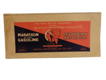
Sold20201933 McCOLL-FRONTENAC SASKATCHEWAN ROAD MAP MAP &1933 McCOLL-FRONTENAC SASKATCHEWAN ROAD MAP MAP & ADVERTISING, SOME STAINING & WEAR, EXCELLENT COVER ADVERTISING RED INDIAN GASOLINE & MOTOR OIL, 11" X 5.25"See Sold Price
Sold2019General road map of Davidson County TennesseeTitle: General road map of Davidson County Tennessee Date: 1/19/1944 Cartographer: Publisher: AAA/Nashville Automobile Club Size: 18.75Height - 17.8Width Nashville Automobile Club AAA Tennessee MotorSee Sold Price
Sold2019Road-Map of England And WalesTitle: Road-Map of England And Wales Publication Date: 1835-03-25 Cartographer: BACON, G. W. & CO. Publisher: G.W. BACON & CO. Dimension: 33Height - 26.5Width Retailed by Forster Groom & Co. Ltd. DissSee Sold Price
Sold2020Ogilby, John 1939 Facsimile Atlas. Road Maps, UK"Britannia, Volume the First..." Facsimile Edition of the 1675 Edition by John Ogilyby & Alexander Duckham, 1939. Oblong 4to (315 x 250mm) 100 Maps printed both sides on 50 sheets. Cloth bound, a littSee Sold Price
Sold2022Slatter & Rose's Motoring and Cycling Road Map. OxfordTitle: Slatter & Rose's Motoring and Cycling Road Map. Oxford District. Cartographer: Bartholomew, John & Co. Publisher: G.W. Bacon & Co., LTD. Height: 24 Width: 34 Extremely early road map intended fSee Sold Price
Sold2022England.- Ogilby (John) Ogilby's Road Maps of England and Wales from Ogilby's 'Britannia', 1675,NO RESERVE England.- Ogilby (John) Ogilby's Road Maps of England and Wales from Ogilby's 'Britannia', 1675, double- and whole-page maps, original cloth, Osprey, [1971]; and 16 others British TopographSee Sold Price
Sold20211846 cloth map and map of the journeyings1846 cloth map and map of the journeyings of Isreal American Sunday SchoolSee Sold Price
Sold2020Abraham Ortelius Scotiae tabula, map of Scotland, 15thAbraham Ortelius Scotiae tabula, map of Scotland, 15th - 16th C., hand-colored engraving, plate size 14" x 18 3/4". Provenance: Estate of Mark W. Izard MD, Cider Brook Road, Avon, CT.See Sold Price
Sold20211846 Huge Carrington Map of Scotland -- A Map ofTitle: 1846 Huge Carrington Map of Scotland -- A Map of Scotland Divided into Counties Shewing The principal Roads, Railways, Rivers, Canals, Lochs, Mountains, Islands, &c. on a Scale of Five Miles toSee Sold Price
Sold2018MAPS: Roads of England and Wales c1860 color mapMAPS: Roads of England and Wales c1860 color map, The Roads of England and Wales, with the whole of Scotland, showing the Distances between each Town, and from London; also the tracks of the Steam NavSee Sold Price
Sold2021Lothian's County Maps of Scotland for Tourists &Publication Date: 1835 Title: Lothian's County Maps of Scotland for Tourists & Sportsmen. Cartographer: LOTHIAN, JOHN Publisher: J. LOTHIAN Width: var. "With roads, fishing streams & lakes, country seSee Sold Price
Sold20191821 Cary’s Itinerary Volume Roads w/ Maps“Cary’s New Itinerary or An Accurate Delineation of the Great Roads Both Direct and Cross throughout England and Wales; with many of the Principal Roads in Scotland From ab Actual Measurement by JSee Sold Price
Sold2022The Middle Eastern QuestionFIRST EDITION. "or, Some Political Problems of Indian Defence" Signed and dated 1905 by Frederick Adam, of Blair Adam, Fife, Scotland. Publishers burgundy cloth with gilt map vignette. Gilt to cover aSee Sold Price
Sold2021FADEN'S MAP OF GREAT BRITAIN, 1795, FRAMEDFolding Pocket Map, "The Roads of Great Britain" by William Faden, Geographer to the King, 1795, with Supplement for the Roads of Scotland. Linen backed five by four fold, in black frame with gold linSee Sold Price
May 10Rail & Road Auctions1906 True Bearing of Celestial Objects for The Great Lakes Book and 1957 The Heavens Map From$20
May 10Rail & Road Auctions1934 Short Line Motor Coach Service Timetable and 1947 Michelin Map 6 of Netherlands$20
May 10Rail & Road AuctionsFour 1992 Russell's Official Bus Guides and Motor Coach Guide Map Supplements$20
May 09Hunt and Peck Estate Services, Inc.Blaeu LEVINIA VICE COMITATUS Province LENNOX Dumbarton Scotland Map$100
BonhamsAfter Patrick Nasmyth In the manner of Nasmyth's Edinburgh from the Braids, in a modern gilt fra...£460(16 bids)
May 09Rail & Road Auctions1951 Chicago, Milwaukee, St. Paul & Pacific Railroad Wall Map - Route of the Hiawathas$50


![[POCKET MAPS] LOT OF 3 SOLD TOGETHER: POCKET MAPS. A lot of 3 sold together. Including: MOTOR ROAD MAP OF SOUTH-EAST ENGLAND showing the new arterial and by-pass roads / ROAD MAP OF LONDON and 10 miles round showing the new arterial roads](https://p1.liveauctioneers.com/8124/283183/149424774_1_x.jpg?height=310&quality=70&version=1679790999)


![England.- Ogilby (John) Ogilby's Road Maps of England and Wales from Ogilby's 'Britannia', 1675,: NO RESERVE England.- Ogilby (John) Ogilby's Road Maps of England and Wales from Ogilby's 'Britannia', 1675, double- and whole-page maps, original cloth, Osprey, [1971]; and 16 others British Topograph](https://p1.liveauctioneers.com/5458/257239/133765092_1_x.jpg?height=310&quality=70&version=1659622051)


![[WWI] P.T. Sherman's WWI Service Record & Books (1 of 8)](https://p1.liveauctioneers.com/7226/322253/173251586_1_x.jpg?height=282&quality=70&version=1710004847)


