Sold2017Map of French & English Grants Lake ChamplainMap of French & English land grants on Lake Champlain. Engraved and published by Rich H Pease Albany. 22" x 14"See Sold Price
Sold2022Map of French and English Grants on Lake ChamplainFramed hand colored cadastral map of French and English land grants in the Champlain valley, names of property owners and boundaries. Engraved by Richard H. Pease (1813-1869), authored by Edmund BaileSee Sold Price
Sold2022Lake Champlain Atlas MapsLot of seven maps relating to Lake Champlain. 1744 map of Richelieu river and Lake Champlain, form atlas, framed. Bilingual French/English map of Lake Champlain published 1748 by de Lery. Map of FrencSee Sold Price
Sold20231790 1ed Ben Franklin Bounty Mutiny Oliver Cromwell Slave Lake MAP French Rev1790 1ed Ben Franklin Bounty Mutiny Oliver Cromwell Slave Lake MAP French Rev The Gentlemans Magazine was an English periodical which first appeared in 1731. It was published without interruption forSee Sold Price
Sold20197 Collectible Maps - Lake Huron - Georgian BayLake Huron Canada. Georgian Bay. French / English. [LA 4529]See Sold Price
Sold2023Colored Map Engraving of North America Before the French Indian War 18th CenturyCharte von dem Engellaendischen u. Franzoesischen Besitzungen in Nord America. This map detail delineation of the English and French colonies prior to the French and Indian War pg. 8. This hand coloreSee Sold Price
Sold2023A Grouping of 17th & 18th Century Old World Maps Lot of 6Lot Includes: The English Channel, A Map of France, North American Rivers and Lakes Between Superior and Slave Lake (2), A New map of Russia in Europe, & Nouvelle Carte Du Royaume de Bengale EngraSee Sold Price
Sold2024Antique Map of Lake ChamplainAntique map of Lake Champlain, 10 1/2" x 8", framed 14" x 11". Provenance: Ogunquit, Maine collection.See Sold Price
Sold20211849 map of Lake ChamplainTitle: 1849 map of Lake Champlain Description: "Map of Lake Champlain from Fort Chambly to Fort St. Frederic or Crown Point, Survey'd by Mr. Anger, King's Surveyor in 1732, Made at Quebec the 10 OctobSee Sold Price
Sold2024SR Stoddard Map of Lake Champlain 18901890 S.R. Stoddard Map of Lake Champlain Linen Backed Paper On a Stretcher. Condition: has wear throughout small tears creases and more. Measurements: 11 3/4” wide 38 1/4” tallSee Sold Price
Sold2023Lake Champlain Books, MapsThree maps of Lake Champlain (reprints), sold with 1940 Lamb "Lake Champlain & Lake George", 1910 Reid "Lake Champlain & Lake George", 1929 Pell "Ethan Allen",See Sold Price
Sold2023IIMPORTANT 18TH C. REVOLUTIONARY WAR PERIOD MAP: SURVEY OF LAKE CHAMPLAIN, 1776IMPORTANT 18TH C. REVOLUTIONARY WAR PERIOD MAP: SURVEY OF LAKE CHAMPLAIN, 1776, SURVEY OF LAKE CHAMPLAIN INCLUDING LAKE GEORGE , CROWN POINT, AND ST. JOHN. SURVEYED, BY ORDER OF HIS EXCELLENCY MAJOR-GSee Sold Price
Sold2018Lake District.- Ruthven (John) Map of the English LakesLake District.- Ruthven (John) Map of the English Lakes and Adjoining Country Geologically Coloured, geological map showing from Lancaster north to Carlisle, and from Whitehaven to Brough, with four dSee Sold Price
Sold20191846 Kemble Map of Central and Eastern US DuringReserve Reduced! Map Title/Content: 1846 Kemble Map of Central and Eastern US During French, English and Spanish Colonial Period -- Map of the French, English & Spanish Possessions in North America inSee Sold Price
Sold2017Moll: A New Map of ye North Parts of America,1729Map: A New Map of ye North Parts of America... Maker: H. Moll Date: 1729 (1730-32) Description: A highly detailed map depicting French America along with English and Spanish territories and showing aSee Sold Price
Sold2024English map of France French Revolutionary Wars 1796 rare engravingFrance.- French Revolutionary Wars.- Anonymous. A General Map of France Divided into Metropolitan Circles and Departments with the surrounding States, detailed map of France, with parts of Spain, SwitSee Sold Price
Sold20241755 Map of the Five Great Lakes French Indian WarMap of the Five Great Lakes, part of Pensylvania, New York, Canada, and Hudson's-Bay Territories & c, printed for and contained in "The London Magazine or Gentleman's Monthly Intelligencer for SeptembSee Sold Price
Sold2022Map of the Possessions angloises et françoises de l'Amérique septentrionale - 1755Map of the Possessions angloises et françoises de l'Amérique septentrionale (1755) Description: Two pages of an atlas mounted on paper, cartouche: Map of the English and French possessioSee Sold Price
Sold2017Speed Map of Cumberland, Lake District, UK, 1611J. Speed. 1611 London 17 x 22 in. An unusual and decorative map of Cumberland, encompassing much of the English Lake District, with an inset plan of the town of Carlisle and a description of "The PuctSee Sold Price
Sold2023Collector's Lot of Wedgwood & Staffordshire (4)Pr candlesticks and a plate Christmas 1971 all marked Wedgwood and a Staffordshire Plate, South Wall and South Barracks Fort-Ticonderoga on Lake Champlain, NY Built by the French 1755-1758. 3 1/2"D ;See Sold Price
Sold20201817 Napoleon Campaign in Russia Napoleonic War Moscow1817 Napoleon Campaign in Russia Napoleonic War Moscow Labaume MAPS English ed The French invasion of Russia of 1812 was a turning point in the Napoleonic Wars. The campaign reduced the French and allSee Sold Price
Sold2022Brassier A Survey of Lake ChamplainWilliam Brassier "A Survey of Lake Champlain", Sayer and Bennett, London, 1776 hand-colored map, plate size 26 1/2" x 19 1/4"See Sold Price
Sold2022Huge 1876 Historical Map of the U.S. by BlanchardHistoric Maps 1876 "Historical Map of the United States Showing Early Spanish, French & English Discoveries and Explorations, also Forts, Towns & Battlefields of Historic Interest" by Rufus BlanchardSee Sold Price
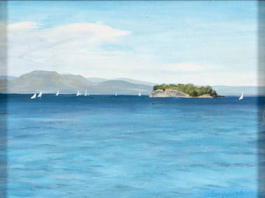
Sold2024A Romance Map of the Northern Gateway1934 Eleanor Hall- "A Romance Map of the Northern Gateway" lithograph with historical facts and information about the Lake Champlain Valley. 20.5 x 24.5" as framed.See Sold Price
5 days LeftJasper521753 Robert de Vaugondy Map of Central France -- Gouvernemens Generaux De La Marche, Du Limosin Et$45
1 day LeftTrillium Antique Prints & Rare BooksCatesby, Folio - Larger Red crested Woodpecker with Live Oak. 1-17$200
1 day LeftTrillium Antique Prints & Rare BooksCatesby, Folio - Blackcap Flycatcher on Yellow Jessamy. 1-53$200
1 day LeftTrillium Antique Prints & Rare BooksCatesby, Folio - Little Thrush with Dahoon Holly. 1-31$200
1 day LeftTrillium Antique Prints & Rare BooksCatesby, Folio - Zebra Swallow-Tail Butterfly with Prickly Apple. 2-100$200
5 days LeftJasper521792 Elwe Map of the Netherlands and Belgium -- Les Dix-Sept Provinces des Pays-Bas$80
May 14Fleischer's Auctions1755 Map Partie de l'Amerique Septentrionale, qui comprend Le Cours de L'Ohio...$200(3 bids)
5 days LeftJasper521792 Elwe Map of Southern Netherlands to Belgium to Northern France -- Carte Nouvelle des Pais Bas$80
9 hrs LeftMerrill's Auctioneers and AppraisersMacDonoughs Victory Blue Staffordshire Tea Set$700(2 bids)
9 hrs LeftMerrill's Auctioneers and Appraisers3 MacDonoughs Victory Blue Staffordshire Cups$125(2 bids)
9 hrs LeftMerrill's Auctioneers and Appraisers3 MacDonoughs Victory Blue Staffordshire Plates$100(1 bid)


![7 Collectible Maps - Lake Huron - Georgian Bay: Lake Huron Canada. Georgian Bay. French / English. [LA 4529]](https://p1.liveauctioneers.com/6288/141133/71496657_1_x.jpg?height=310&quality=70&version=1556635288)


![[EPHEMERA]. Group of Booklets, Magazines, Postcards, Brochu... (1 of 1)](https://p1.liveauctioneers.com/928/328184/176813372_1_x.jpg?height=282&quality=70&version=1714496988)