Sold20221850 map of Northern Italy by Joseph MeyerNice map of Northern Italy, with insets of the region around Rome and Naples and a small inset of Malta. Full title: Die Staaten von Ober Italien namlicdas Lomb. Venet, Konigriech Parma, Modena, ToscaSee Sold Price
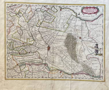
Sold2023The Netherlands Map. The region Around the city of Utrecht. 1660?s by W. BlaeuTitle: The Netherlands Map. The region Around the city of Utrecht. 1660?s by W. Blaeu Date/Period: 1660?s Materials: Hand colored copper plate engraved Size: 22 x 19 1/2'' Netherlands regional map cenSee Sold Price
Sold2018SDUK (Pub) 1830's Town Plan Map of Parma, Italy"Parma" Steel Engraved Map Published 1830's, London for "Maps by the Society for the Diffusion of Useful Knowledge" Paper Size: 16.5 x 13.5 inch (42 x 34cm) Good ConditionSee Sold Price
Sold2018Ortelius: Antique Map of Abruzzo Region, Italy, 1609Title/Content of Map: Abruzzo region of Italy. From the world's first modern Atlas. Date Printed: 1609 Cartographer: A. Ortelius Material/Medium: Paper Size: 15" x 19" Hand colored copperplate engraveSee Sold Price
Sold2016Map of Milan region Italy 1640Heading: Author: Blaeu, Willem Title: Stato di Milano Place Published: Amsterdam Publisher: Date Published: c.1640 Description: Copper-engraved map, hand-colored in outline; colSee Sold Price
Sold2018Arrowsmith: Antique Map of Northern Italy, 1828TITLE/CONTENT OF MAP: 'North Italy' Papal States. Sardinia Lombardy Tuscany. DATE PRINTED: 1828 IMAGE SIZE: Approx 24.5 x 31.0cm, 9.5 x 12.25 inches (Large) TYPE: Antique copperplate map CONDITION: GoSee Sold Price
Sold2023Findlay, Alexander 1828 Map. ItalyCopper Engraved Map Published 1828, London for "The Oxford Encyclopaedia: Or, Dictionary of Arts, Sciences and General Literature" by Rev. W. Harris, J. A. Stewart, C. Butler, Rev. J. H. Hinton et al.See Sold Price
Sold2024TWO ANTIQUE HAND COLORED MAPS OF REGIONS OF ITALYTwo antique hand colored maps of different regions of Italy. The first map is of Perugia / Perusini Italy, frame 17" x 21.5" wide, published by Abraham Ortelius after a map by Egnatio Dante. The seconSee Sold Price
Sold20221602 Ortelius Map of Northern Italy Around Verona -- Veronensis Ager.Title: 1602 Ortelius Map of Northern Italy Around Verona -- Veronensis Ager. Cartographer: A Ortelius Year/Place: 1602, Antwerp Dimensions: 3 X 4.2 in. Description: This is a lovely smaller map of theSee Sold Price
Sold2024Antique Map of Italy - Venice - Jodocus Hondius"Dominium venetum in Italia." Attractive and early map of the area around Venice, Italy. With South-Tirol in the North, areas of Krain (Slovenia), Croatia, Ferrara, Modena and Piacenza. In the east wiSee Sold Price
Sold2019Tanner: Piedmont and Sardinia, 1839The wonderfully detailed map of the island of Sardinia, divided into the provinces of Sassari and Cagliari, is an inset in the larger-scale map of the Piedmont region in northwestern Italy, the mainlaSee Sold Price
Sold2018BRITISH SCHOOL (19TH CENTURY) MAPS OF NUBIA & ABYSSINIABRITISH SCHOOL (19TH CENTURY) MAPS OF NUBIA & ABYSSINIA and NORTHERN ITALY, 1828 and 1830 Handcolored engravings: 21 1/2 x 17 3/4 in. each (sight) Framed; published by Longman, Rose, Orme, Brown, GreeSee Sold Price
Sold20172 early maps, Chili & Auriacus Princip, by Ortelius.2 Antique Hand-Colored Map Prints, "Royaume de Chili", a miniature map of Chili, South America ; and "Auriacus Principatus" ( by Ortelius), showing the region around the Roman city of Orange in southeSee Sold Price
Sold2021Wilkes, John 1810 Map. ItalyCopper Engraved Map Published 1796-1828 London for "Encyclopaedia Londinensis, or universal dictionary of arts, sciences and literature" by John Wilkes et al. Paper Size: 10.5 x 8.5 inch (27 x 22cm) TSee Sold Price
Sold20231837. Map of North Eastern Italy. Venice region and Lombardy. By A. PerrotTitle: 1837. Map of North Eastern Italy. Venice region and Lombardy. By A. Perrot Date/Period: 1837 Materials: Copperplate engraved Size: 7 x 10 3/4” This is a map of Northeastern Italy, VeniceSee Sold Price
Sold2021Older Maps of San Francisco Bay Area and SurroundingA collection of 27 fascinating maps from the early 1900's, reprinted in the 1920's showing regions around the Bay Area. They show rail routes for both the Western Pacific and Southern Pacific RailroadSee Sold Price
Sold20186V Abate Luigi Lanzi THE HISTORY OF PAINTING IN ITALY6V Abate Luigi Lanzi THE HISTORY OF PAINTING IN ITALY 1828 Complete First English Edition Scarce Translated by Thomas Roscoe Indices Fine Arts Schools Florence Siena Methods Giotto Parma Lombardy CremSee Sold Price
Sold2023Antique Map Northern Italy, Alps to VeniceCarta Geograpohica e Postale del Regno Lombardo-Venteto. C. Pinchetti, Giuseppe Pezze, Milan: 1848. Italian wall map, folding as dissected on linen. Slip case. Lombardy and Veneto regions of Italy. 17See Sold Price
Sold20181573 Ortelius Map of French Riviera and Italy'sTitle/Content of Map: 1573 Ortelius Map of French Riviera and Italy's Piedmont Region -- Pedemontanae Vicinorumque Regionum Auctore Iacobo Castaldo Descrip Date Printed: 1573, Antwerp Cartographer: ASee Sold Price
Sold2021Paolo Petrini (17C.) Hand Colored Naples Italy Map17th to 18th Century panorama map by Paolo Petrini depicting the coastal region of Naples, Italy. Beautifully detailed and colored, with all divisions of the city gorgeous etching artwork throughout.See Sold Price
Sold2019SDUK: Pre-unification Italy, 1852The general map of Italy from the SDUK atlas, including Sicily, Malta, Sardinia, and Corsica, plus a list of the various pre-unification Italian states, their size, population (as of 1828), and populaSee Sold Price
Sold2017Mercator (Gerard) - Atlas sive Cosmographicae,Editio Quinta, engraved pictorial title, prelims, 49 double-page maps, including Asia, Russia, Turkey, Lithuania, Asia Minor and Persia, regions of Italy Spain, Germany and Eastern Europe, and 11 singSee Sold Price
Sold20221667 Blaeu Map of Orvieto, Italy -- Territorio diTitle: 1667 Blaeu Map of Orvieto, Italy -- Territorio di Orvieto Cartographer: Blaeu Family Year / Place: 1667 c., Amsterdam Map Dimension (in.): 15x19.4 in. This is a lovely map of Orvieto region, juSee Sold Price
Sold2021Wilkes, John 1807 HCol Map. Italia Antiqua ItalyFinely Hand Colored Copper Engraved Map Published 1796-1828 London for "Encyclopaedia Londinensis, or universal dictionary of arts, sciences and literature" by John Wilkes et al. Paper Size: 10.5 x 8.See Sold Price
Featured2 days LeftJasper521587 Ortelius Map of Holland -- Hollandiae Antiquorum Catthorum sedis Nova Descriptio, Auctore$440
2 days LeftJasper521598 Munster Map of Northern Adriatic Coastal Areas -- Sclavonia oder Windisch Marck Bossen Crabaten$140
Featured2 days LeftJasper521702 Homann Map of Northern Italy, Milan Included -- Belli Typus in Italia…$160
16 hrs LeftActivity Auctions1799 Campaign of General Buonaparte in Italy Large Map Leather First Edition$500
5 days LeftArt Legacy Auctionsm Ancient engraving CARRACCI Agostino Italy, Bologna 1557, Rome 1602$990
2 days LeftDOYLE Auctioneers & AppraisersOrtelius' historical map of antique "Magna Graecia," present-day Southern Italy$150
7 days LeftBrandywine Valley AuctionsRare Antique 17th Century William Beery English Map of Bavaria$25(1 bid)
Featured2 days LeftJasper521720 Homann Map of the Caspian Sea Region -- Provinciarum Persicarum Kilaniae nempe Chirvaniae$220
2 days LeftCain Modern Auctions6 Piece Sectional Made in Italy by Rodolfo Dordoni for Minotti, Italy 2006$6,000
3 days LeftFreeman's | HindmanNORTH ITALIAN ILLUMINATOR A partial leaf from a Choir Book, with a historiated initial ‘$1,000
Jul 06Case Antiques, Inc. Auctions & Appraisals5 TVA Map Books incl. Tennessee & New York c. 1935-1950$250


![[Maps & Atlases] Speed, John: The Turkish Empire (1 of 2)](https://p1.liveauctioneers.com/65/332523/179335176_1_x.jpg?height=282&quality=70&version=1717709446)


