Sold2021Foppens & Harrewijn 1743 Map. Gravelines, FranceCopper Engraved Map Published 1743, Brussels for "Les Délices des Pais-Bas" by Foppens. Engraved J. Harrewijn. Paper Size: 7 x 5.5 inch (18 x 14cm) Plus margins - Neatly remargined with old Wove PapeSee Sold Price
Sold2022Nicolas Lancret (1690 - 1743) FranceNicolas Lancret (1690 - 1743) France Watercolor on Paper Measure 17 1/2"in H x 26"in W with frame Known for: Figure and genre painting Biography: Nicolas Lancret, as Antoine Watteau's poetic follower,See Sold Price
Sold20171848 1st ed French ATLAS 95 Maps France Colonies1848 1st ed French ATLAS 95 Maps France Colonies Brittany Herault Illustrated A rare 19th-century French atlas published by Migeon and collected by Vuillemin. Each of these extremely desirable engraviSee Sold Price
Sold2024Original Air France Map of the Zodiac Created by Lucien Boucher in 1950This is one of the most desirable posters ever created by Lucien Boucher, for Air France. In it we see the various destinations that Air France flew to in the 1950s. Boucher uses the signs of the ZodiSee Sold Price
Sold2017An extremely attractive map of France and Belgium fromTabula tertia de Europa. Francesco Berlinghieri (1440-1501) attributed to Francesco Roselli (1445-before 1513). from Geographia. Engraved map. Florence: N. Laurentii, Alamanus, before 1482-early sixteSee Sold Price
Sold2022Popple, Henry,(Britain, 16?? - 1743) A Map of The British Empire in America with French, Spanish and(d. 1743) Printed In Amsterdam For L Covens And C. Mortier c.1755, Sight View 19" x 18-1/2", Overall 21" x 26" "Carte Particuliere de l'Amerique Septentrionale."See Sold Price
Sold2017First Edition Waldseemuller Map of FranceTabula Moderna Gallie. Martin Waldseemuller (1473-1520). Woodcut. Strasbourg, 1513. 17 1/2 x 23 inches sheet. First Edition Waldseemuller Map of ”Modern” France from what is considered to be the mSee Sold Price
Sold2018J. P. Pinchon, illustrated map of France c. 1951J. P. Pinchon, illustrated map of France c. 1951, Joseph Porphyre Pinchon (French, 1871-1953), partially completed map of France, c. 1951, watercolor and oil on paper mounted on linen, unframed, whimsSee Sold Price
Sold2023Original Vintage 1950s Tour de France Map Poster RouteAnonymous - France Tour de France (Map Poster) Offset 1950 27.1 x 20 in. (69 x 51 cm) Printer: Mont-Louis, Clermont Condition Details: (A-) was folded, linen-backed #France #Travel #Tour de France #BiSee Sold Price
Sold2023Lucien Boucher (1889–1971) Air France mapLucien Boucher (1889–1971) Air France map lithographic poster, 1948, condition A-; not backed (24 x 39 in. (61 x 99cm.))See Sold Price
Sold2018Carte De La Nouvelle France (Map of New France)Carte De La Nouvelle France (Map of New France / Canada). Framed Size: 24 1/2" x 22". Fine full color example of Henri Chatelain's map of the inhabited parts of North America, based upon Nicholas De FSee Sold Price
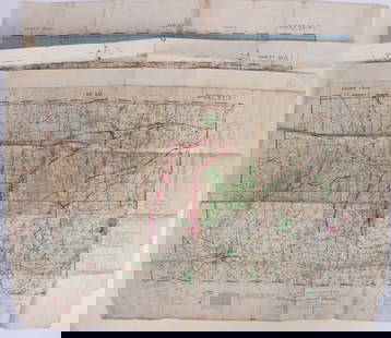
Sold2023WWII U.S. MILITARY WAR MAPS OF FRANCE - (3)171283 WWII U.S. MILITARY WAR MAPS OF FRANCE - (3) WWII U.S. military war maps of France to include, one sheet 6F/6 Vire France(50000) war map second edition, one sheet 6E/6 Isigny France(50000) war mSee Sold Price
Sold2023U.S. MILITARY FIELD MAPS OF FRANCE 1939-1945 -(3)170302 U.S. MILITARY FIELD MAPS OF FRANCE 1939-1945 -(3) U.S. military field maps of France 1939-1945 to include one France and Belgium (50000) Sittard Field Map Second Edition Sheet 48, One France (5See Sold Price
Sold2023Canada ou Nouvelle France Map Pieter van der AaMap Titled Canada ou Nouvelle France Suivant les Nouvelles Observations, 1700, Pieter van der Aa. Map measures 9 inches H x 12 W, 13 inche sH x 18.5 W framed.See Sold Price
Sold2024Antique Map of France, 1703 by Gillaume Del Isle PrintAntique Map of France, 1703 by Gillaume Del Isle Print. 28 x 34 1/2 in framed. 18 3/4 x 25 in unframed.Local Pick up call one day before to make an appointment. TO SHIP THIS ITEM IN USA OR INTERNATIONSee Sold Price
Sold20231743 Homann Map of Europe -- Europa Secundum Legitimas Projectionis Stereographicae Regulas et JuxtaTitle: 1743 Homann Map of Europe -- Europa Secundum Legitimas Projectionis Stereographicae Regulas et Juxta Recentissimas Observationes Aeque ac Relationes… Cartographer: J. Homann Year / Place: 174See Sold Price
Sold2023WWII U.S MILITARY WAR MAPS OF FRANCE/BELGIUM - (9)171281 WWII U.S MILITARY WAR MAPS OF FRANCE/BELGIUM - (9) WWII U.S. military war maps of France/Belgium to include one sheet 79 Defenses Vierville-Sur-Mer France (12500) war map, two sheet 31/18 S.E.See Sold Price
Sold201718th C. French Map w/ Oiled Paper, ex-Sotheby'sEurope, France, map from 1709 CE, oiled paper overlays from 1756 to 1763 CE, owned by Louis-Alexandre Berthier (1753 to 1815 CE), Marshal, Vice-Constable of France, and Chief of Staff (Major general)See Sold Price
Sold2021Johannes Cloppenburg Nova Galliae TabulaDESCRIPTION: Johannes Cloppenburg Nova Galliae Tabula. Map of France with border depicting views of French cities and inhabitants. Geographical content based on Blaeu, 1607. With Cloppenburg's imprintSee Sold Price
Sold2018France.- Ortelius (Abraham) Gallia, detailed map ofFrance.- Ortelius (Abraham) Gallia, detailed map of France, with part of southern England, northern Italy, and includes Belgium and the Netherlands, a large title cartouche with two putto decorating tSee Sold Price
Sold2017Homann: Map of Europe, 1743Map: 1743 Homann Map of Europe -- Europa Secundum Legitimas Projectionis Stereographicae Regulas et Juxta Recentissimas Observationes Aeque ac Relationes… Cartographer: J. Homann Year / Place: 1743See Sold Price
Sold2020Grp: 6 Maps of SpainGroup of six maps of France and Spain. Includes Friedrich Wilhelm Streit (1772-1839) map of France "Charte von Frankreich nach den besten Hulfsmitteln," Nuremberg, 1815; Guillaume Delisle (1675-1726)See Sold Price
Sold2023Six Antique Maps of America Engravings, 19th c., H.- 7 1/4 in., W.- 4 1/2 in., Framed- H.- 15 in.,Six Antique Maps of America Engravings, 19th c., includes: "Map 8 1776 / Framing Declaration," "Map 5 1692 / New France: Map of the Discoveries of Marquette, La Salle and Other Frenchmen," "Map No. 12See Sold Price
Sold2022Buffalo Bill’s Wild West. Tour of France 1905. London: Wein...Buffalo Bill’s Wild West. Tour of France 1905. London: Weiners Ltd. Souvenir folding map of France, with Buffalo Bill’s Wild West show route outlined in red, with dates, towns, and railwaySee Sold Price
May 14Hermann Historica GmbHJean-Laurent Mosnier (1743 - 1808), French court painter - Portrait of a Nobleman€5,000
2 days LeftJasper521942 Myra Z Barnes Map of French Quarter, New Orleans -- Le Vieux Carre de la Nouvelle Orleans$95
May 12Schilb Antiquarian Rare Books1844 Siege of Gibraltar American Revolution SPAIN France Drinkwater MAP History$1(1 bid)
2 days LeftJasper521753 Robert de Vaugondy Map of Central France -- Gouvernemens Generaux De La Marche, Du Limosin Et$45
May 16Potter & Potter AuctionsAUDIBERTI, J. Choain. Afrique Equatoriale Francaise. Paris:...$100(1 bid)
5 days LeftDoyen AuctionOil on Canvas Painting of Leashed Hounds Tied to a Tree, France, 18th Century$2,400
2 days LeftJasper521792 Elwe Map of the Netherlands and Belgium -- Les Dix-Sept Provinces des Pays-Bas$80
4 days LeftHunt and Peck Estate Services, Inc.Jacques Nicolas Bellin Map Of Western Part Of New France Or Canada$220(2 bids)
May 14Fleischer's Auctions1755 Map Partie de l'Amerique Septentrionale, qui comprend Le Cours de L'Ohio...$200(3 bids)


![[MAPS]. A group of 3 engraved maps, most with hand-coloring. (1 of 4)](https://p1.liveauctioneers.com/197/328642/177014805_1_x.jpg?height=282&quality=70&version=1714760103)


