Sold2021Baltimore 1889Title/Content of Map: Baltimore 1889 Date Printed: 1889 Material/Medium: Paper Size: Approx. 10.5x 13.5 inches Additional Info: Crams Indexed Atlas, published by W.H. Stewart, Rochester NY Reserve: $3See Sold Price
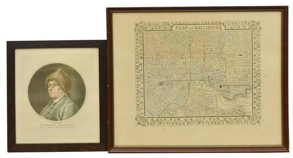
Sold2020(2) BEN FRANKLIN RUOTTE & BALTIMORE MAP ENGRAVINGS(lot of 2) Framed engravings on paper, including: (1) Benjamin Franklin (American, 1706-1790), after the original drawing by Charles Nicolas Cochin II (French, 1715-1790), engraved by C. Ruotte (LouisSee Sold Price
Sold20221856 Chart of The Hudson River from Albany to New Baltimore -- Map of Comparison of Hudson RiverTitle: 1856 Chart of The Hudson River from Albany to New Baltimore -- Map of Comparison of Hudson River from Albany to New Baltimore Cartographer: US Coast Survey Year / Place: 1856 Map Dimension (in.See Sold Price
Sold2023Excellent 1860 map of Baltimore by Samuel A. Mitchell, Jr.Nice example of Samuel Augustus Mitchell Jr’s map of Baltimore with the vivid outline hand coloring that sets this edition off from other editions. Shows wonderful detail at the street level, inSee Sold Price
Sold20191860 Mitchell Map of Baltimore -- Plan of BaltimoreTitle: 1860 Mitchell Map of Baltimore -- Plan of Baltimore Date: 1860, Philadelphia Cartographer: S Mitchell Size: 9 X 11.2 in. Additional Information: A very nice map of Baltimore, identifying the vaSee Sold Price
Sold20211855 Colton Map of Baltimore -- Colton's City ofTitle: 1855 Colton Map of Baltimore -- Colton's City of Baltimore, Maryland Cartographer: Johnson & Browning Year / Place: 1855, New York Map Dimension (in.): 12.7 X 15.7 in. This is a very attractiveSee Sold Price
Sold2017Rand McNally: Antique Map of Baltimore, 1911Title/Content of Map: 1911 Rand McNally Map of Baltimore -- Baltimore Date Printed: 1911, Chicago Cartographer: Rand McNally Size: 26 X 19 in. A very nice large map of central Baltimore. Highly detailSee Sold Price
Sold20191855 Colton Map of Baltimore -- City of BaltimoreTitle/Content of Map: 1855 Colton Map of Baltimore -- City of Baltimore Maryland Date: 1855, New York Cartographer: J Colton Size: 11.9 X 14.6 in. This is a very attractive city map. It is full of detSee Sold Price
Sold2022Antique Map Print - America - Map of Baltimore - Maryland - United States - 1924Title: Antique Map Print - America - Map of Baltimore - Maryland - United States - 1924 Date/Period: 1924 Dimension: 38 cm x 27 cm Material: Paper Additional Information: This is an antique map of BalSee Sold Price
Sold2017Mitchell: Antique Map of Baltimore, 1870Map: 1870 Mitchell Map of Baltimore -- Plan of Baltimore Cartographer: S Mitchell Year / Place: 1870, Philadelphia Map Dimensions: 9 X 11.2 in. Condition: Very good; Pastel colors. Some age toning, moSee Sold Price
Sold20221867 Mitchell Map of Baltimore -- Plan of BaltimoreTitle: 1867 Mitchell Map of Baltimore -- Plan of Baltimore Cartographer: S Mitchell Year/Place: 1867, Philadelphia Dimensions: 9. 4 X 11.1 in. Description: This is a very nice map of Baltimore, identiSee Sold Price
Sold2019Map of BaltimoreTitle: Map of Baltimore Publication Date: 1895 Cartographer: CRAM, GEO. F. Publisher: GEO. F. CRAM Dimensions: 18.1 X 12.5 Additional Information: From Cram's Universal atlas,... All streets named orSee Sold Price
Sold2021EARLY CITY MAP OF BALTIMORE 1855Framed, plate no 23; toned; image 14 1/2" x 17 1/2", G-VGSee Sold Price
Sold2022Framed Map and Baltimore AdvocateTwo framed items to include a reproduction map of Anna Arundel Co. Together with an 1862 page from the Baltimore County Advocate. Mat opening of page: 20 in x 14 in. total.See Sold Price
Sold20211857 Map of BaltimoreAuthor: Bradley Title: 1857 Map of Baltimore Medium: Ink on Paper Dimensions: 15"X12" Map of Baltimore dated 1857. Copper plate. Engraved by Joseph Miller. Published by W. Bradley & son. This is one oSee Sold Price
Sold2022Antique Map of Baltimore County, Maryland 1898Antique Map of Baltimore County, Maryland 1898. This item requires third party shipping or pickup arrangements to be made. Dimensions of Frame: 36 x 25 x 2See Sold Price
Sold2023Early 19th century map titled "Baltimore, Annapolis and adjacent Country" by John M. Atwood Sc.A hand colored map titled "BALTIMORE, ANNAPOLIS and adjacent Country" with "John M. Atwood Sc." printed in bottom left corner. A variant of this map was included as "Plate 5" in the 1826 3rd edition oSee Sold Price
Sold2019Colton's Baltimore Map [Southern Cities]Colton's Baltimore Map. J. H. Colton Cartographer. Published by J. H. Colton, New York. Stamped 'Entered according to Act of Congress in the Year 1855 by J. H. Colton and Co. in in the Clerks Office oSee Sold Price
Sold2019Five City Maps, "Philadelphia, Baltimore, Washington,Five City Maps, "Philadelphia, Baltimore, Washington, Dallas, and St. Joseph, MO," H.- 14 1/4 in., W.- 23 in. (2 Pcs.)See Sold Price
Sold2018Craig's Business Directory and Baltimore Almanac; forCraig's Business Directory and Baltimore Almanac; for 1842. Map of Baltimore, 145p. 14cm. Green cloth. Minor wear and in very good condition. Reserve: $25.00 Shipping: Domestic: Flat-rate of $8.00 toSee Sold Price
Sold2017Four framed pieces to include WWI photograph ofFour framed pieces to include WWI photograph of Headquarters Co. 323rd Field Artillery 32nd Division just back from Germany, two framed photographs N.Y.C., and New and Enlarged map of Baltimore City,See Sold Price
Sold2021Plan of Baltimore, Mitchell 1872A beautiful example of S. A. Mitchell Jr.'s 1872 map of Baltimore, Maryland. Offers wonderful detail at the street level including references to the important buildings, trains, canals, and roads. ColSee Sold Price
Sold2018Early 19th Century Map of LouisianaEarly 19th Century Map of Louisiana(Baltimore: F. Lucas, 1817), engraving with outline color, depicts adjacent areas in Mississippi, Alabama, Florida, Texas and Arkansas (being labeled "Missouri"). PrSee Sold Price
May 16Potter & Potter AuctionsTUNIS, Edward (1897 – 1973). From Chesapeake Bay / Land of ...$250
6 days LeftRail & Road AuctionsEleven Port Series Books with Fold Out Maps - No. 9 Through No. 23 - Army Corps of Engineers$20(1 bid)
May 14Fleischer's Auctions1755 Map Partie de l'Amerique Septentrionale, qui comprend Le Cours de L'Ohio...$200(3 bids)
18 hrs LeftTremont AuctionsJohn Speed and Francis Lamb "Map of New England and New York", ca. 1676. Hand colored engraved map$900(3 bids)
18 hrs LeftTremont Auctions17th century original map 1676 "Virginia and Maryland" by John Speed. 2 sided framing. Overall:$650(3 bids)
7 days LeftCrescent City Auction GalleryWilliam H. Williams (1817-1886), New Orleans "Map of the Sixth District and Carrollton," 1871, H.-$650
18 hrs LeftTremont Auctions18th century map "Americae Septentrion" by Homann. Rarer early edition. Framed. Holes around outer$250(1 bid)
May 12Schilb Antiquarian Rare Books1977 JRR Tolkien 1st ed 1st Printing Silmarillion Lord of the Rings + MAP + DJ$200(5 bids)
5 days LeftHunt and Peck Estate Services, Inc.Jacques Nicolas Bellin Map Of Western Part Of New France Or Canada$200(1 bid)
18 hrs LeftTremont Auctions18th century map of New Jersey. "A New and Accurate Map of New Jersey". W. Long, London. Map size 13$100
May 12Schilb Antiquarian Rare Books1883 FLORIDA for Tourists & Settlers Illustrated Fort Barrancas MAP Fine BINDING$90(5 bids)
May 12Schilb Antiquarian Rare Books1859 AFRICA VOYAGES Barth Timbuktu Tripoli SLAVES Illustrated Slavery MAP African$62(4 bids)
18 hrs LeftTremont Auctions17th century "Sub Polo Artico" original map by Blaeu. 2 sided framing. Overall: 18.375 x 22.5in.$225(2 bids)


![Colton's Baltimore Map [Southern Cities]: Colton's Baltimore Map. J. H. Colton Cartographer. Published by J. H. Colton, New York. Stamped 'Entered according to Act of Congress in the Year 1855 by J. H. Colton and Co. in in the Clerks Office o](https://p1.liveauctioneers.com/5755/154409/77936947_1_x.jpg?height=310&quality=70&version=1573094011)


