Sold2023Map of Proposed Road Bet. Washington & New OrleansMap Depicting a Proposed Route for a National Road Between Washington and New Orleans, 1826-28. Depicting major towns and cities, existing roads and military posts, printed "MAP OF RECONNAISSANCE EXHISee Sold Price
Sold2017Bradford: Antique Map of Four US Cities, 1838Title/Content of Map: Cities of Washington D.C., New Orleans, Cincinnati and Louisville Date Printed: 1838/1841 Cartographer: Thomas G. Bradford Material/Medium: Paper Size: 13" x 16 1/2" Hand coloredSee Sold Price
Sold20181846 Bradford Maps of Key US Cities -- Washington,Title/Content of Map: 1846 Bradford Maps of Key US Cities -- Washington, Louisville and Jeffersonville, New Orleans, Cincinnati Date: 1846 Boston Cartographer: T. Bradford Size: 11 x 13.5 in Well engrSee Sold Price
Sold2019U S Coast Survey 1896 LG Map. New Orleans Texas Florida"Sketch of General Progress June 30. 1896" Showing Southern, Eastern and Mid West States, incl Florida, Texas, Gulf of Mexico, Georgia etc. Large Lithograph Map Published 1896, Washington for "U.S. CoSee Sold Price
Sold2019In Camp & Battle with Washington ArtilleryIn Camp and Battle with the Washington Artillery of New Orleans A narrative of events during the Late Civil War from Bull Run to Appomattox and Spanish Fort. IlSee Sold Price
Sold20171886 Crams's Map of New Orleans & Atlanta1886 Crams's Map of New Orleans verso Atlanta G Cram / People's Publishing Co. 1886, New York 11.3 X 9.4 in. Very nice maps showing streets, steam / horse roads, ferries, churches, government buildingSee Sold Price
Sold2019Map of New Orleans LakefrontAntique Map of New Orleans Lakefront, "Plan of Proposed Improvements for the Lake Shore Front of the City of New Orleans...", 1873, lithograph by D. Simon, New Orleans, drawn by Alex Debrunner, detailSee Sold Price
Sold20191831 McNeill Map of the Very Early New England RailroadTitle/Content of Map: 1831 McNeill Map of the Very Early New England Railroad Plans -- Map Exhibiting the Several Routes Surveyed for a Proposed Rail Road from Boston to Providence and also to TauntonSee Sold Price
Sold2021Map of WashingtonPublication Date: 1882 Title: Map of Washington Cartographer: HARDESTY Publisher: RAND, MCNALLY & CO. Map showing towns, townships, forts, missions, topography, roads, railroads, proposed N. Pac. RR,See Sold Price
Sold2016Topographical Map of Virginia and Washington, 1861Title: Topographical Map of Virginia between Washington and Manassas Junction Origin: Charles Mangus & Co., 12 Frankfort St. New York Date: 1861 "New Road to Mt. Vernon in progress." "Guide to MOUNT VSee Sold Price
Sold2018London.- Cruchley (George Frederick) New Map ExtendingLondon.- Cruchley (George Frederick) New Map Extending 24 Miles Round London, showing all the Mail, Turnpike, and Cross Roads, Gentleman's Seats, parks etc. etc. Also all the Proposed Railways, &c., cSee Sold Price
Sold2018U.S Coast Survey 1857 Map. New Orleans, Louisiana"Sketch II Showing The Progress of the Survey in Section No. VIII" A Rare Map centred on New Orleans and Lake Pontchartrain. Also showing Bon Secours Bay (Alabama) Isle au Breton Sound and Vermilion BSee Sold Price
Sold2018U.S Coast Survey 1856 Map. New Orleans, Louisiana"Sketch II Showing The Progress of the Survey in Section No. VIII" A Rare Map centred on New Orleans and Lake Pontchartrain. Also showing Bon Secours Bay (Alabama) Isle au Breton Sound and Vermilion BSee Sold Price
Sold2018Large lot early maps, New Orleans, Boston, New York,Large lot early maps, New Orleans, Boston, New York, Mamaroneck, also includes several atlas. All items sold as is as found, please refer to images for additional condition issues, all sales final.See Sold Price
Sold2024New Orleans 1889Title/Content of Map: New Orleans 1889 Date Printed: 1889 Material/Medium: paper Size: approx. 14.5"x10.75" George F. Cram, Chicago Reserve: $40.00 Shipping: Domestic: Flat-rate of $15.00 to anywhereSee Sold Price
Sold2020New Orleans 1896Title/Content of Map: New Orleans 1896 Date Printed: 1896 Material/Medium: paper Size: approx. 10.5x 13.5 inches Additional Info: Rand McNally & Co. Universal Atlas of the World Reserve: $25.00 ShippiSee Sold Price
Sold2022New Orleans 1889Title/Content of Map: New Orleans 1889 Date Printed: 1889 Material/Medium: paper Size: Approx. 14.5x10.5 inches Additional Info: Cram's Unrivaled Atlas of the World. W.H. Stewart Publisher, RochesterSee Sold Price
Sold2021New Orleans 1900Title/Content of Map: New Orleans 1900 Date Printed: 1900Material/Medium: Paper Size: 11x14 inches Rand McNally prepared for The Public Ledger, Philadelphia Reserve: $30.00 Shipping: Domestic: Flat-See Sold Price
Sold2023Collection of New Orleans coffee table booksCollection of New Orleans coffee table books: Creole Faubourg, American Sector, Esplanade Ridge, Lower Garden District, Faubourg, Treme, Bayou Road, New Orleans Now & Then, 20th centurySee Sold Price
Sold2017Mitchell: Antique Map of New Orleans, 1869Title/Content of Map: New Orleans by Mitchell Date Printed: 1869 Cartographer: Augustus S. Mitchell Material/Medium: Paper Size: 12" x 15" Hand colored engraved Map. From 'Mitchell's New General AtlasSee Sold Price
Sold20231853 U.S. Coast Survey Map of New Orleans1853 U.S. Coast Survey Map of New Orleans, Lake Pontchartrain and the Mississippi Delta hand-colored lithograph, inscribed "U.S. Coast Survey, A. D. Bache Superintendent, Sketch H, Showing the progresSee Sold Price
Sold2021Map of New Orleans- "Diagram Showing the InundatedMap of New Orleans- "Diagram Showing the Inundated District Sauve's Crevasse, May 3, 1849, " 19th c., print, presented in an ebonized frame with a beaded liner, H.- 7 1/8 in., W.- 9 1/4 in.See Sold Price
Sold2024Antique Map of New OrleansAntique Map of New Orleans, "Plan of New Orleans the Capital of Louisiana", 1761, by Benning, engraved map from the London Magazine, 7 1/2 in. x 9 1/2 in., framed.See Sold Price
Sold2023Antique Map of New OrleansAntique Map of New Orleans, "Plan of New Orleans The Capital of Louisiana; with the Disposition of its Quarters and Canals as they have been traced by Mr. de la Tour in the Year 1720", later reproductSee Sold Price
3 days LeftRail & Road AuctionsEleven Army Corps of Engineers Port Series No. 1 Through No. 8 Books with Fold Out Maps$35(2 bids)
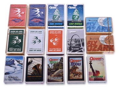
3 days LeftRail & Road AuctionsSixteen Delta Air Lines Playing Card Decks - Travel Destination Advertising, Boston, San Francisco,$20(1 bid)
3 days LeftRail & Road AuctionsTwenty-Four Delta Air Lines Playing Card Decks - Travel Destination Advertising, Arizona, Jamaica,$50
3 days LeftRail & Road AuctionsFourteen Decks of Delta Air Lines Playing Cards Advertising Travel Destinations and Royal Jet$20
4 days LeftCrescent City Auction GalleryWilliam H. Williams (1817-1886), New Orleans "Map of the Sixth District and Carrollton," 1871, H.-$650
May 17Albion AuctionsPaterson & Mogg C1830 British Road Map. New Shorehamd to Chichester to Fareham$5(1 bid)
17 hrs LeftJasper521942 Myra Z Barnes Map of French Quarter, New Orleans -- Le Vieux Carre de la Nouvelle Orleans$95
May 22Thomaston Place Auction GalleriesCOLLECTION OF TRAVEL EPHEMERA, BROCHURES, BOOKLETS, MAPS 1900-1950$100
17 hrs LeftJasper521775-1780 Southwest (Arizona, New Mexico, Texas, with most of Mexico) by Bonne & Raynal$160(1 bid)
3 days LeftRail & Road AuctionsSixteen Delta Air Lines Playing Card Decks - Travel Destination Advertising Chicago, Jamaica, Miami,$20(1 bid)
2 days LeftRail & Road AuctionsFive 1912 Southeastern Railroad Annual Passes - Alabama Great Southern, Southern, Central of$30(1 bid)
3 days LeftRail & Road AuctionsSeventeen Delta Air Lines Playing Card Decks - Travel Destination Advertising, Arizona, Jamaica, Las$30
2 days LeftRail & Road AuctionsEight Southwestern Railroad 1912 Annual Passes - Trinity & Brazos Valley, Kansas City Southern, Fort$50
2 days LeftRail & Road AuctionsSeven Illinois Central Railroad Dining Car Menus - Panama Limited, City of New Orleans, and More$20
2 days LeftRail & Road AuctionsThirty-Three Amtrak Railroad Dining Car Menus - Coast Starlight, Empire Builder, Montrealer, and$40
4 days LeftCrescent City Auction GalleryDale Chihuly (American/Washington, b. 1941), Garnet Flame Blown Glass Basket, 2018, H.- 20 in., W.-$4,000