Sold2024Historic Map - The Duchy of Silesia, Poland, Wilkinson, 1792.Historic Map The Duchy of Silesia, Poland, Wilkinson, 1792.Size: 35 cm x 27 cmSee Sold Price
Sold2024Covens & Mortier Map Of The Duchy Of Mantua In AmsterdamMap Of The Course Of The Po In The Duchy Of Mantua in Amsterdam By Jean Covens and Corneille Mortier, hand coloredSee Sold Price
Sold2022Alexis Hubert Jaillot and Nicolas Sanson - Map of the Grand Duchy of Moscow, Etching, 1708.Alexis Hubert Jaillot (French, 1632-1712) and Nicolas Sanson (French, 1600-1667) - Map of the White Russia or the Grand Duchy of Moscow, Etching, 1708. Title: Les Estats du Czaar de Russie Blanche ouSee Sold Price
Sold2021Hondius Map of the Grand Duchy of Lithuania, 1613Hondius Map of the Grand Duchy of Lithuania, 1613Lithuania / LithuanieAutorius Jodocus Hondius I (Joost de Hondt 1563-1612)Graveris Jodocus Hondius II (1594-1629)Leidejai: Jodocus Hondius II (1594-162See Sold Price
Sold20191698 Moscow VOYAGES Grand Duchy Russia Moscovia1698 Moscow VOYAGES Grand Duchy Russia Moscovia Geography MAP Claude Jordan A rare volume from Claude Jordan’s ‘Historical Voyages of Europe’. This volume focuses primarily on the history of MosSee Sold Price
Sold2017Tallis/Rapkin: Antique Map of Belgium & Luxembourg 1851Title/Content of Map: 'Belgium' Includes the Grand Duchy of Luxembourg. Railways are marked. Vignettes: Altar of St. Gudule - Brussels; Monuments on the Plains of Waterloo; Antwerp Cathedral Date PrinSee Sold Price
Sold2022RUSSIA/UKRAINE 'Moscovie' Muscovy Moscow Smolensk Novgorod. MALLET 1683 mapTITLE OF THE MAP: 'Moscovie' (De L'Europe) The Grand Duchy of Moscow (Russian: Великое КнÑжеÑтво МоÑковÑкое, Velikoye KnSee Sold Price
Sold2019R. Wilkinson Antique Hand Colored Map of SwabiaDescription: R. Wilkinson antique, hand colored map of Swabia. Swabia was a medieval Duchy in southwest Germany, that also included part of Poland. Possibly circa 1822 as indicated by original owner.See Sold Price
Sold20241736 LARGE MAP OF SILESIA POLAND KARNOVIENSIS antique 25 x 4 3/4" Duchy of KrnovPrincipatus Silesiae KARNOVIENSIS by HOMANN HEIRS Nuremberg, 1736 The land survey was done by J. W. Wieland, and corrected by M. v. Schubarth. With a large very attractive cartouche in the upper leftSee Sold Price
Sold2018Poln, Denmark. Residence of the rulers of the Duchy ofReserve Reduced! Title/Content of Map: Poln, Denmark. Residence of the rulers of the Duchy of Schleswig-Holstein. RARE. Date: 1572-1617. Size: 22x16 1/2”. From the Civitates Orbis Terrarum by BraunSee Sold Price
Sold2018Thomson: Antique Map of Southern Germany, 1817Title/Content of Map: 'Germany, south of the Mayne'. This large, decorative map shows Southern Germany, including the Kingdom of Bavaria, Hesse-Darmstadt, the Grand Duchy of Baden, the Kingdom of WurtSee Sold Price
Sold2018Mallet: Antique Map of Central Italy, Papal States 1683Title of the Map: 'Estat Ecclesiastique et Duche de Toscane' Shows the Papal States & the Duchy of Tuscany. Rome. Tuscany and Central Italy. Date Printed: 1683 Image Size: Approx Overall page size 13See Sold Price
Sold20211760 Kitchin Map of Moravia: Austria and Czechia -- ATitle: 1760 Kitchin Map of Moravia: Austria and Czechia -- A Map of the Marquisate of Moravia with North.n Part of Arch Duchy of Austria Cartographer: T Kitchin Year/Place: 1760 c., London Dimensions:See Sold Price
Sold2022Antique Map Print - Map of Bohemia - Map of Czech Republic - KingdomAntique outline hand colored map from edition of Meyer’s world atlas, edited by Ludwig Ravenstein, published by Bibliographic Institute in 1872. Technique: Engraving. Place: Leipzig, Germany. SSee Sold Price
Sold2022Original Antique Map -Pommern Provinz - Map of Bornholm Island Baltic SeaAntique outline hand colored map from edition of Meyer’s world atlas, edited by Ludwig Ravenstein, published by Bibliographic Institute in 1872. Technique: Engraving. Place: Leipzig, Germany. SSee Sold Price
Sold2022Original Antique Map - Mecklenburg-Schwerin - Map of Northern GermanyAntique outline hand colored map from edition of Meyer’s world atlas, edited by Ludwig Ravenstein, published by Bibliographic Institute in 1872. Technique: Engraving. Place: Leipzig, Germany. SSee Sold Price
Sold2022Original Antique Map -Bremen Oldenburg - Map of Bremen OldenburgAntique outline hand colored map from edition of Meyer’s world atlas, edited by Ludwig Ravenstein, published by Bibliographic Institute in 1872. Technique: Engraving. Place: Leipzig, Germany. SSee Sold Price
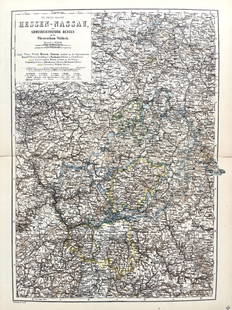
Sold2022Original Antique Map -Hessen Nassau - Map of Furstenthum WaldeckAntique outline hand colored map from edition of Meyer’s world atlas, edited by Ludwig Ravenstein, published by Bibliographic Institute in 1872. Technique: Engraving. Place: Leipzig, Germany. SSee Sold Price
Sold2022Antique Map Print - Map of Schleswig - Holstein - Map of Germany - LauenburgAntique outline hand colored map from edition of Meyer’s world atlas, edited by Ludwig Ravenstein, published by Bibliographic Institute in 1872. Technique: Engraving. Place: Leipzig, Germany. SSee Sold Price
Sold2022Antique Map Print - Map of Mecklenburg-Schwerin - Map of Germany - Roman EmpireAntique outline hand colored map from edition of Meyer’s world atlas, edited by Ludwig Ravenstein, published by Bibliographic Institute in 1872. Technique: Engraving. Place: Leipzig, Germany. SSee Sold Price
Sold2022Original Antique Map - Konicreich Bohmen - Map of Bohmen - Prague - CarlsbadAntique outline hand colored map from edition of Meyer’s world atlas, edited by Ludwig Ravenstein, published by Bibliographic Institute in 1872. Technique: Engraving. Place: Leipzig, Germany. SSee Sold Price
Sold2022Antique Map Print - Map of Rheinprovinz - Map of Germany - Prussian StateAntique outline hand colored map from edition of Meyer’s world atlas, edited by Ludwig Ravenstein, published by Bibliographic Institute in 1872. Technique: Engraving. Place: Leipzig, Germany. SSee Sold Price
Sold2022Antique Map Print - Map of Pomerania - Map of Germany - South of the Baltic SeaAntique outline hand colored map from edition of Meyer’s world atlas, edited by Ludwig Ravenstein, published by Bibliographic Institute in 1872. Technique: Engraving. Place: Leipzig, Germany. SSee Sold Price
Sold2022Antique Map Print - Map of Oldenburg - Map of Germany - Lower Saxony - HunteAntique outline hand colored map from edition of Meyer’s world atlas, edited by Ludwig Ravenstein, published by Bibliographic Institute in 1872. Technique: Engraving. Place: Leipzig, Germany. SSee Sold Price
5 days LeftJasper521736 LARGE MAP OF SILESIA POLAND SAGANENSIS antique 25 x 4 3/4" Duchy of Krnov$260
2 days LeftSchilb Antiquarian Rare Books1848 Emory Military Reconnaissance 1ed California MAP Indians Texas New Mexico$56(7 bids)
2 days LeftSchilb Antiquarian Rare Books1977 JRR Tolkien 1st ed Silmarillion Lord of the Rings Middle Earth + MAP$155(7 bids)
2 days LeftSchilb Antiquarian Rare Books1890 Livingstone 1ed In Darkest Africa Henry Stanley Emin Pasha Expedition MAP$145(8 bids)
2 days LeftSchilb Antiquarian Rare Books1870 BEAUTIFUL Life of Jesus Christ Fleetwood Bible ART Miracles Jerusalem Map$150(7 bids)
2 days LeftLeonard Auction, a division of The Leonard CompanyEuropean and United States Map Assortment$150
Jul 06Case Antiques, Inc. Auctions & AppraisalsColton's Atlas of the World, 1856, in Two Volumes; plus Africa / Mahdist War Map$500(1 bid)
4 days LeftFreeman's | Hindman[Maps & Atlases] Seutter, Matth(ias).: Novus Orbis sive America...$300(1 bid)
4 days LeftFreeman's | Hindman[Maps & Atlases] Braun, Georg, and Frans Hogenberg: Londinum, Feracissimi Angliae...$1,000
2 days LeftSchilb Antiquarian Rare Books1790 Life of Jesus Christ Fleetwood Bible ART Miracles Jerusalem MAP Holy Land$120(7 bids)
4 days LeftFreeman's | Hindman[Maps & Atlases] A New Map of North America, with the West India Islands...$300
2 days LeftEast Coast Fine Arts LLC1777 US Revolutionary War Map French Brion de la Tour Theatre de Guerre$1,000


![[Maps & Atlases] Speed, John: Spaine (1 of 2)](https://p1.liveauctioneers.com/65/332523/179335175_1_x.jpg?height=282&quality=70&version=1717709446)
![[Maps & Atlases] Speed, John: The Turkish Empire (1 of 2)](https://p1.liveauctioneers.com/65/332523/179335176_1_x.jpg?height=282&quality=70&version=1717709446)


![[Maps & Atlases] Seutter, Matth(ias).: Novus Orbis sive America... (1 of 2)](https://p1.liveauctioneers.com/65/332523/179335174_1_x.jpg?height=282&quality=70&version=1717709447)
![[Maps & Atlases] Braun, Georg, and Frans Hogenberg: Londinum, Feracissimi Angliae... (1 of 3)](https://p1.liveauctioneers.com/65/332523/179335170_1_x.jpg?height=282&quality=70&version=1717622830)


![[Maps & Atlases] A New Map of North America, with the West India Islands... (1 of 2)](https://p1.liveauctioneers.com/65/332523/179335173_1_x.jpg?height=282&quality=70&version=1717709447)
