Sold2023The World including the late discoveries by Captn Cook… by Thomas BOWEN 1789 mapTITLE/CONTENT OF MAP: 'The World including the late discoveries, by Captn Cook and other circumnavigators carefully laid down to the present time by Thos Bowen' DATE PRINTED: 1789 IMAGE SIZE: Approx 2See Sold Price
Sold2023Three Engraved Maps, including Thomas BowenTHREE ENGRAVED MAPS, including THOMAS BOWEN (Welsh, died 1790), "The World, including the late Discoveries, by Capt. Cook and other Circumnavigators," handcolored engraving on laid paper, plate: 11 1/See Sold Price
Sold2019World map showing latest discoveries, 1778Heading: Author: Bowen, Thomas Title: The World including the late Discoveries by Captn. Cook and other Circum Navigators... Place Published: London Publisher: Date Published: [1778] DSee Sold Price
Sold2020Bowen, Thomas 1789 Map of North America. USA Canada"A New & Accurate Map of North America including Nootka Sound, with the new discovered Islands on the North East Coast of Asia" Copper Engraved Map Published 1789-91 by C. Cooke, London for "The New RSee Sold Price
Sold20231758 Map Chart of World TradewindsAn Accurate Chart of the World with the New Discoveries....Tradewinds.., by Thomas Kitchin, 1758. Large folding map, measures 17 x 13", Condition issues including creasing and repaired breaks at foldsSee Sold Price
Sold2016T-O World Map.- Lucanus (Marcus Annaeus) Pharsalia,Lucanus (Marcus Annaeus) Pharsalia, manuscript on paper, [Northern Italy (possibly Padua), first half of the fifteenth century]. 294 x 217mm., I + 149 + I leaves (including defective leaves and 3 blanSee Sold Price
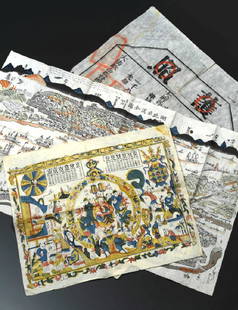
Sold2019China Missions, late 19th century, a small box ofChina Missions, late 19th century, a small box of various China Missionary items and ephemera, including a tissue paper map, passport to Rev. A W Nightingale expiring 1880, signed 'Bullock', printed sSee Sold Price
Sold2022World.- Speed (John) A New and Accurat Map of the World Drawne according to ye truest DescriptionsWorld.- Speed (John) A New and Accurat Map of the World Drawne according to ye truest Descriptions latest Discoveries & best observations yt have beene made by English or Strangers, double-hemisphereSee Sold Price
Sold2024Petrus Plancius, Engraved World MapOrbis Terrarum Typus de Integro Multis in Locis Emendatus. Petrus Plancius (1552-1622). Copper-plate engraving with original hand color in full. Amsterdam, 1594. Some stains, creases, folds. Sight sizSee Sold Price
2022Blaeu, Johannes (Netherlands, 1596-1673) "The New World Map" Double Hemisphere World Map C. 1664Nova et Accuratissima Totius Terrarum Orbis Tabula Translated "The New World Map", Hand Colored w/ Elaborately Decorated Spandrels.   Sight View 16" x 21-1/2", Overall View 21" x 25-1/2"See Sold Price
Sold2018Ortelius' 1570 world mapHeading: Author: Ortelius, Abraham Title: Typus Orbis Terrarum Place Published: Antwerp Publisher: Date Published: 1570-[1584?] Description: Copper-engraved map, hand-colorSee Sold Price
Sold2019WorldTitle/Content of Map: World Date: 1493 Cartographer: Schedel Material/Medium: Woodblock engraving Size: 18x25” The oldest decorative world map that’s obtainable. Map shows 12 wind heads, shows theSee Sold Price
Sold2022Thomas Jefferson Document Signed as Secretary of StateDS, signed "Th: Jefferson," one page, 8 x 13, December 16, 1791. An Act of the Second Congress, in part: "An Act for the relief of David Cook and Thomas Campbell. Be it enacted by the Senate and HouseSee Sold Price
Sold2024Merkelbach & Wick #1455, German Crest2.0 Liter Pottery Stein hand painted in relief with pewter lid - We Germans fear God, nothing else in the world, circa late 1890'sSee Sold Price
Sold2022Vintage Playing CardsA group of vintage playing cards including Texas, Thomas Hart Benton, Kennedy Kards, & ca. 1900 Cribbage board with original box detailed in hearts & diamonds.See Sold Price
Sold2020Thomas Moran Seascape Painting American 1837-1926Thomas Moran Watercolor signed, dated and titled "OFF THE COAST OF MAINE". Measures 9" x 29" not including the frame. Thomas Moran (1837 - 1926)Thomas Moran was active/lived in Pennsylvania, CaliforniSee Sold Price
Sold2016Leica M3 black paint outfitExtremely rare first owner outfit including a beautiful late production black paint M3 body no.1134105 (B+ condition, in perfect original and good working order, clean finder, perfect vulcanite, 'L' sSee Sold Price
Sold2024Ohio copy of Mathew Carey’s 1796 GENERAL ATLASCarey, Mathew (publisher). CAREY’S GENERAL ATLAS. Philadelphia: Printed by Mathew Carey, May 1, 1796. FOLIO (14.75 x 9.5 inches), COMPLETE AS PUBLISHED (including a Rare Map of The United States bySee Sold Price
Sold2022World: Coin AssortmentWorld: Coin Assortment Including Birth of the Republic of China commemorative coin; 1934 China 'Junk Dollar'; 1933 'Sun Yat Sen' head; as well as the Philippines, Great Britain, France, Australia, SyrSee Sold Price
Sold2023Rare Etruscan Bronze Helmet Montefortino TypeClassical World, Etruria, ca. late 4th to 3rd century CE. A single-cast bronze Montefortino helmet of a domed bowl form with layers of deep, glossy patina and a top knob incised with a layered, scale-See Sold Price
Sold2023A Pair of George III Giltwood and Polychrome Inlaid Marble-Top Pier TablesA Pair of George III Giltwood and Polychrome Inlaid Marble-Top Pier Tables Manner of Thomas Chippendale, Late 18th Century Height 34 x width 35 1/4 x depth 15 3/8 inches. This lot is located in ChicagSee Sold Price
Sold2016JOHN SPEED (BRITISH, 1552-1629) MAP OF THE WORLDJOHN SPEED (BRITISH, 1552-1629) MAP OF THE WORLD, (UPDATED 6/14/16) hand-colored engraving on laid paper, titled "A New and Accurat Map of the World Drawne according to ye truest Descriptions latest DSee Sold Price
Sold2021GROUP OF SIX BAGFACES SHAHSAVAN AND OTHERS, LATE 19THGROUP OF SIX BAGFACES SHAHSAVAN AND OTHERS, LATE 19TH CENTURY including a pair of flatweaves made into cushions, with red cruciform medallions; two other flatweaves; and two piled examples (largest 58See Sold Price
2 days LeftThomaston Place Auction GalleriesCOLLECTION OF TRAVEL EPHEMERA, BROCHURES, BOOKLETS, MAPS 1900-1950$100
Jun 02Schilb Antiquarian Rare Books1871 Alfred the Great King of England MAP Battle of Ashdown Vikings Thom Hughes$125(3 bids)
2 days LeftThomaston Place Auction Galleries(7) LIMITED EDITION CLUB TITLES IN (8 VOLS), ALL NO. 733 OF THE EDITION$150
May 31Freeman's | Hindman[CIVIL WAR]. Small archive associated with Lt. Col. William M. Vogelson (1831-1892), 27th Ohio$250
Jun 02Schilb Antiquarian Rare Books1897 History of British Empire England Scotland Canada James II MAPS India 6v$3(2 bids)
Jun 29The RSL Auction CompanyThe Excelsior Paddlewheel Riverboat - Original Hand-Drawn & Colored Sketch$6,000
1 day LeftHannam's Auctioneers LtdThe Complete Atlas of Modern, Classical and Celestial Maps, together with Plans of the Principal Cit£240
Jun 08Austin Auction Gallery(3) FRENCH MARBLE & GILT METAL FIGURAL MANTEL CLOCK & GARNITURE SET$300(3 bids)
Jun 02Tremont Auctions18th century Spanish school old master still life painting with delft bowls and baskets, including$1,200


![World map showing latest discoveries, 1778: Heading: Author: Bowen, Thomas Title: The World including the late Discoveries by Captn. Cook and other Circum Navigators... Place Published: London Publisher: Date Published: [1778] D](https://p1.liveauctioneers.com/642/151690/76551227_1_x.jpg?height=310&quality=70&version=1570486555)


![T-O World Map.- Lucanus (Marcus Annaeus) Pharsalia,: Lucanus (Marcus Annaeus) Pharsalia, manuscript on paper, [Northern Italy (possibly Padua), first half of the fifteenth century]. 294 x 217mm., I + 149 + I leaves (including defective leaves and 3 blan](https://p1.liveauctioneers.com/5458/94966/48431616_1_x.jpg?height=310&quality=70&version=1476369049)


![Ortelius' 1570 world map: Heading: Author: Ortelius, Abraham Title: Typus Orbis Terrarum Place Published: Antwerp Publisher: Date Published: 1570-[1584?] Description: Copper-engraved map, hand-color](https://p1.liveauctioneers.com/642/127929/65081054_1_x.jpg?height=310&quality=70&version=1537227236)


![[MAP]. ORTELIUS, Abraham. Aevi Veteris, Typus Geographicus. 1601. (1 of 3)](https://p1.liveauctioneers.com/197/329395/177650532_1_x.jpg?height=282&quality=70&version=1715364962)


![[CIVIL WAR]. Small archive associated with Lt. Col. William M. Vogelson (1831-1892), 27th Ohio (1 of 10)](https://p1.liveauctioneers.com/197/329785/177758363_1_x.jpg?height=282&quality=70&version=1715625218)


