Sold2021Richfield Reporter War MapPublication Date: c1939 Title: Richfield Reporter War Map Cartographer: UNITED PRESS ASSOCIATIONSRICHFIELD OIL CORPORATION Height: 20.6 Width: 26.5 "compiled through the facilities of the United PressSee Sold Price
Sold2022The March of Evil 1945 and Four Esso War Maps and Two Richfield US Defense MapsThe March of Evil 1945 and Four Esso War Maps and Two Richfield US Defense MapsSee Sold Price
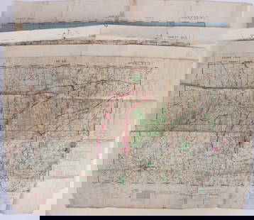
Sold2023WWII U.S MILITARY WAR MAPS OF FRANCE/BELGIUM - (9)171281 WWII U.S MILITARY WAR MAPS OF FRANCE/BELGIUM - (9) WWII U.S. military war maps of France/Belgium to include one sheet 79 Defenses Vierville-Sur-Mer France (12500) war map, two sheet 31/18 S.E.See Sold Price
Sold2023IMPORTANT DATED 1780 REVOLUTIONARY WAR MAP HORN CANNONEER'S SIZE W/ FORTS, ALBANY, NY, SARATOGA,IMPORTANT DATED 1780 REVOLUTIONARY WAR MAP HORN CANNONEER'S SIZE W/ FORTS, ALBANY, NY, SARATOGA, ETC. 27" LONGSee Sold Price
Sold2017William Faden, rare Revolutionary War Map of NYWilliam Faden, rare Revolutionary War Map of NY, William Faden (British, 1749-1836), "A Plan of the Operations of the Kings Army under the Command of General Sr. William Howe, K.B. in New York and EasSee Sold Price
Sold2023Sauthier & Fadden Revolutionary War Map EngravingAn original 18th Century hand colored engraved topographical map, illustrated by Claude Joseph Sauthier (1736–1802) and published by William Faden (1749-1836), the latter serving as royal geogrSee Sold Price
Sold2022Mitchell's large Mexican-American War map, 1847Heading: Author: Mitchell, Samuel Augustus Title: Map of Mexico, Including Yucatan & Upper California, Exhibiting the Chief Cities and Towns, the Principal Travelling Routes &c. Place Published: PhilSee Sold Price
Sold20241777 Revolutionary War Map America Septentrionalis1777 hand-colored map published by Homann Heirs, Nuremberg, showing the British colonies in North American, published in the midst of the American Revolution, entitled "America Septentrionalis a DominSee Sold Price
Sold2019Revolutionary War Map"A Plan of the Operations ... in New York and East New Jersey against the American Forces Commanded by General Washington" 29" x 20" (sight) Claude Joseph Sauthier, 1777See Sold Price
Sold2023AMERICAN REVOLUTIONARY WAR MAP OF BOSTON, MASSACHUSETTSAMERICAN REVOLUTIONARY WAR MAP OF BOSTON, MASSACHUSETTS, uncolored engraving on paper, A New and Correct Plan of the Town of Boston and Provincial Camp, engraved by Robert Aitken (AmeriSee Sold Price
Sold20221777 Revolutionary War Map AMERICA SEPTENTRIKONALHistoric Maps 1777 AMERICA SEPTENTRIKONALIS... Homann Heirs 1777-Dated American Revolutionary War Period, Hand-Colored Engraved Map titled, "AMERICA SEPTENTRIKONALIS...," by Homann Heirs, Nuremberg, CSee Sold Price
Sold2022Hungary.- Serio-Comic War Map.- Varga (Imre) A HáHungary.- Serio-Comic War Map.- Varga (Imre) A Háborús Európa Térkép-Karikatúrája, Hungarian pictorial map with Russia drunk on Vodka, who is keeping his army reservSee Sold Price
Sold2023FIRST EDITION OF RARE REVOLUTIONARY WAR MAPCarte Nouvelle des Possessions Angloises en Amérique dressée pour l'intellegence de la guerre, Paris 1777, Maurille Antoine Moithey, engineer. Translation: New map of the English possessionsSee Sold Price
Sold2024Johnson’s 1863 Family Atlas with Seat of War mapColton, J. H., and A. J. Johnson (compilers). Johnson’s New Illustrated Steel Plate FAMILY ATLAS, with Physical Geography, and with descriptions Geographical, Statistical, and Historical, includSee Sold Price
Sold2019Virginia which was the Seat of Action Rev War MapAmerican Revolution 1788 Engraved Map: "The Part of Virginia which was the Seat of Action" by T. Conder, Sculptor, London 1788 Revolutionary War Era Map titled, "The Part of Virginia which was the SeaSee Sold Price
Sold2022UNUSUAL U.S. REVOLUTIONARY WAR MAP 1780Titled in both French and English "Seat of War in America." Date penciled on. Includes 1935 letter of provenance framed verso. Dimensions: (Frame) H 16" x W 21.75", (Sight) H 9.75" x W 15.5" ConditionSee Sold Price
Sold20161760 French + Indian War Map Louisiana + FloridaHistoric Maps French & Indian War Era Map of Louisiana & Florida c. 1760 French & Indian War Era, Historic Map Titled, “Carte de la Louisiane, et de la Floride. Par M. Bonne, Ingenieur-Hydrographe dSee Sold Price
Sold2023WWII U.S. MILITARY WAR MAPS OF FRANCE - (3)171283 WWII U.S. MILITARY WAR MAPS OF FRANCE - (3) WWII U.S. military war maps of France to include, one sheet 6F/6 Vire France(50000) war map second edition, one sheet 6E/6 Isigny France(50000) war mSee Sold Price
Sold2024Rare Civil War map: Bird's Eye View Seat of War, Prang, 1862BIRD'S EYE VIEW OF THE SEAT OF WAR, 1862, Civil War lithograph map published by Louis Prang & Co., Boston. Depicts key sites of the conflict including Washington, Baltimore, Harper's Ferry, Richmond,See Sold Price
Sold2022Lodge's Rev. War map, ext. scarce 1870 reprintExtremely scarce reprint of the original 1781 map by John Lodge and John Bew. Uncommon Revolutionary War map showing the defenses for New York and the surrounding area, including Staten and Long islanSee Sold Price
Sold2022c 1760 Northern Colonies French + Indian War MapHistoric Maps Louisiana & Florida French & Indian War Era Map c. 1760 c. 1760 French & Indian War Era, Hand-Colored Map of Pennsylvania and New England titled, "Carte de la Partie Nord, Des Etats UnisSee Sold Price
Sold2017Homann Heirs: Antique Revolutionary War Map of the USTitle: 1777 Revolutionary War issue of Homann's map of the United States. America Septentrionalis a Domino d'Anville in Galliis edita nunc in Anglia Coloniis in Interiorem Virginiam... Map maker: HomaSee Sold Price
Sold2024Faden Revolutionary War Map of SaratogaFADEN, William (1749-1836). Plan of the Position which the Army under Lt. Genl. Burgoine took at Saratoga on the 10th of September 1777, and in which it remained till the Convention was signed. EngravSee Sold Price
Sold2024Faden Revolutionary War Map of HubertonFADEN, William (1749-1836). Plan of the action at Huberton under Brigadier Genl. Frazer, supported by Major Genl. Reidesel, on the 7th July 1777. Drawn by P. Gerlach Deputy Quarter Master General. EngSee Sold Price
Jul 06Case Antiques, Inc. Auctions & AppraisalsColton's Atlas of the World, 1856, in Two Volumes; plus Africa / Mahdist War Map$500(1 bid)
2 days LeftEast Coast Fine Arts LLC1777 US Revolutionary War Map French Brion de la Tour Theatre de Guerre$1,000
Jun 29Matthew Bullock AuctioneersAntique Sanford-Gordy American History Series Civil War Classroom Map$25
Freeman's | Hindman[MAPS - LOUISIANA - WAR OF 1812]. Maps of Louisiana, incl. Battle of New Orleans battle site map.$150(1 bid)
7 days LeftSwann Auction Galleries(AMERICAN REVOLUTION--1779.) [Joseph Galloway.] Letters to a Nobleman, on the Conduct of the War in$450
7 days LeftSwann Auction Galleries(CIVIL WAR--PRINTS.) Ethan Blodgett. Map of a Portion of Roanoke Island, Showing the Battlefield of$750
6 days LeftWestmore Galleries and AuctionsNorth America 1771 Colonial Map - 13 Colonies - 20x24$700(2 bids)
6 days LeftForum AuctionsWorld War II.- Burma & Far East.- Wingate (Brigadier O.C.) Report on Operations of 77th Indian£300
6 days LeftJulien's AuctionsDuke of Kent | 1900 Commemorative Linen Scarf With South Africa Map And Poem$50
6 days LeftA.H. Wilkens Auctions & AppraisalsHARPER'S PICTORIAL HISTORY OF THE CIVIL WAR (1866)CA$150
7 days LeftSwann Auction Galleries(MEXICAN WAR.) An Easy Guide to the Spanish Language or, English and Spanish Conductor . . . for the$450
7 days LeftSwann Auction Galleries(CIVIL WAR--VIRGINIA.) Robert B. Hathaway. Letter with detailed map of the possible river crossings$600
6 days LeftA.H. Wilkens Auctions & AppraisalsA PLAN OF THE FORT AND BAY OF FRONTENAC (1758)CA$150(1 bid)
7 days LeftSwann Auction Galleries(AMERICAN REVOLUTION--HISTORY.) William Gordon. The History of the Rise, Progress, and Establishment$1,500


![[MAPS - LOUISIANA - WAR OF 1812]. Maps of Louisiana, incl. Battle of New Orleans battle site map. (1 of 7)](https://p1.liveauctioneers.com/197/333931/180433328_1_x.jpg?height=282&quality=70&version=1718838007)
![(AMERICAN REVOLUTION--1779.) [Joseph Galloway.] Letters to a Nobleman, on the Conduct of the War in (1 of 1)](https://p1.liveauctioneers.com/199/334052/180497797_1_x.jpg?height=282&quality=70&version=1718909401)


